- Home
- :
- All Communities
- :
- Products
- :
- ArcGIS Pro
- :
- ArcGIS Pro Ideas
- :
- Use Default Coordinate System in Geoprocessing Too...
- Subscribe to RSS Feed
- Mark as New
- Mark as Read
- Bookmark
- Follow this Idea
- Printer Friendly Page
Use Default Coordinate System in Geoprocessing Tools
- Mark as New
- Bookmark
- Subscribe
- Mute
- Subscribe to RSS Feed
- Permalink
Coordinate System in Geoprocessing tools defaults to WGS_1984_Web. It would be beneficial if it was automatically set to the Map Application Spatial Reference default (as set in Options) instead. 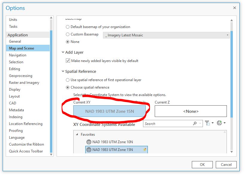

Jakub Sisak The description is about geoprocessing tools, but then you show the Create Feature Class wizard (not gp tool).
For geoprocessing tools, use the Environments to control your defaults. For example, when I set my Output Coordinate System in my gp environments, and then open the Project tool, it looks like this:

Now, for the Create Feature Class wizard, what version of ArcGIS Pro are you using?
In 2.3.1, here is what I see - the wizard picks up the map's coordinate system:
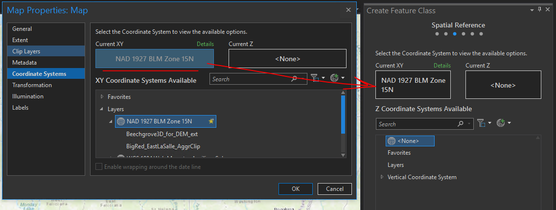
If you're on 2.3.1 and are seeing something different, post back here and we can try to figure out what is happening.
Cheers
Geoprocessing environments provide an output coordinate system that many geoprocessing tools will honor and use as default.
You can also specify tool parameter overrides if there is a specific coordinate system you want to be the default every time you open Project or other tools.
You must be a registered user to add a comment. If you've already registered, sign in. Otherwise, register and sign in.