- Home
- :
- All Communities
- :
- Products
- :
- ArcGIS Pro
- :
- ArcGIS Pro Ideas
- :
- subscript and superscript support in Arcade Text F...
- Subscribe to RSS Feed
- Mark as New
- Mark as Read
- Bookmark
- Follow this Idea
- Printer Friendly Page
subscript and superscript support in Arcade Text Function
- Mark as New
- Bookmark
- Subscribe
- Mute
- Subscribe to RSS Feed
- Permalink
The text function's in Arcade are great, it would be even better with Subscript and Superscript support. ie Subscript() and Superscript()
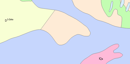
We create a lot of lithology maps that are labeled with two bits of text, the second bit of text is always subscript. ArcGIS Pro and ArcGIS Enterprise Portal both utilize Arcade. The currently deployed formatting tags are limited to the applications and are outdated.
I suspect Arcade... but Avenue would be just as good ![]()
I was tired and showing my age... yes I meant Arcade. ![]()
Hello everyone,
It will be very useful if we can do labeling of geological index like in image 
You should be able to do this by using ArcGIS Pro text formatting tags in combination with Arcade. See https://pro.arcgis.com/en/pro-app/help/mapping/text/text-formatting-tags.htm
For example, something like $feature.field1 + " " + "<bol>" + $feature.field2 + "</bol>" would give you "field1 field2" (without quotes) as your label.
I've used formatting tags in the application since 2002, however they are not something that can be used across platform: ie in ArcGIS Pro, ArcGIS Online, Enterprise Portal, and Collector. Arcade is the future and will have cross platform support, so it makes sense to ask for heavily used functions.
Superscript / subscript are text drawing capabilities are not script language specific. This can be achieved in Arcade, VBScript, Python, or JScript with Text Formatting tags instead: https://pro.arcgis.com/en/pro-app/latest/help/mapping/text/text-formatting-tags.htm
Here's an example of using superscript in an Arcade label:
SYSTEM_CALCULATED_AREA + " m" + "<SUP>" + "2" + "</SUP>"
You can just paste it from windows. This works for annotations anyway
You must be a registered user to add a comment. If you've already registered, sign in. Otherwise, register and sign in.