- Home
- :
- All Communities
- :
- Products
- :
- ArcGIS Pro
- :
- ArcGIS Pro Ideas
- :
- Shrink Lines — GP Tool
- Subscribe to RSS Feed
- Mark as New
- Mark as Read
- Bookmark
- Printer Friendly Page

- Mark as New
- Bookmark
- Subscribe to RSS Feed
- Permalink
It would be helpful if there were an OOTB geoprocessing tool for shrinking lines at each end. By a measure or a percentage.
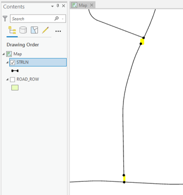
It would also be good if the tool could stretch out lines too -- using the angle of the last segment at each end. Or make that separate GP tool.
Thanks.
Related: Batch shrink lines at each end
- « Previous
-
- 1
- 2
- 3
- Next »


Feel free to delete some of the old comments in this thread, such as the comments where I gave feedback, if you think it's appropriate. They might not add much value now that the they've been implemented.
Also, out of curiosity, is the plan to keep the tool shared publicly online -- indefinitely? Or was it planned as a mockup for a future GP tool? Etc.

I have tried to use the tool. The "Percentage" method works well but the "Length" method does not work, at least for me. This is the error i get:
ValueError: The units value is either invalid or not supportedI have tried to use different units but i keep getting the same error. Anyone else has the same problem?
Hi Giare,
Could you provide a sample data and details about the parameters you used so we can try to reproduce and explain the problem? If you are concerned about posting your data here, please feel free to attach your data in email to me at [email protected]. We will only use your data for internal testing/debugging purposed. Thanks! - Dan

Hi @Giare, I just did some quick debugging. This seems to be happening because the input data used is not using a Projected Coordinate System, but using a Geographic Coordinate System instead. As you know, linear units do not work in GCSs. A workaround for now is to make sure the input layer is projected to a PCS. I will work on a warning/error to prevent users from encountering this error and update the tool soon. The tool is now updated to throw an error when the input is not projected. Thanks for reporting!
Tool link: https://www.arcgis.com/home/item.html?id=09ac91c60633484c811b79418c5c871d#overview
You must be a registered user to add a comment. If you've already registered, sign in. Otherwise, register and sign in.