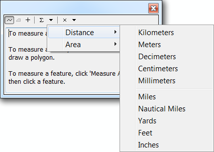
Currently in ArcMap (ArcGIS 10.2), the Measure Tool has no option to reset and/or change the Measure Units to Degrees. The only available distance units are linear, such as meters, feet, etc:
Even if the Map/Layer has a Geographic Coordinate System (such as WGS84), initially the measure units will be in (Decimal) Degrees, but when you change the distance unit to meters, say, there is no option to revert back to Geographical units of degrees.
The current know method is to restart ArcMap, which will reset the Distance Unit to the Map/Layer unit.
This is impractical if you have to conduct a number of measurements between linear and angular (degrees), if you have a geographic coordinate system.
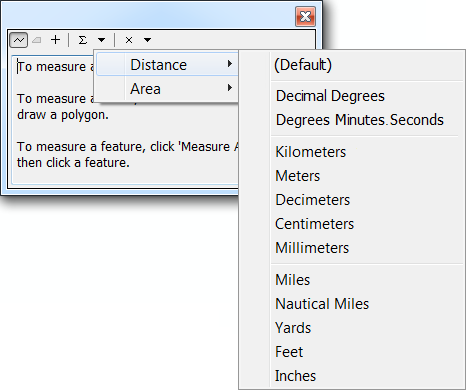
The ArcGIS idea here would be to have a "Default" Unit available along side the other Distance linear units.
The Default unit would be the "actual" units specified by the Map/Layer, which could be either Linear or Angular.
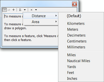
For additional clarity for these options, a prescribed list of Degree options could also be provided.