- Home
- :
- All Communities
- :
- Products
- :
- ArcGIS Pro
- :
- ArcGIS Pro Ideas
- :
- Pro: GP tools reatain metadata in output
- Subscribe to RSS Feed
- Mark as New
- Mark as Read
- Bookmark
- Follow this Idea
- Printer Friendly Page
- Mark as New
- Bookmark
- Subscribe
- Mute
- Subscribe to RSS Feed
- Permalink
In Pro, when running a GP tool (e.g Clip) on a feature class that has detailed metadata, there is no metadata in the output. Arcmap GP tools do not strip the metadata from the output. And since Pro has no way to import metadata....
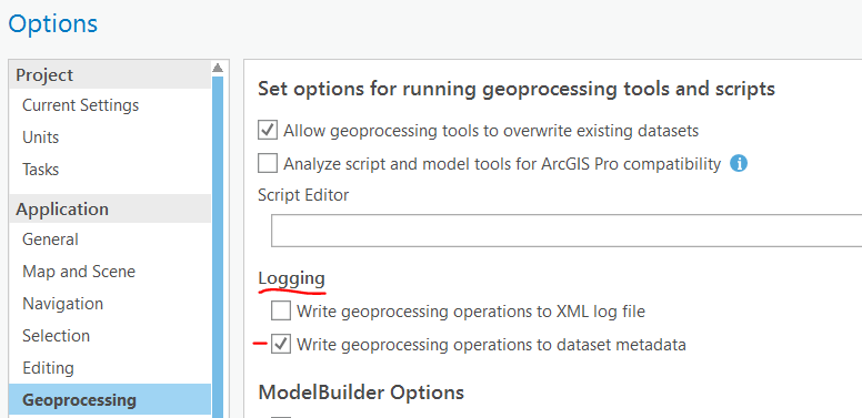
What happens if you go to project Options > Geoprocessing and check on Write geoprocessing operations to log file and dataset metadata?
2.0.1

It looks like that gets a little redesign for 2.1, with Logging split out and writing metadata as default:

half-way there: The "real" metadata is there now if I go to Catalog -> View Metadata, however, the "Map"(?) metadata is still blank (output), where it is populated (source).
Thomas, sorry, I think my original comment from yesterday was off track. That has to do with writing the gp operations to the metadata, not whether/how metadata is taken from the source and stored in the output.
Take a look at my comment with screenshots on Pro: Retain map layer metadata when changing data source
The functionality coming in 2.1 will could potentially help with this scenario, if you want to copy source metadata to the layer.
I quickly checked the behavior in ArcMap - even when I have some metadata in the layer

when I run Clip like suggested in this idea's description and look at the output layer (not data source) it is blank.

But the metadata from the data source is carried through into the output feature class' data source.
In ArcGIS Pro 2.0.1 (current release) we see the exact same behavior. Given that, can you please clarify the original idea and description to detail out what the expectation is?
Thank you!
Based on Kory's explanation of layer and data source metadata above, this idea is being closed. All data source metadata is maintained when new feature classes are created as geoprocessing output. But that metadata may not be available on the map layer unless you perform the metadata syncing Kory described.
You must be a registered user to add a comment. If you've already registered, sign in. Otherwise, register and sign in.