- Home
- :
- All Communities
- :
- Products
- :
- ArcGIS Pro
- :
- ArcGIS Pro Ideas
- :
- Pro: Change Data Source for XY Event Layer should ...
- Subscribe to RSS Feed
- Mark as New
- Mark as Read
- Bookmark
- Follow this Idea
- Printer Friendly Page
Pro: Change Data Source for XY Event Layer should present geometry options (Like ArcMap)
- Mark as New
- Bookmark
- Subscribe
- Mute
- Subscribe to RSS Feed
- Permalink
In Arc Map, one can right-click on a XY Event Layer and change the data source to (another) XLSX, XLX, TXT, CSV, DBF, etc...... imagine you got a new spreadsheet showing the locations of the latest Zombie Outbreak.
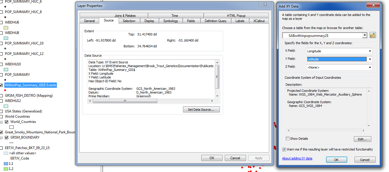
You can change the coordinate system, the XY fields..
Pro....
It might be clearer for the title to be something like Set Data Source for XY Event Layer in ArcGIS Pro:

That might be misleading? The idea is specifically related to the geometry options in Set Data Source when doing it for XY Event Layer...not Set Data Source for XY Event Layer....
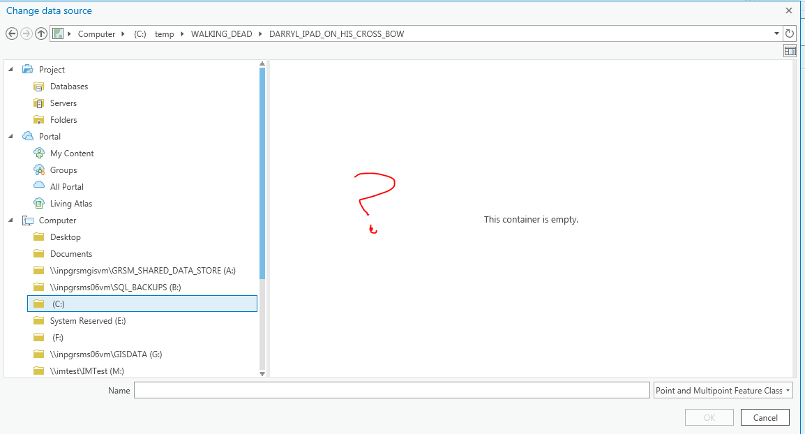
I guess I'm confused then because I don't see how we can get to any options in Set Data Source for an XY Event Layer when that button is disabled for the XY Event Layer in Pro. So first we need to be able to get into the data source for the layer, then specifically you want to change the geometry options. Either way, I have this noted as an equivalency issue. Thanks!
It is implemented in ArcGIS Pro 3.4 release. Thank you all for your suggestions and feedback.

You must be a registered user to add a comment. If you've already registered, sign in. Otherwise, register and sign in.