Turn on suggestions
Auto-suggest helps you quickly narrow down your search results by suggesting possible matches as you type.
Cancel
- Home
- :
- All Communities
- :
- Products
- :
- ArcGIS Pro
- :
- ArcGIS Pro Ideas
- :
- Modern Open Source Map Styling with CartoCSS/Mapni...
Options
- Subscribe to RSS Feed
- Mark as New
- Mark as Read
- Bookmark
- Follow this Idea
- Printer Friendly Page
Modern Open Source Map Styling with CartoCSS/Mapnik
Follow this Idea
1872
1
04-29-2014 11:00 AM
Status:
Open
- Mark as New
- Bookmark
- Subscribe
- Mute
- Subscribe to RSS Feed
- Permalink
This is a suggestion to modernize Esri's graphics rendering engine
The open source mapping community has been advancing via leaps and bounds towards a more modern, streamlined map rendering engine with a focus on web mapping.
I suggest that Esri leverage the Mapnik rendering engine and the CartoCSS styling language that runs it by integrating them into their desktop, mobile, and web map rendering architecture.
Here is whyHere are the 22 clicks it takes to symbolize a layer and add a label with a halo in ArcMap: (I'm a fast clicker)

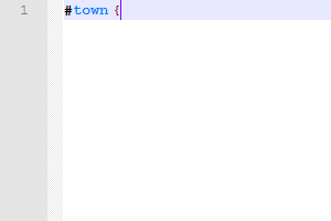
Contrast that to the 9 lines of simple, human readable code to do the same thing in CartoCSS: (I'm a slow typer)
 Someone who hasn't been doing ArcMap for 7 years might not know where those settings are buried. CartoCSS is much more elegant and lightweight. The same thing could be easily copied and pasted for #county and #state, saving dozens of clicks in ArcMap. To see how this is implemented in a desktop mapping program, take a look at the free software TileMill.To see the depth of artistic expression possible with CartoCSS, see "Assemblage", WoodCut Streets, or this Pirate Themed MapMapmaking is increasingly focused on form rather than function. Data creation and collection is always going to be vital to GIS. For these tasks, Esri's tools are the best in the business. However Esri should not neglect the "ART" in "CARTOGRAPHY".
1 Comment
well that's a mouthful...
You must be a registered user to add a comment. If you've already registered, sign in. Otherwise, register and sign in.