- Home
- :
- All Communities
- :
- Products
- :
- ArcGIS Pro
- :
- ArcGIS Pro Ideas
- :
- Indexing Capability for ArcGIS 10 Mapbooks (data d...
- Subscribe to RSS Feed
- Mark as New
- Mark as Read
- Bookmark
- Follow this Idea
- Printer Friendly Page
Indexing Capability for ArcGIS 10 Mapbooks (data driven pages)
- Mark as New
- Bookmark
- Subscribe
- Mute
- Subscribe to RSS Feed
- Permalink
I am hoping to be able to use Data Driven Pages in ArcGIS 10 to create mapbooks. I have used (30-day trial) software from MapLogic called "Layout Manager" (one time intial cost $1200 - my City cannot pay). It is the industry leader for the moment. One strong capability of that software is indexing. Lets say you create a "Fire District Map" showing the city's roads, streets, hydrant locations, and more. THERE MUST BE AN INDEX FOR EVERY MAPBOOK (if desired). The index software figures out for every segment of road or streets which pages of the mapbook contain these streets. Long Hill Ave may appear on 6 different pages. It must list those pages. Constitution Boulevard will also appear an many pages. The index will tell you which pages to look for that Boulevard. Huntington Circle will be on one page only. The index confirms which page. The index is usually located as a separate section at the end of the mapbook. The user should have options as to how the index is formated (font, font size, comma delimited page numbers, 1-2-3 column formating, in alphabetical order with option for a break and large capital letter between each alphabet group, page numbering, and so forth.
A fireman going to a fire needs to quickly see which page(s) of the mapbook he needs to turn to to get to the fire and find the hydrant location. It may be a matter of life or death. An INDEXING CAPABILITY is VERY IMPORTANT!
[To my knowledge, ArcGIS 10 does not have this capability yet.] I have been asking ESRI about this.
- « Previous
-
- 1
- 2
- 3
- 4
- Next »
(Until now the only joins I knew of were under Joins & Relates, which doesn't have any kind of rules or delimiters. It took about an hour on Google to find the right spatial join tool. All the search results talked about how to use the tool in python and not how to find it in the toolbox.)
http://www.arcgis.com/home/item.html?id=b38c6c3fff844eda9b33ff54b24a349b
It was designed to address this specific issue. It uses Data Driven Pages to create individual map pages based on the user specified map index and includes two scirpts. The first creates the street index based on a Fire Map Index feature class and the second script appends the title page, map pages and street index into a single PDF map book for printing. Here is the blog post that introduces this map and other for the Fire Service industry. There are also accompanying videos to see how it works before you download the map doc.
http://blogs.esri.com/esri/arcgis/2012/06/25/new-maps-for-the-fire-service/
The code was there in DSMapBook. Can't it be integrated into the new Data Driven Pages functionality?
The best I can come up with is to add a data driven page name to the attributes for what you want to display. In my case it is customer location id's and names. You can add the table to the layout. This may not work for roads if there is more than on part of a given road name.
The use the data driven page option for defintion query. However, it works best to have a second copy of the feature in question. The bad part is yout have to manually refresh the table each time you change a data driven page.
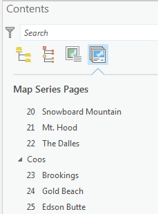
I have created a map series of 118 sheets and have used the nice "Sort Field" feature.
Thank you for this functionality.
There are two things that I would like MSP to do:
1) The individual PDF file names to be a combination of Page Number AND Page Name
2) To be able to create an index page with a map showing the pages and numbers as the first page of the Map Series
The problem is that with Page Number on individual files it isn't possible to know the grouping, and with the Page Nameit also isn't possible to know the grouping since they sort alphabetically.
I can create an index sheet showing the entire extent of the map series, but an index with page numbers would allow the users to quickly go to the desired page.
Are these things possible and I'm missing something?
If the Map Series Group By and Page Numbers could be exported then the values could be added to the index featureclass I am using, and then easily displayed on an index page.
Thanks
Emmor
You must be a registered user to add a comment. If you've already registered, sign in. Otherwise, register and sign in.