Hello,
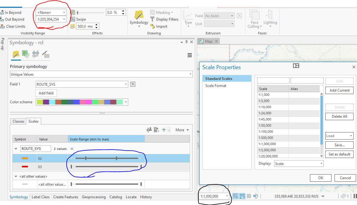
In ArcGIS Pro we can set the visible scale range for a layer using manual values (Shown in red in the image) such as "1:205,004,254". However, each symbol class uses a slider instead (Shown in blue). After some help I was told that the only way I could add a custom scale for a symbol class is to add a custom scale in the map view (shown in black).
These different ways of setting scale ranges seem inconsistent to me. Please consider allowing us to manually set a scale range for each class without needing to adjust the map scales.
Thank You