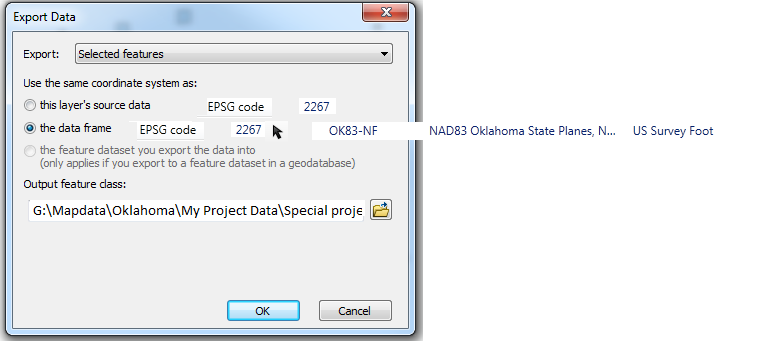
When exporting data the dialog allows to select "Use the same coordinate system as:".
However there is no indicator of what those systems are.
It would be helpful if there were a short name or the EPSG code indicated next to at least the two choice that arcmap would already know about.
the layer's source data, and the data frame.
It would also help if there were a flyout of the long description of the CRS.
a bonus would be if you chose the geodatabase option it would populate it when you returned from the output feature class location dialog box.