- Home
- :
- All Communities
- :
- Products
- :
- ArcGIS Pro
- :
- ArcGIS Pro Ideas
- :
- ArcGIS Pro Exploratory Viewshed Improvements
- Subscribe to RSS Feed
- Mark as New
- Mark as Read
- Bookmark
- Follow this Idea
- Printer Friendly Page
ArcGIS Pro Exploratory Viewshed Improvements
- Mark as New
- Bookmark
- Subscribe
- Mute
- Subscribe to RSS Feed
- Permalink
We have found this tool to be interesting except for 2 limitations:
- You cannot export the VS to a Raster or Vector Feature; Only to a point FC which is not useful
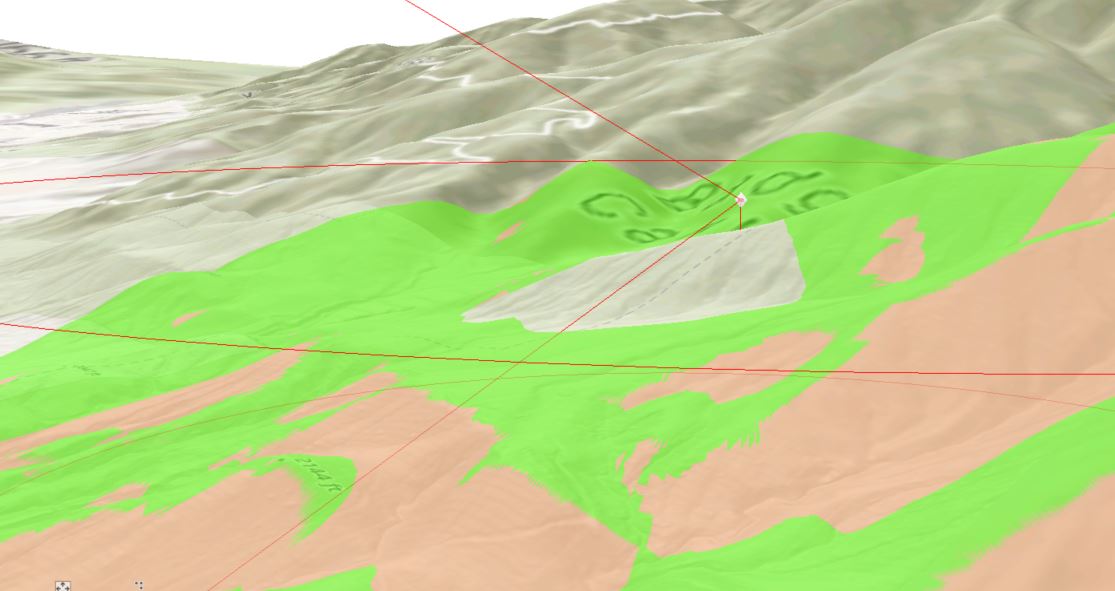
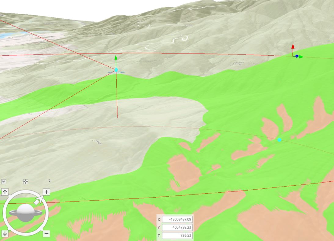
- When placing an interactive point and then moving it, the tool does not honor the offset altitude for the viewpoint. For example if I place a VS on a hill and give it a 100 Foot offset and then move the point down off the hill, it remains at the same elevation which results in unrealistic results. Can there be an option to dynamically update the VS offset when the original point is moved? This is crucial in judging the best locations for viewsheds.
Original Location with 100 Foot Offset on Hill
Second location with VS moved down hill. Notice the offset is significantly more than 100 Feet now.
I would ask the same for the LOS tool as the same behavior is exhibited when moving the Target site around. It ends up in the air or under a hill/mountain if moved around areas of varying topography. TKS
@KoryKramer not sure if you are involved with this one, but would love for the above to be implemented.
Hi Jeff,
Thanks for your feedback.
1) A raster output sounds good. We're also considering something like a TIN or multipatch since a raster wouldn't represent all visibility. (e.g. surface area visibility of the side of a building) Is this example a concern for your type of work? Would a TIN or multipatch be as useable as a raster for you?
2) This is a good improvement too. Also noted for LOS observers and targets.
Mati
@JeffBishop You may have missed mcodesal's questions. Could you please take a look at the comment above and provide any additional details about your expectations around the export?
Thanks!
This is a great idea and a huge reason we can't really use the interactive viewshed. Being able to export the results out into any format would be a great improvement.
@RichLeeson be sure to add your kudos to the idea to show your support. Are there specific export formats that you would use most (to help narrow down from "any" format)?
The Viewshed tool under Exploratory 3D Analysis is so nice and easy to set up. It would be really convenient to be able to export the Viewshed raster and Wireframe directly from this tool so the user has output after completing a visual analysis in a Scene. Currently the tool only lets you export a reference point to be used for set up in another pro session via the "Convert to Features" panel menu option in this tool. the Ability to export the raster and wireframe would make it easier to migrate a Pro project with viewsheds over to a Web Scene.

When using the Viewshed tool under Exploratory 3D Analysis, the result changes when viewed in different scales. Under the result viewed in scale 1:155000

..and here the result viewed in 1:490000

The result as cleary different.
There should be a button/choice whether to use the full DTM/Analyse in all scales (longer processing time) to make sure the result is the same in all scales, or to use a simplified solution when zooming out - as it is today. As it is now I can not use the visual result of the analysis as it changes due to scale.
I also support the export of the result (not only the center point of the analysis) either as polygons, raster, tin og 3D Multipatch..
Hello all
It will also be nice to be able to control the target offset
You must be a registered user to add a comment. If you've already registered, sign in. Otherwise, register and sign in.