- Home
- :
- All Communities
- :
- Products
- :
- ArcGIS Pro
- :
- ArcGIS Pro Ideas
- :
- ArcGIS Pro Calculate Geometry Fixes
- Subscribe to RSS Feed
- Mark as New
- Mark as Read
- Bookmark
- Follow this Idea
- Printer Friendly Page
- Mark as New
- Bookmark
- Subscribe
- Mute
- Subscribe to RSS Feed
- Permalink
arcgis-pro-2.4
We need the ability to calculate the selected records and the ability to choose the geometry property based on the selected projection, not the coordinate system of the underlying data.
Update:
Per post by Kory Kramer, geoprocessing tools do selected records by default so scratch that part, already does it.
Hi KKramer-esristaff I was trying it yesterday (ArGIS Pro 2.4), but didn't see a check box for selected records only and it seemed to take awhile to run so thought it recalculated all of them. The other thing has to do with Planar or Geodesic area calculations. I believe only the Geodesic property was available because my data is in GCS, but think it should calculate geometry in the projected coordinate system you choose and the properties that are available to select should be based on that selection, not the coordinate system of the underlying data?
Hi Daryl Hochhalter I just went to ArcGIS Pro 2.4.2 and set up Calculate Geometry Attributes (from right-clicking my LAT field > Calculate Geometry) like this:

I'm showing the layer properties to show that the data source is in NAD 1983 StatePlane California V FIPS 0405, but I'm calculating the LAT and LON in WGS 1984.
I have one record selected.
Here is the result:

Is that what you're asking for?
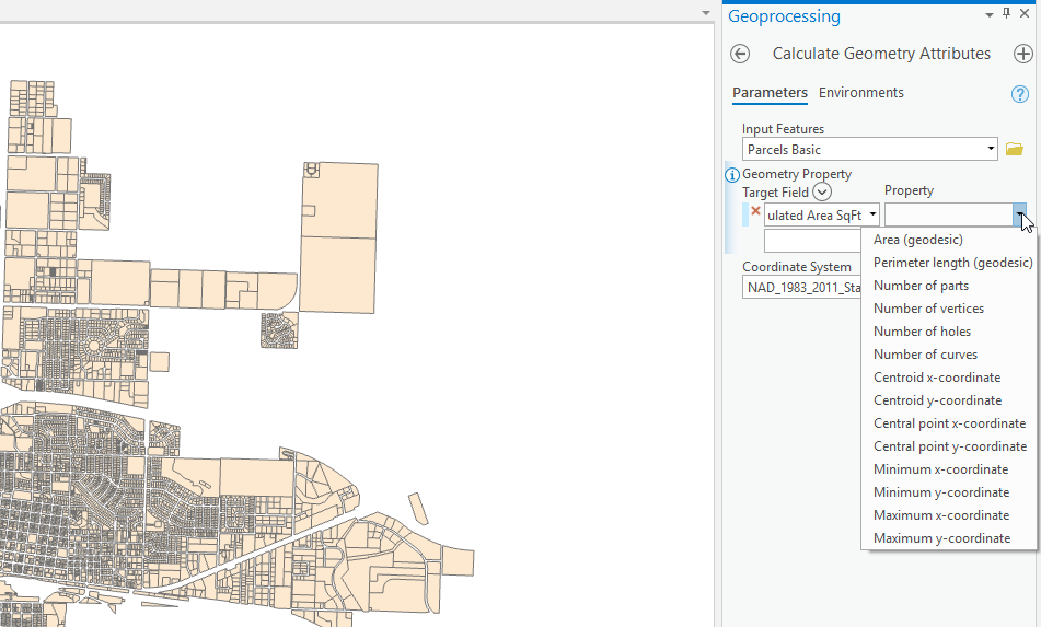
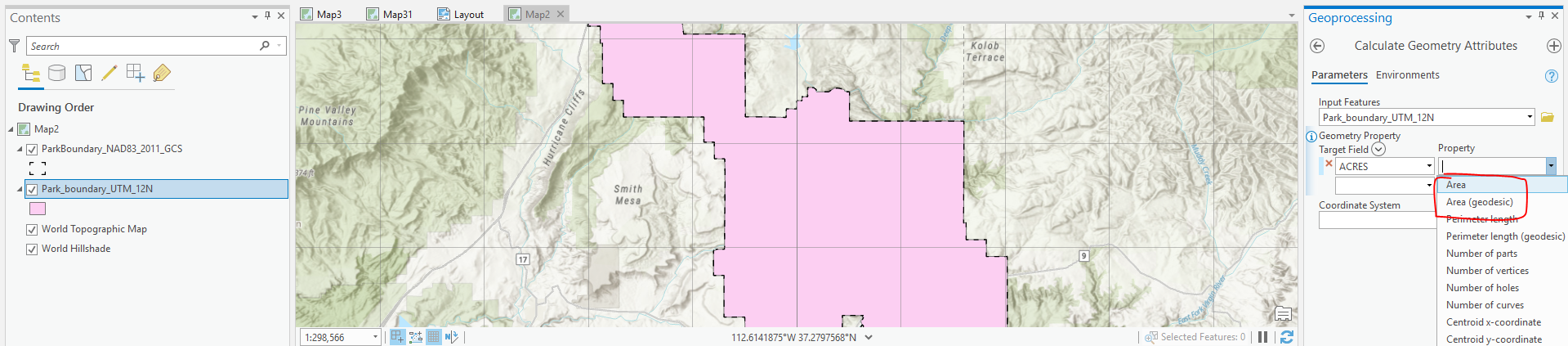
I didn't try XY, but wanted to set the property to planar for calculating area, from data is in NAD83 2011 GCS, but to calculate area as SQ FT in the corresponding State Plane projection. The only choice was Area (Geodesic), which leads me to think perhaps the choices are based on the coords of the underlying data rather than the selected coord system in the dialog.
No, I didn’t try an XY I was doing area, I made another post that explains. Also, I don’t know if it does just selected records but don’t see an option in the dialog?
Since it is a geoprocessing tool it will work on only selected records.
Yes, because the data is in a GCS, the area option is geodesic. With the data in a PCS, you would have both options:
Shouldn't the choice be based on the projection you choose in the dialog for the calculation, rather then the actual coordinate system of the data? In my opinion it should be. If I'm choosing a planar projection like state plane for the area calculation. I believe that is how it works in Arcmap when you choose the data frame projection rather than the coordinate system of the data?
The tool in ArcMap works the same as Pro.
The functionality you are remembering from ArcMap is right-clicking a numeric field in a table attribute view and selecting Calculate Geometry... which allows you to choose to calculate area in any coord system you wish.
In Arcmap 10.4
I get
Or this
It really doesn’t tell you if it is calculating planar area or geodesic area, not that there is a big difference for the polygons in my current layer, but according to https://support.esri.com/en/technical-article/000018807
The calculate geometry tool in Arcmap uses a planar calculation while the Field Calculator and Add Geometry Attributes Tool use Geodesic.
I guess that I’m just saying it would be nice to have the option to calculate as if you had actually re-projected the underlying data for comparison. If we are able to choose a projected coordinate system different than that of the data source in which to calculate the area value, why wouldn’t we want to choose properties such as planar or geodesic that might be appropriate for that chosen projection?
So is there a way to make Pro field calculator the x & y in the projected linear units (aka northing/easting) of the coordinate system instead of the lat/long degrees? I can't seem to find it if there is.
You must be a registered user to add a comment. If you've already registered, sign in. Otherwise, register and sign in.