- Home
- :
- All Communities
- :
- Products
- :
- ArcGIS Parcel Fabric
- :
- ArcGIS Parcel Fabric Ideas
- :
- Geoprocessing Tool: Check the Parcel Fabric
- Subscribe to RSS Feed
- Mark as New
- Mark as Read
- Bookmark
- Follow this Idea
- Printer Friendly Page
Geoprocessing Tool: Check the Parcel Fabric
- Mark as New
- Bookmark
- Subscribe
- Mute
- Subscribe to RSS Feed
- Permalink
In a typical production editing environment avoidance of heavy query and loading operations during peak hours is essential for optimal performance. With a large parcel fabric, utilizing the check the parcel fabric command on a production dataset during normal business hours is not the best approach. It would be helpful to be able to schedule the Check the Parcel Fabric command along with other maintenance jobs run on the enterprise geodatabase via a python script. If the Check the Parcel Fabric were formalized into a geoprocessing tool for example, this would facilitate periodic topological integrity checking. The report or log file could be reviewed at a later time and plans made to correct any geometry issues.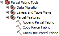
In addition to the above suggestion , once the Check Fabric function is completed, it would be beneficial to have the option to choose the error and zoom to that error in the Fabric Errors window instead of using the search tool.
Furthermore, after running the check parcel error tool I get different results, has anyone else come across this issue?
Are you not able to run this tool in python and then run it as a Scheduled Task at a designated time during non-business hours?
This is implemented in Pro using: geodatabase topology, Attribute Rules and LSA (Consistency check). No more alphanumeric reports but real error features.
In ArcGIS Pro you can run a geoprocessing tool to validate (check) your parcel fabric.
Beyond the rules you can configure to meet your business needs the result are error features that can be inspected visually on the map as well as in the Error Inspector:

You must be a registered user to add a comment. If you've already registered, sign in. Otherwise, register and sign in.