Turn on suggestions
Auto-suggest helps you quickly narrow down your search results by suggesting possible matches as you type.
Cancel
- Home
- :
- All Communities
- :
- Products
- :
- ArcGIS Online
- :
- ArcGIS Online Questions
- :
- XY feature
Options
- Subscribe to RSS Feed
- Mark Topic as New
- Mark Topic as Read
- Float this Topic for Current User
- Bookmark
- Subscribe
- Mute
- Printer Friendly Page
XY feature
Subscribe
2061
1
09-28-2014 09:08 AM
09-28-2014
09:08 AM
- Mark as New
- Bookmark
- Subscribe
- Mute
- Subscribe to RSS Feed
- Permalink
On ArcGis Online does anybody know how to get the toolbar function to appear on there screen in order to use the XY function to input latitude and longitude coordinates?
1 Reply
09-28-2014
10:27 AM
- Mark as New
- Bookmark
- Subscribe
- Mute
- Subscribe to RSS Feed
- Permalink
I guess an easy way to do it if you have multiple points is to create a TAB separated text file and add the data using the "Add Layer from File":
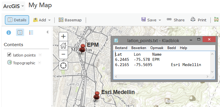
Kind regards, Xander
Or have look at: