- Home
- :
- All Communities
- :
- Products
- :
- ArcGIS Online
- :
- ArcGIS Online Questions
- :
- watershed using hydrology
- Subscribe to RSS Feed
- Mark Topic as New
- Mark Topic as Read
- Float this Topic for Current User
- Bookmark
- Subscribe
- Mute
- Printer Friendly Page
watershed using hydrology
- Mark as New
- Bookmark
- Subscribe
- Mute
- Subscribe to RSS Feed
- Permalink
Good day to all.
I have a question about creating watersheds in ArcMap.
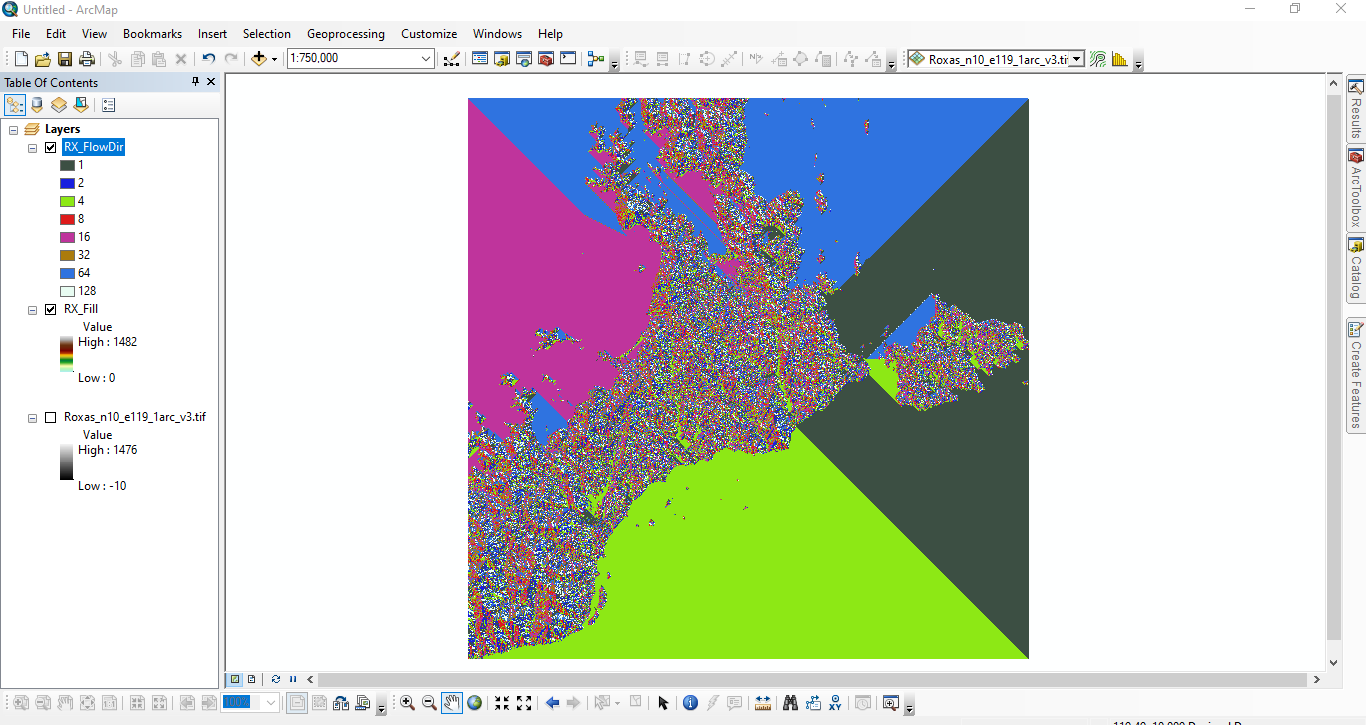
I am working on a watershed delineation for a certain place here in the Philippines. I am using a SRTM 1arc Global tif file from USGS. My question is: am I doing something wrong because the output keeps on creating solid colors? These colors will eventually turn into lines after I do Flow Accumulation from Hydrology. Did I choose the wrong file?
I am attaching a screenshot of my work.
Here is my workflow
-tif file to layers
-Arctoolbox > Hydrology > Fill
-Arctoolbox > Hydrology > Flow Direction
I hope you guys can help me.
What kind of file do I need to download?
Can you spare me some sites where I can download them?
Good day to all!
- Mark as New
- Bookmark
- Subscribe
- Mute
- Subscribe to RSS Feed
- Permalink
Can you please share the screenshot of the input dem file. Also, I would like to suggest you to test some other datasets.
- Mark as New
- Bookmark
- Subscribe
- Mute
- Subscribe to RSS Feed
- Permalink
Hi @DrVSSKiran,
Thank you for your response.
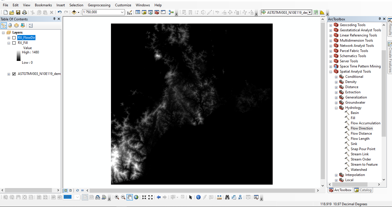
Attached here is the screenshot of my DEM uploaded in Arcgis.
- Mark as New
- Bookmark
- Subscribe
- Mute
- Subscribe to RSS Feed
- Permalink
Contiguous/uniform areas in the Flow Direction result usually mean the surface is flat (like open water), but it might be some other artifact in your original DEM or Filled DEM because those triangle-like areas suggest there was null/no-data cells in your original input raster.
You're correct that the Flow Accumulation (after Flow Direction) will turn the result into lines--you may just have to adjust the symbology (two bins, make one black and one white) to see the linework.
t