Turn on suggestions
Auto-suggest helps you quickly narrow down your search results by suggesting possible matches as you type.
Cancel
- Home
- :
- All Communities
- :
- Products
- :
- ArcGIS Online
- :
- ArcGIS Online Questions
- :
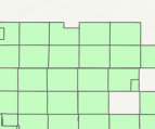
- Square landgrid showing as rectangles
Options
- Subscribe to RSS Feed
- Mark Topic as New
- Mark Topic as Read
- Float this Topic for Current User
- Bookmark
- Subscribe
- Mute
- Printer Friendly Page
Square landgrid showing as rectangles
Subscribe
913
1
10-26-2021 12:08 PM
1 Reply
10-26-2021
03:27 PM
- Mark as New
- Bookmark
- Subscribe
- Mute
- Subscribe to RSS Feed
- Permalink
doesn't agol use web mercator? which means it will be distorted if it gets projected on the fly to the coordinate system of your display
... sort of retired...