- Home
- :
- All Communities
- :
- Products
- :
- ArcGIS Online
- :
- ArcGIS Online Questions
- :
- Spatial Reference Undefined in 10.2.2
- Subscribe to RSS Feed
- Mark Topic as New
- Mark Topic as Read
- Float this Topic for Current User
- Bookmark
- Subscribe
- Mute
- Printer Friendly Page
Spatial Reference Undefined in 10.2.2
- Mark as New
- Bookmark
- Subscribe
- Mute
- Subscribe to RSS Feed
- Permalink
Hi,
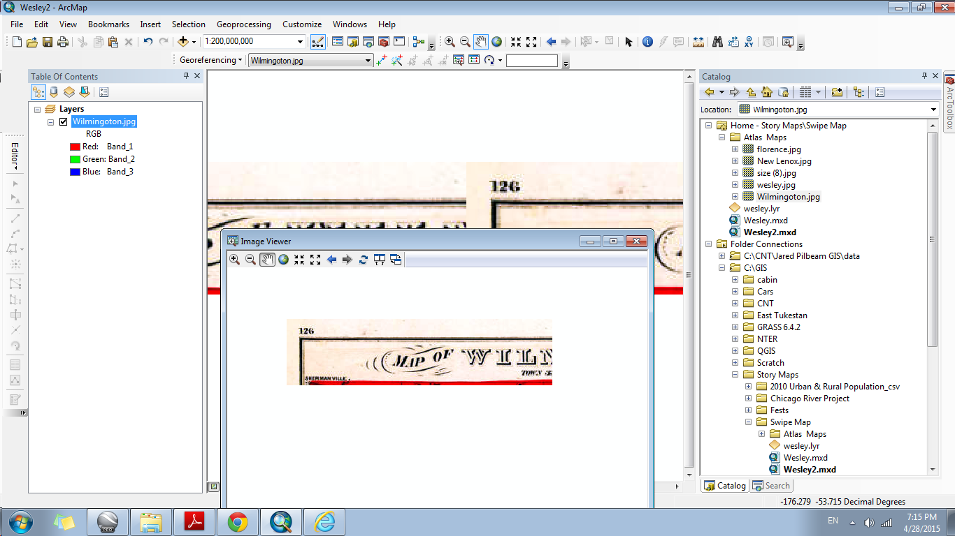
My intention is to georeference an image so as to create a Swipe Map in AGOL. First, I add my control points, rectify, then analyze before attempting to share and finally publish in AGOL. The other day I ran through these steps and it worked fine. I was able to then create the app for a simple Swipe Map. Using the same steps while adding another image to the same map back in Desktop I now continually get the spatial reference undefined error when analyzing. Or the newly created projection through rectifying just disappears and I have to add the control points all over again.
I've added some screenshots.
Thanks for any help.
-Jared
- Mark as New
- Bookmark
- Subscribe
- Mute
- Subscribe to RSS Feed
- Permalink
@ Dan: I read that, thanks.
@ Jayanta: What you see of the image in this attachment is after giving it a spatial reference in ArcCatalog. I can't start adding any control points to this raster as for some reason it's not all there.
So, I carried out the proceeding steps which did work:
1. Add raster and basemap to Desktop
2. Add control points
3. On the Georeference Toolbar, "Update Georeferencing" - this worked in giving it a GCS
4. Left click on the layer and "save as a layer file"
5. In the File menu, "Share as" then "Tile Package"
After publishing the tiles in AGOL, I'm still having the same problems with portions disappearing:
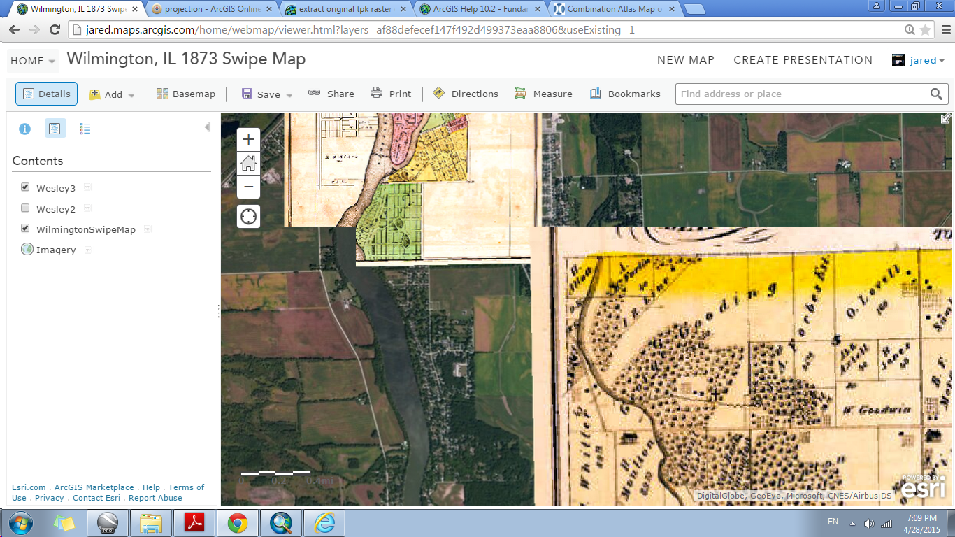
Notice the corner missing on the smaller raster and the top missing on the bigger raster. Before this, I had a small problem with the whole raster disappearing after zoomed in past a certain scale. But to remedy that I deleted that image and went back to Desktop. On Desktop I brought the file back in and "Share as", "Tile Package" window under "Tile Format" I gave it the highest level of detail: "Building". Of course, this took the longest as it had the most tiles to upload, but I was at least able to zoom in enough to read the raster.
But, now portions are missing?
Thanks to both of you for the help so far.
- « Previous
-
- 1
- 2
- Next »
- « Previous
-
- 1
- 2
- Next »