- Home
- :
- All Communities
- :
- Products
- :
- ArcGIS Online
- :
- ArcGIS Online Questions
- :
- Re: Remove Duplicate Labels on WebMap (& More)
- Subscribe to RSS Feed
- Mark Topic as New
- Mark Topic as Read
- Float this Topic for Current User
- Bookmark
- Subscribe
- Mute
- Printer Friendly Page
Remove Duplicate Labels on WebMap (& More)
- Mark as New
- Bookmark
- Subscribe
- Mute
- Subscribe to RSS Feed
- Permalink
I really need some assistance with some issues I'm having with AGOL. I'll list them out to make it easier.
I have created a map in ArcGIS Pro & uploaded it to AGOL.
1. When I do this, it removes my "remove duplicate labels" setting on the roads and there are labels everywhere. Is there still not a way to get rid of this issue without using basemap labels? I am using layers where you cannot see the basemap too great and need the roads on top.
2. When I do this, my highway shields disappear for my labels and there are just route numbers everywhere with no shields/symbols. Is there a way to fix this?
3. I have two Neighborhoods layers - same outlines, but 1 has the Neighborhood name labeled and the 2nd one has the tract number labeled. However, when they are both on, it only allows one label and not both. Is there a way to fix this?
Really hoping somebody can give me some direction, I'm at a loss. Thank you in advance.
- Mark as New
- Bookmark
- Subscribe
- Mute
- Subscribe to RSS Feed
- Permalink
Hello Kamille,
I ran into this same issue when publishing the Atlanta street data from Geocoding sample in ArcTutor. This dataset look to be very similar to yours, where each street segment is its very own feature.
ArcGIS online has less powerful labeling options compared to ArcGIS desktop. I think you could resolve this issue a couple different ways.
1) Run a dissolve on the streets layer to be labeled, this will provide less features to label in ArcGIS online.
2) Publish the layer as a Hosted Tile layer, when the tiles are generated this way they will preserve the labels as placed in ArcGIS Desktop.
Because the tile methodology will be fast and preserve the cartographic quality we achieved using the desktop software its a good option for creating basemap or contextual layers .
Hope this helps!
-Adam
- Mark as New
- Bookmark
- Subscribe
- Mute
- Subscribe to RSS Feed
- Permalink
Hi Adam,
Thank you for your response. I will try these out.
Some follow up questions: When you publish as a hosted feature layer, will that retain the highway shield labels as well? Also, will I have the ability to choose the level that they are visible at?
Thank you again, I appreciate your help.
-Kami
- Mark as New
- Bookmark
- Subscribe
- Mute
- Subscribe to RSS Feed
- Permalink
Kami,
Shields will not be retained with the default labeling for Feature layers in ArcGIS online. labels are still very basic.
A Hosted Tile layer will support the shields and any scale visibility you set in desktop.
As a rule of thumb when considering Tiles or Features,
- Use Tiles to deliver cartographically rich map.
- Use Features to deliver data and attributes.
If it helps, I can add more technical explanation, that labels and their placement require a good deal of processing power that are suited to desktop environments, In a web browser however the same types of processing would slow down the webpage, thus we see fairly basic labeling of features. Now with Tiles, its essentially a collection of lightweight image files. All the heavy lifting used to create a detailed map is performed ahead of time, and the results saved at tile images. So the browsers jod is much simpler, Just request and display the image tiles for this area.
On a side note: Tile layers may appear to be only Static, but they can be configured to display popups from existing feature layers.
-Adam
- Mark as New
- Bookmark
- Subscribe
- Mute
- Subscribe to RSS Feed
- Permalink
Hi Adam,
I did everything you recommended in your first comment with success, so I really appreciate your help!
However, now the issue that I'm experiencing is that one of my layers I have (Neighborhoods) is a Feature layer, not a Tile Layer and needs to be underneath all of the other layers to show properly. But I am unable to move Tile Layers above the regular layer.
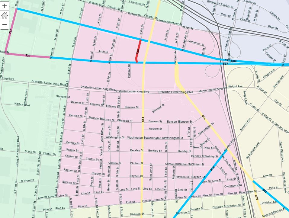
See image below.
- You can see Rt. 30 is underneath of the colored neighborhood polygons and needs to be on top to be clear and a more prominent layer. Would you recommend that I just make all of the layers Tile Layers so that I can move them into whatever order I need to? Before I did this, I was not aware you couldn't move Tile Layers on top of Feature Layers.
Advice is appreciated.
-Kami

- Mark as New
- Bookmark
- Subscribe
- Mute
- Subscribe to RSS Feed
- Permalink
Kami,
Great observation. I should have considered this too. This restrictions It is documented. So yeah, it looks like we must utilize a tile layer for the neighborhoods, we can optionally include that layer and the Roads together in the same service to get this working.
To be honest, I'm not sure of a good explanation why we can order the Tile Layers above Feature Layers in Web Maps except for it might be confusing when a basemap covers all other layers.
This idea was posted regarding this restriction. - Allow Cached Layers Above Feature Layers in AGO Map,
- Mark as New
- Bookmark
- Subscribe
- Mute
- Subscribe to RSS Feed
- Permalink
Kami,
I dug into this issue, we have a couple other Ideas posted on this same issue.
- Enable any ordering for all types of services in the web map contents.
- Allow Cached Layers Above Feature Layers in AGO Map
Looking over our support records we didn't have a formal enhancement logged, so we submitted the following record.
- ENH-000119248 - Allow webmaps to rearrange and organize the order of map layers regardless of type.
Additionally we found a trick to workaround the problem by adding the Layer as a "Reference Layer"
- Use More options > Move to Basemap .
- Finding the layer in the basemap > Use More options > Set As Reference Layer
For any customers who are experiencing this issue you can contact Esri Support to get your account attached to the following record:
- Mark as New
- Bookmark
- Subscribe
- Mute
- Subscribe to RSS Feed
- Permalink
Hi Adam,
One more question.
Every time I save my Local roads to the minimum of Streets viewing extent and save it, I re-open the map up and they are visible again at full extent. I've tried saving repeatedly and even creating a copy and they will not stay at the extent I save them to.
The first image is obviously incorrect and what it is re-setting to. The second image is how it's supposed to look. AGOL seems kind of glitchy with some of the things I am trying to accomplish.
Any help would be great again, thank you.
-Kami


- Mark as New
- Bookmark
- Subscribe
- Mute
- Subscribe to RSS Feed
- Permalink
I like how this map is looking!
You are using the normal save option, correct? This saves the Map:

This should normally save how all the layers are configured in the map. however we used that workaround to add the layer to the basemap, and this save is not applying. The Basemap uses its layers default display settings, Let's save the visibility to the layer instead. (temporarily remove the layer from the basemap to apply)

That should do the trick I hope!
- Mark as New
- Bookmark
- Subscribe
- Mute
- Subscribe to RSS Feed
- Permalink
Thank you so much, Adam, you have been very helpful! Your last suggestion worked out perfectly and resolved the issue I was having with the local roads & neighborhood labels.
Here is a link to the web map -