- Home
- :
- All Communities
- :
- Products
- :
- ArcGIS Online
- :
- ArcGIS Online Questions
- :
- Is there a way to visually activate a data layer o...
- Subscribe to RSS Feed
- Mark Topic as New
- Mark Topic as Read
- Float this Topic for Current User
- Bookmark
- Subscribe
- Mute
- Printer Friendly Page
Is there a way to visually activate a data layer only after it has been filtered or queried by a widget?
- Mark as New
- Bookmark
- Subscribe
- Mute
- Subscribe to RSS Feed
- Permalink
I have a large dataset that I don't want to be visible on startup of my web map. I only want the results of a Filter or Query expression to show up on the map once the filter or query has been requested.
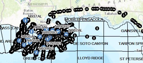
In this map, the black dots with white arrows are part of the historic dataset and I would like the map not to show this on startup but only on filter or query.
Solved! Go to Solution.
Accepted Solutions
- Mark as New
- Bookmark
- Subscribe
- Mute
- Subscribe to RSS Feed
- Permalink
Hi James,
Try setting the visibility range so that layer doesn't draw at small scales. Ensure that the data is visible at the resulting scale. Check out this Minimalist app as a sample:
https://webapps.maps.arcgis.com/apps/Minimalist/index.html?appid=8eed999928d34ca68c2c1a2a9ae308ae
This is the source web map:
https://webapps.maps.arcgis.com/home/webmap/viewer.html?webmap=b9dec521521b4a528b1127a1276eee42
-Kelly
- Mark as New
- Bookmark
- Subscribe
- Mute
- Subscribe to RSS Feed
- Permalink
from other post:
Kelly, cool map . In this case that will not work. I already have a layer of information and labels that only come on when the data is zoomed. This data set that is hidden from is so many data points it clogs the visibility of the other sets. I don't want the end user to have to know they have to toggle the layer on and off to make this work.
Are you using a hosted feature service or a server service?
Do you only want a specific subset of features to appear when searching? Is there logic in how to filter some of the data out? An option may be to look into the filter configurable app
-Kelly
- Mark as New
- Bookmark
- Subscribe
- Mute
- Subscribe to RSS Feed
- Permalink
Kelly, Thanks for the help. I'm new to all this and kinda learning on the fly.
So not sure if it is considered hosted or server but this is what I have. We are tracking aircraft and we have a provider that is ingesting the data from the different tracking providers and then producing 2 different sets of data from that. Current Asset Position and Historical Asset Positions.
So now with that, I am working on making custom Web Maps for users. My end user, in this case, needs to be able to run a query or use a filter to be able to isolate a historic track or tracks from a previous day/times flight. This is why I don't want to visually show the historic track because it is so much data and on a regular basis of just looking at the map they will just want to see the current position of the asset.
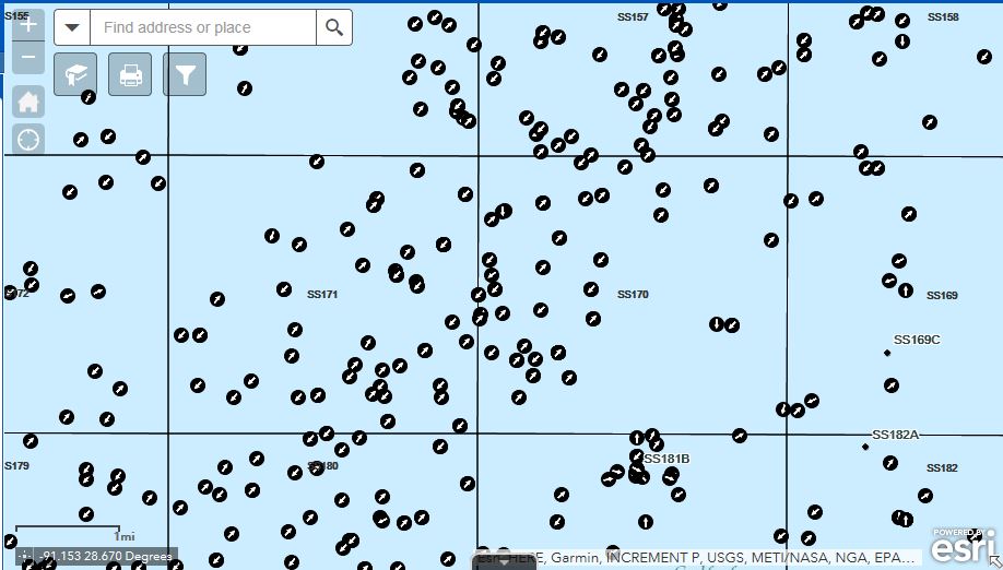
Below is what it looks like close in with the history visible. The square blocks are 3 miles square.
I will try and take a look at the Filter configurable app to see if that is something they have provided me with and or if it would work in this situation.