- Home
- :
- All Communities
- :
- Products
- :
- ArcGIS Online
- :
- ArcGIS Online Questions
- :
- Re: How to convert a point layer to a polygon laye...
- Subscribe to RSS Feed
- Mark Topic as New
- Mark Topic as Read
- Float this Topic for Current User
- Bookmark
- Subscribe
- Mute
- Printer Friendly Page
How to convert a point layer to a polygon layer?
- Mark as New
- Bookmark
- Subscribe
- Mute
- Subscribe to RSS Feed
- Permalink
I am trying to alter a rather large dataset about solar radiation across the US.
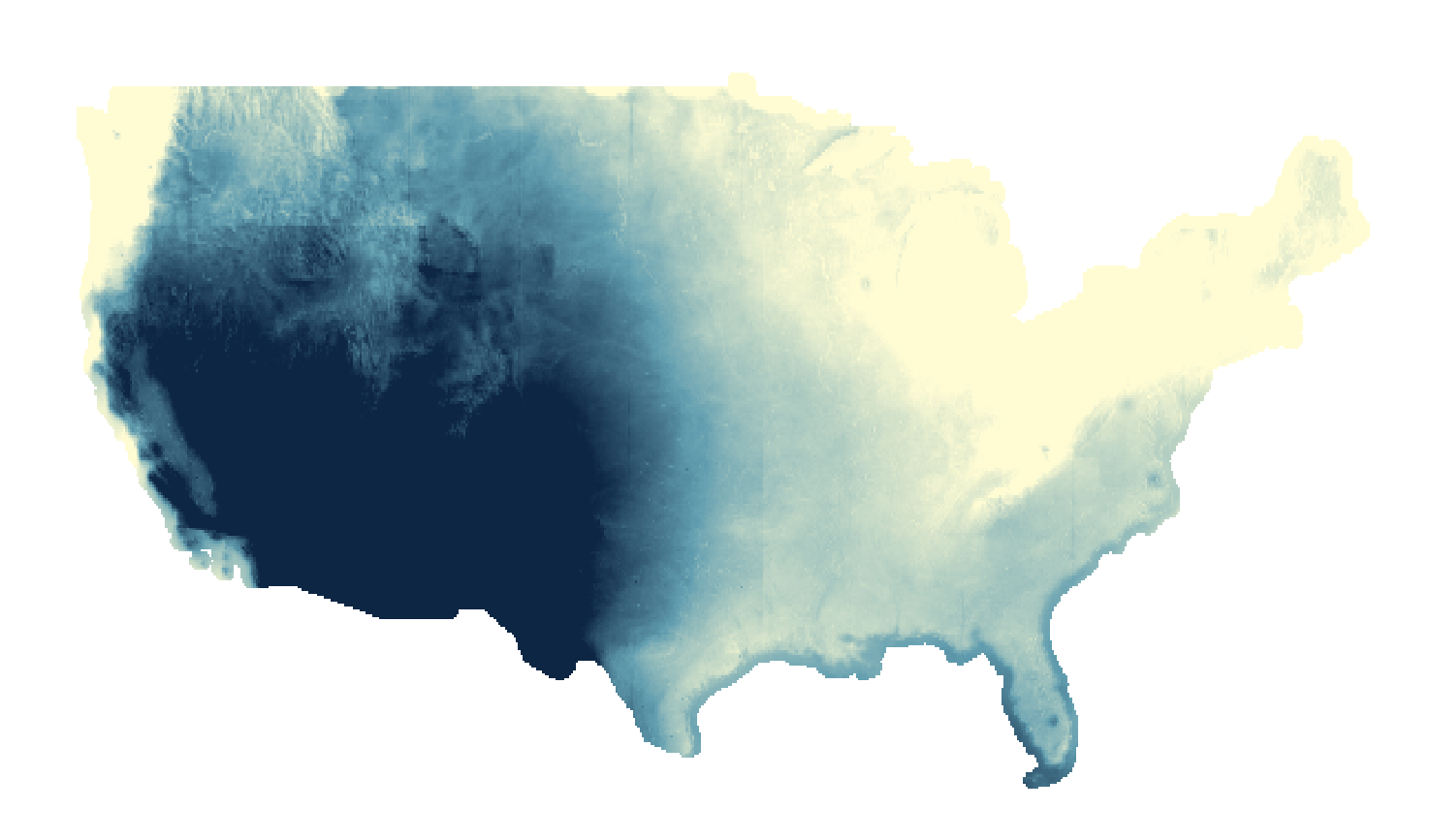
This map was downloaded from the NREL as a zip file. The table has an ID, Gridcode, Long, Lat, etc. The data is gridded into 10km by 10km squares.
GIS recognizes this layer as a Polygon layer, and gives me quite a few styling options to represent it.
I wanted to calculate an optimal tilt for solar panels based on Latitude and add it to my pop-ups. I exported the map's table as a CSV and did this calculation in Excel. The new table is identical to the one I exported except that it has a new column that is the optimal tilt.
I imported this new table back into ArcGIS online, however, it uploaded as a point layer instead of a polygon layer. When mapping any data, it represents my data as points instead of polygons.
Singular points still represent a square area of 10km by 10km. The data is actually identical to my previous map (save for the new addition). I only have two styling options, neither of which represent my data efficiently.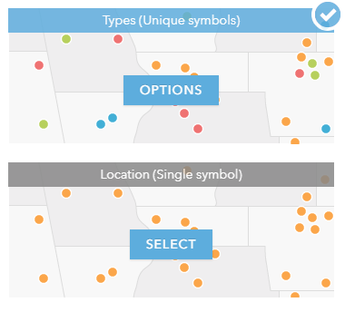
As I stated previously, GIS lists this new feature layer as a point layer instead of a polygon layer. I am confused as to why this is the case. Is there a way that I can change this to a polygon layer so that I have more options in visually representing this data?
Tldr: GIS online views my feature layer as a point layer. I want GIS to view my point layer as a Polygon layer.
- Mark as New
- Bookmark
- Subscribe
- Mute
- Subscribe to RSS Feed
- Permalink
You could have joined the point layer to the polygon layer to get your desired attributes back to the original dataset
... sort of retired...
- Mark as New
- Bookmark
- Subscribe
- Mute
- Subscribe to RSS Feed
- Permalink
Yes, I did consider that, but the dataset is too large to be used with the Join Features tool. After about 6 hours of it processing that analysis, I gave up on it.
- Mark as New
- Bookmark
- Subscribe
- Mute
- Subscribe to RSS Feed
- Permalink
That leaves you with converting it back to a raster because converting a point to a polygon is going to be a more onerous computational task
... sort of retired...
- Mark as New
- Bookmark
- Subscribe
- Mute
- Subscribe to RSS Feed
- Permalink
If you have pro you can do a join and just calculate the field s across its quicker then join field's. Can the calculation be done directly into the table on arcgis online ?
- Mark as New
- Bookmark
- Subscribe
- Mute
- Subscribe to RSS Feed
- Permalink
Sorry, I don't do arcgis online much and I tend to use arcpy.ExtendTable to do joins.
... sort of retired...