- Home
- :
- All Communities
- :
- Products
- :
- ArcGIS Online
- :
- ArcGIS Online Questions
- :
- Georeferencing error 00037
- Subscribe to RSS Feed
- Mark Topic as New
- Mark Topic as Read
- Float this Topic for Current User
- Bookmark
- Subscribe
- Mute
- Printer Friendly Page
Georeferencing error 00037
- Mark as New
- Bookmark
- Subscribe
- Mute
- Subscribe to RSS Feed
- Permalink
Hello,
I am trying to take a map from a PDF document and get it so I can use it in ArcGIS Online. I was following a great tutorial but ran into a snag.
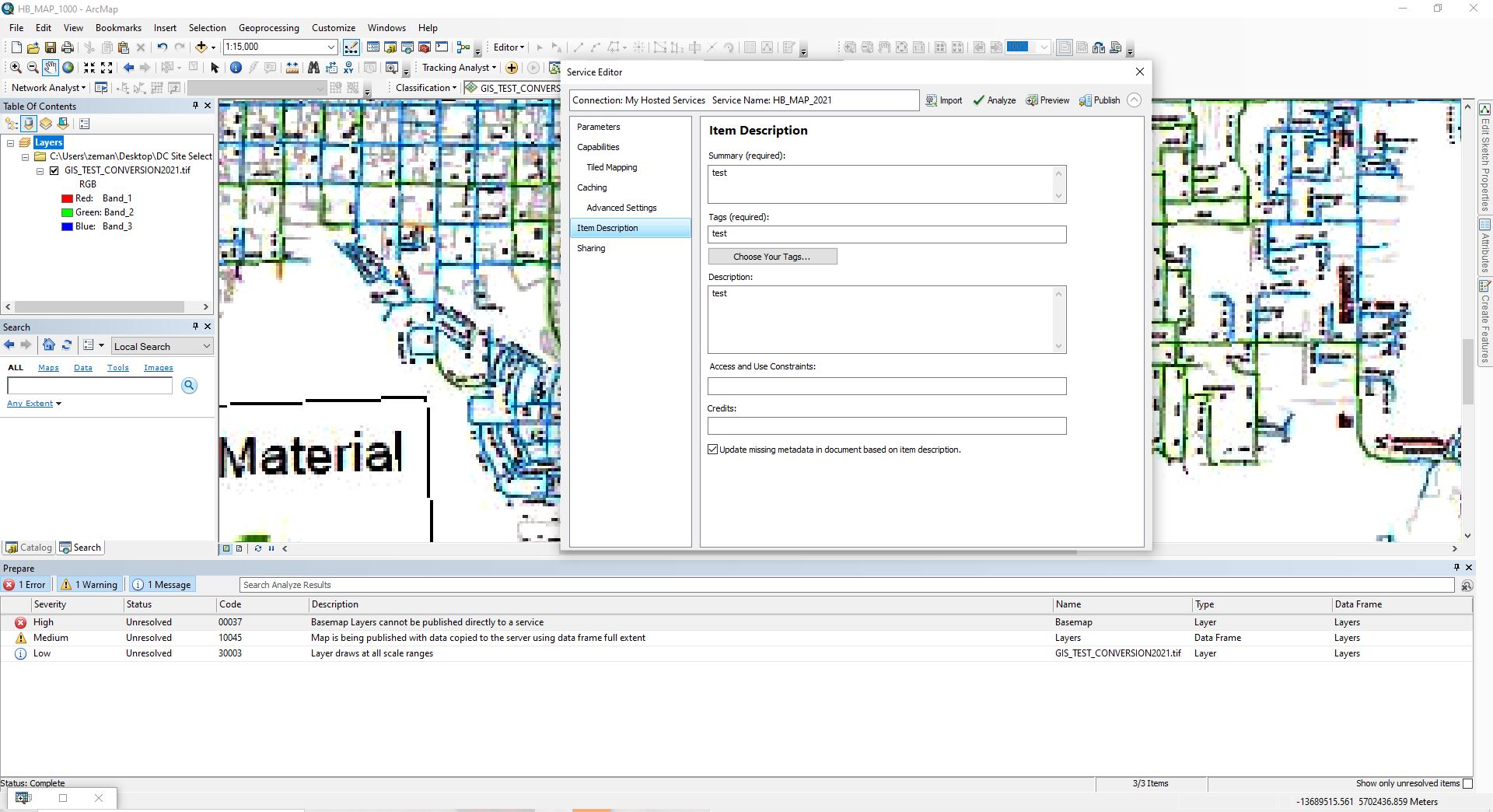
My overall methodology is to georeference the pdf map (that I converted into a JPG before putting it into ArcMap Desktop) and then I get it the way I want it. After I georeference the JPG image I rectify and delete the base map I was using. Now I go to share as a service ---> publish a service --> choose a connection ---> and then I fill out the service editor. HOWEVER, once I click analyze I get this error:
Severity: High
Status: Unresolved
Code: 00037
Description: Basemap Layers cannot be published directly to a service
Name: Basemap
Type: Payer
Data Frame: Layers
I don't know why I am getting this error! I UPLOADED AN IMAGE SO YOU CAN SEE MY SCREEN, JUST DOWNLOAD THE IMAGE. Any advice?
I'm trying to follow this guys tutorials: https://www.youtube.com/watch?v=aXu6xdIzzIY&t=1s
https://www.youtube.com/watch?v=klFwpWTUi8A&index=23&list=UUdShBEYmIgoDn34bi1vVA9w
- Mark as New
- Bookmark
- Subscribe
- Mute
- Subscribe to RSS Feed
- Permalink
Can you post a screenshot, but showing the 'List by Drawing Order' option in ArcMap. Using the table of contents—Help | ArcGIS for Desktop
Can you also show sshots of all the options in your publishing wizard if able.
- Mark as New
- Bookmark
- Subscribe
- Mute
- Subscribe to RSS Feed
- Permalink
Thank you for your reply! I'm not sure how that helps get a PDF map onto a map I'm making in ArcMap online.