- Home
- :
- All Communities
- :
- Products
- :
- ArcGIS Online
- :
- ArcGIS Online Questions
- :
- Custom Basemap & Map Viewer
- Subscribe to RSS Feed
- Mark Topic as New
- Mark Topic as Read
- Float this Topic for Current User
- Bookmark
- Subscribe
- Mute
- Printer Friendly Page
Custom Basemap & Map Viewer
- Mark as New
- Bookmark
- Subscribe
- Mute
- Subscribe to RSS Feed
- Permalink
I have a need to restrict the scale level to around 1:30,000 for a series of maps I will be embedding into the Cascade Story Map template.
Therefore, I created my own simple basemap (key for this one is simple) using some minimal reference datasets.
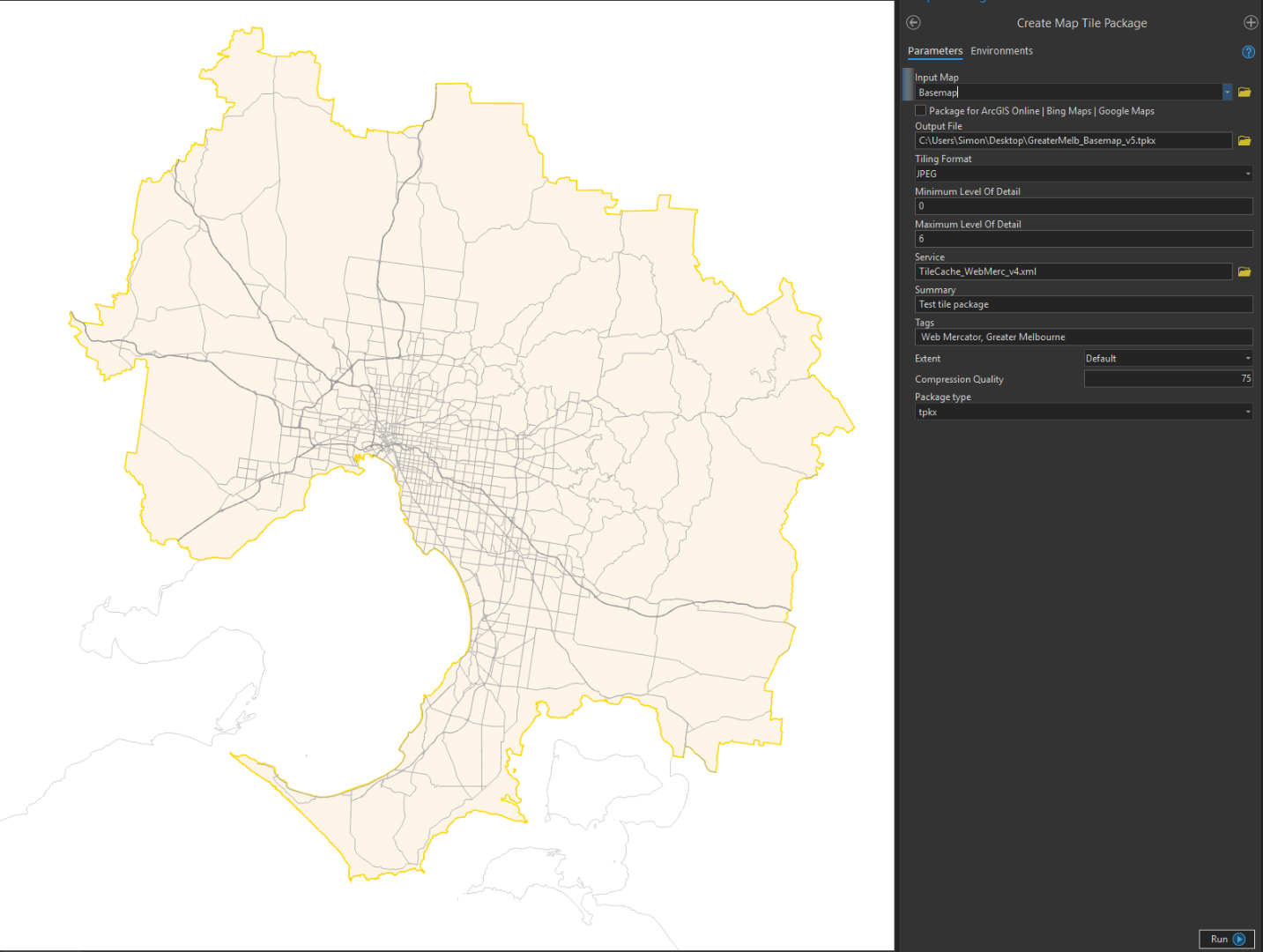
- I ran the Generate Map Server Cache Tiling Scheme tool to create an xml file (pastebin)
- I then created a Tile Package in ArcGIS Pro (see screenshot below)
- Using the new tiling scheme (Web Mercator, but my scale levels)
- PNG
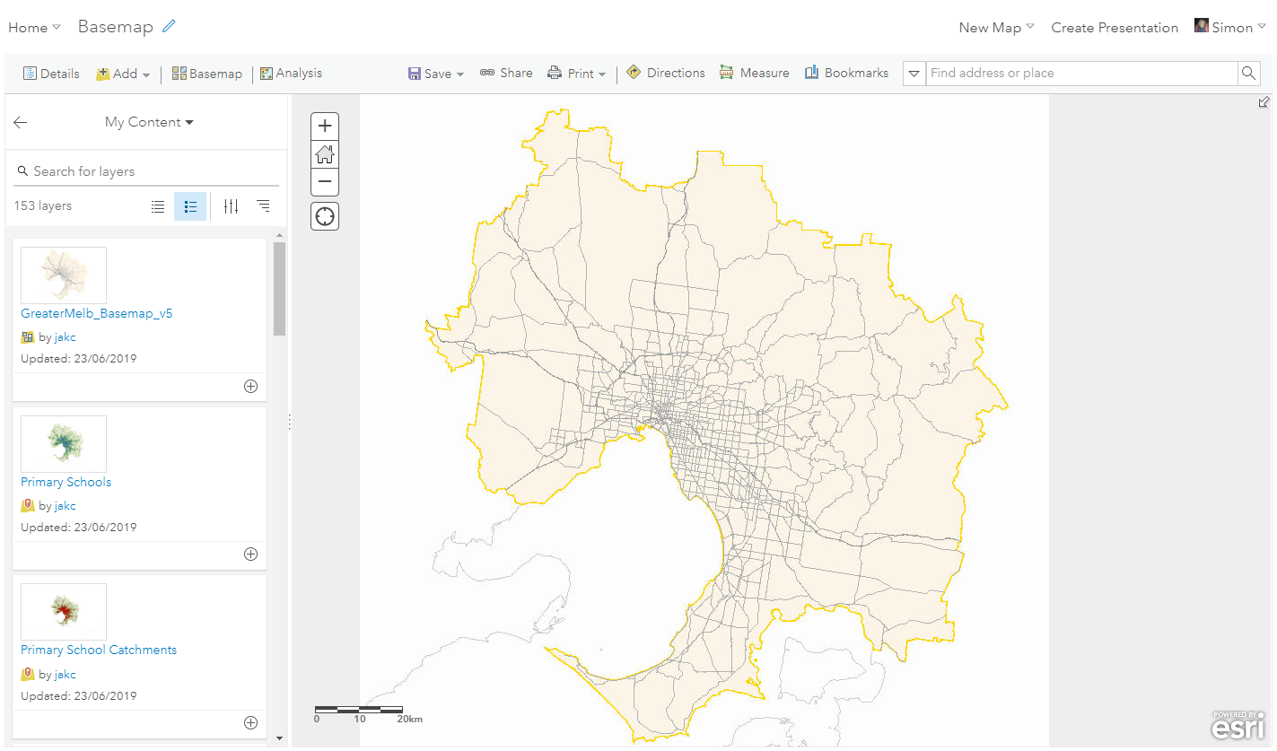
- I then uploaded this into my ArcGIS Online account and published the tiles.
- This appears great, and I can add it as a basemap layer into the Map Viewer.
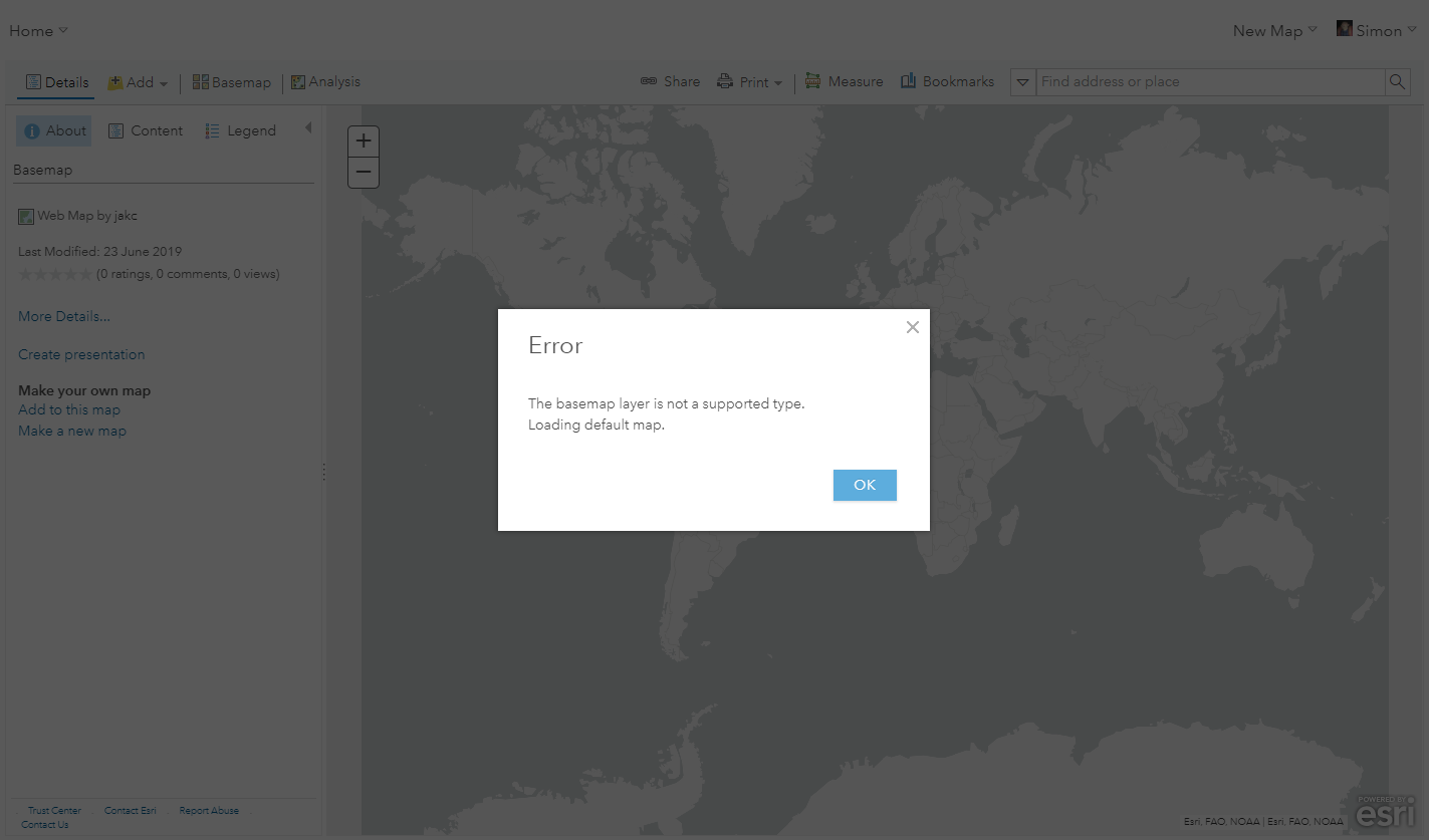
- IF I refresh the browser or try to open the web map again, it then gives me a "The basemap layer is not a supported type" and reverts to the default basemap for our organisation.
I initially tried using a local coordinate system (VicGrid GDA2020) but have reverted to Web Mercator for the map. However I do not want to use the ArcGIS Online/Bing tiling scheme as that will have high detail levels of detail. I need to prevent the user from zooming in beyond 1:30k
Any idea why I am getting the error? Is there specific requirements for a layer to be nested on its own in the basemap group in a web map?
Thanks
EDIT
Just tried a JPEG tile package using same tiling scheme. Same issue.
Looks good...
Save and refresh...
Have also followed the steps in this whitepaper (from ArcGIS Pro) and also Bern Szukalski blog post here.
I get the same error.
Strangely, if I google for this exact error, it would appear that this Geonet post is the only result, so it must be something wrong with my data/workflow?
- Mark as New
- Bookmark
- Subscribe
- Mute
- Subscribe to RSS Feed
- Permalink
Hi Simon,
This issue should be fixed now. Sorry for the inconvenience.
Cheers,
Chris