- Home
- :
- All Communities
- :
- Products
- :
- ArcGIS Online
- :
- ArcGIS Online Questions
- :
- Creating cache with a mask
- Subscribe to RSS Feed
- Mark Topic as New
- Mark Topic as Read
- Float this Topic for Current User
- Bookmark
- Subscribe
- Mute
- Printer Friendly Page
Creating cache with a mask
- Mark as New
- Bookmark
- Subscribe
- Mute
- Subscribe to RSS Feed
- Permalink
Hello,
I am publishing a very large OrthoPhoto I had built a mosaic dataset for it. The boundary and footprint are set ok. When I build a cache I get a white picture for all of the extent. I don’t want it.
What I am asking is how to get only the mask and not the extent when publishing a map cache?
Thank you all,
Roi Algavish.
- Mark as New
- Bookmark
- Subscribe
- Mute
- Subscribe to RSS Feed
- Permalink
Hi Roi,
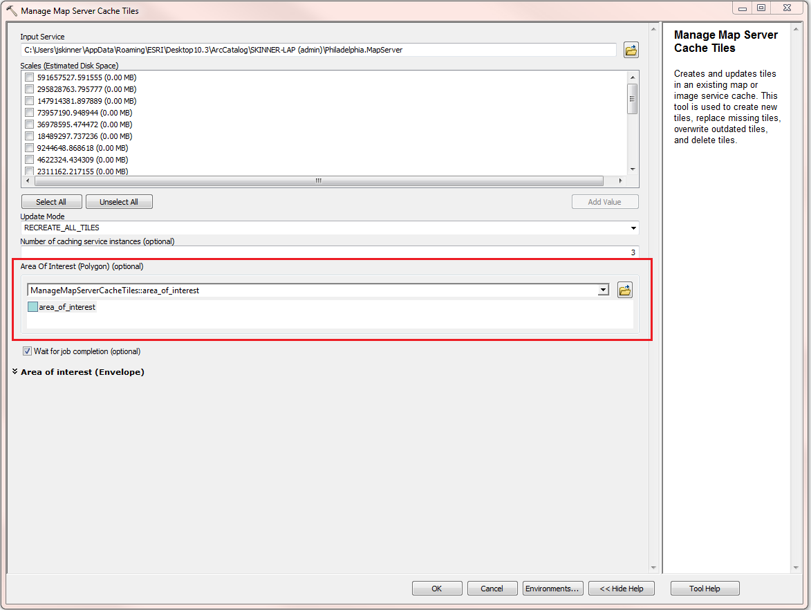
When setting up the cache, choose to build the cache manually. You can then right-click on the service > Manage Cache > Manage Tiles. Here you will have the option to build the cache for an Area of Interest. You can browse to a shapefile/feature class or draw the extent for the cache you would like built.
- Mark as New
- Bookmark
- Subscribe
- Mute
- Subscribe to RSS Feed
- Permalink
Hi jake,
First of all thank you .
This is what i did, but when I added the service to a map I got the whole extent of the mosaic also in places with no data defined. It looks like it built the cache In the area of internee but gave me a white picture in all of the extent.
Am I doing something wrong?
- Mark as New
- Bookmark
- Subscribe
- Mute
- Subscribe to RSS Feed
- Permalink
What did you specify for the Tile Format? If this is raster data, it's recommended to use 'MIXED'.

- Mark as New
- Bookmark
- Subscribe
- Mute
- Subscribe to RSS Feed
- Permalink
Hi,
I had used jpg in order to compress it a bit more, but I will publish it again with mixed and hopefully it will solve it. I will let you know,.
Thank you.