- Home
- :
- All Communities
- :
- Products
- :
- ArcGIS Online
- :
- ArcGIS Online Questions
- :
- ArcGIS Pro export extent issues
- Subscribe to RSS Feed
- Mark Topic as New
- Mark Topic as Read
- Float this Topic for Current User
- Bookmark
- Subscribe
- Mute
- Printer Friendly Page
ArcGIS Pro export extent issues
- Mark as New
- Bookmark
- Subscribe
- Mute
- Subscribe to RSS Feed
- Permalink
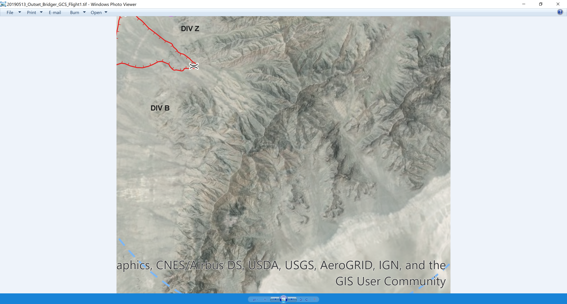
When exporting a .tif file in Data view of ArcGIS Pro (2.3.2), the extent of the map in data view is correct (Figure 1), but when exported, the file displays only half of my data view extent and is at a much larger scale (Figure 2). I suspect an incompatibility between my Windows 10 (1803), NVIDIA and Intel displays, as other issues with text manifests with programs such as Agisoft as well. I have the most current drivers for both displays.
Figure 1 - Data view
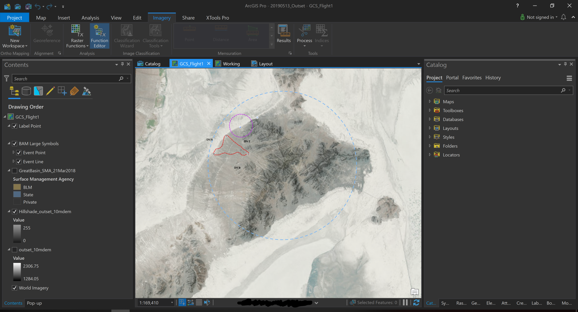
Figure 2 - Exported TIF
- Mark as New
- Bookmark
- Subscribe
- Mute
- Subscribe to RSS Feed
- Permalink
Sounds similar to https://community.esri.com/message/848906-re-arcgis-pro-224-exporting-only-square-central-portions-o..., and for which I suspect the only solution is a call to tech support. Last comment in https://community.esri.com/ideas/3492 might also be the culprit. I am a bit surprised that you can't export tags in layout view in Pro, but you can in ArcMap (yes I have production mapping license on both), and wonder why that is disabled? Nor can you export a world file from Pro layout view?
- Mark as New
- Bookmark
- Subscribe
- Mute
- Subscribe to RSS Feed
- Permalink
Hmmm....from https://pro.arcgis.com/en/pro-app/help/sharing/overview/export-a-map-or-layout.htm "TIFFs also support georeferencing information in GeoTIFF tags or in a separate world file for use as raster data." suggests that you get the tags and wordfile in layout or map view, which suggests that what you are experiencing is a bug. I can't repro the extent issue, do you get the same problem with the same project on a different computer?