- Home
- :
- All Communities
- :
- Products
- :
- ArcGIS Online
- :
- ArcGIS Online Questions
- :
- Re: ArcGIS OnLine - Allow selection color for poly...
- Subscribe to RSS Feed
- Mark Topic as New
- Mark Topic as Read
- Float this Topic for Current User
- Bookmark
- Subscribe
- Mute
- Printer Friendly Page
ArcGIS OnLine - Allow selection color for polygons to be controlled
- Mark as New
- Bookmark
- Subscribe
- Mute
- Subscribe to RSS Feed
- Permalink
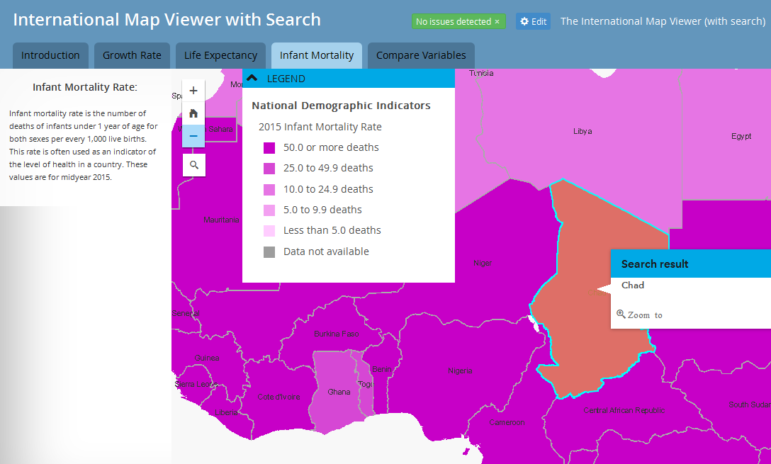
In ArcGIS Online, both Web Maps and Web Mapping Applications, seem to have a default color set for selected polygons. The polygon boundary is highlighted in cyan and the polygon highlighted in a semi-transparent brown. (See image below)
While clearing the selection will removes the highlight, many inexperienced users may not think to do that. Users have also been confused with the coloring, thinking the value or class of the polygon has been changed to something else.
Some Web Mapping Application templates do change the color, but I have found they then change too many other things to be acceptable.
Does anyone know how to allow selection color to be controlled in all Web Maps and Web Mapping Applications? I have tried all I know from the MXD used to make the REST service to all available options in Web Maps and Web Mapping Applications. This is a big enough deal for my reviewers to kill the project without a solution. My dream is to keep the cyan boundary and have a no color highlight for the polygon. Am considering adding a separate line layer, but am hoping to avoid that.
Solved! Go to Solution.
- Mark as New
- Bookmark
- Subscribe
- Mute
- Subscribe to RSS Feed
- Permalink
I am planning to try this out this week and will report back.
- Mark as New
- Bookmark
- Subscribe
- Mute
- Subscribe to RSS Feed
- Permalink
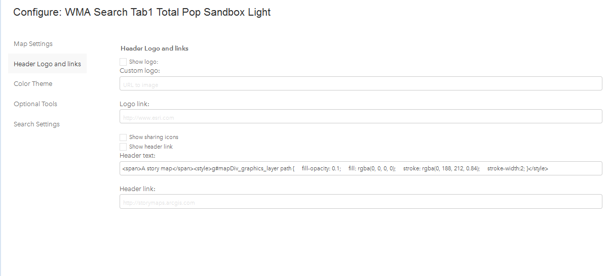
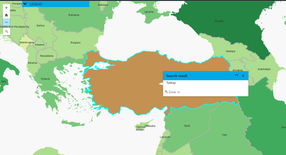
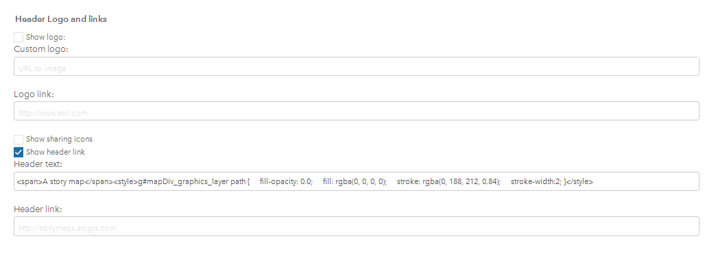
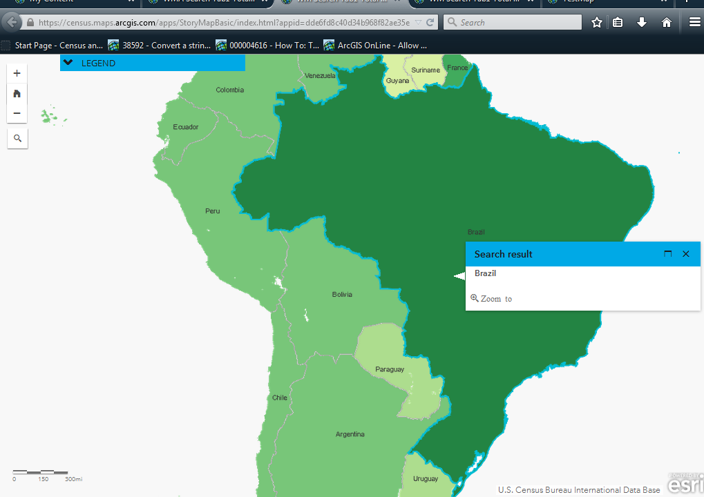
Hello, tried this out with no effect. I entered the text (first image below) and the highlight color is still brown inside the polygon. (Second image below)
Still highlighted in brown. Turkey should be the same green as Russia.
I then tried a few other mods (line thickness, fill-opacity, ....) and none of them seem to have any effect. Am I entering the text into the wrong field? Detail screen capture of what I entered below.
- Mark as New
- Bookmark
- Subscribe
- Mute
- Subscribe to RSS Feed
- Permalink
Hmm it should work. Is your web map/app public? If so can you send me the link and I can take a look to see if there's something odd going on?
- Mark as New
- Bookmark
- Subscribe
- Mute
- Subscribe to RSS Feed
- Permalink
Here's a link to a test app I built showing the search without the default selection color. Use the search tool to search for Flagstaff to see the new selection.
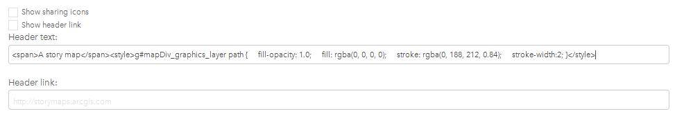
I think the problem is that you don't have 'Show header link' checked. Try turning this option on and then use the &embed=true url param as shown in the link above to hide the title area.
- Mark as New
- Bookmark
- Subscribe
- Mute
- Subscribe to RSS Feed
- Permalink
Turning on the option for "Shown header link" was the key. It is now showing the outline as cyan and the interior of the poly has no color.
One thing, I am not sure how to use the "&embed=true url" If I add that to the end of my url, can that Web Mapping Application still be used as any W.M.A? I will check that out myself. One note, I have nothing in the field Header Link. And my test WMA with the "Show Header Link" checked on shows no header.
- Mark as New
- Bookmark
- Subscribe
- Mute
- Subscribe to RSS Feed
- Permalink
It should still be usable embedded in another app but if the header isn't showing up you probably don't need to add the embed url param.
- Mark as New
- Bookmark
- Subscribe
- Mute
- Subscribe to RSS Feed
- Permalink
Is this possible to do with a AGOL Web App (WebApp Builder)?
- Mark as New
- Bookmark
- Subscribe
- Mute
- Subscribe to RSS Feed
- Permalink
The map is not public and I am not authorized to make it public. Nor even ask to have it made public.
- Mark as New
- Bookmark
- Subscribe
- Mute
- Subscribe to RSS Feed
- Permalink
Hi kelly,
I am wanting to make the selected item that has been searched to have no fill. What folder/file is the code found. I am using the traditional Search widget from ArcGIS Online that has been downloaded onto my server.
- Mark as New
- Bookmark
- Subscribe
- Mute
- Subscribe to RSS Feed
- Permalink
Hi,
I would like to be able to remove the cian outline completely when a feature is selected on a map (as well as no fill). Is this possible using a similar method to what you have mentioned here? I'm using a Map Journal app embedded in a Map Series app. I can send examples if necessary.
Thanks, Sarah