Hi. I'm hoping someone can help. I have created a hosted feature layer of 100 polygons. This data contains an attribute that groups the polygons. I want to create an editing environment where the color changes when the attribute value changes.
To do that, I thought I could add the hosted feature layer to a web map and create a "unique symbols" drawing style based on that attribute. It works, HOWEVER, doing so creates a dropdown choice for that attribute when editing. Which is fine, except the full list of choices is not made available.
It seems like it gets stuck on a default and I can't figure out how to change it.
Any help or other ideas is appreciated.
Here's a bit more information:
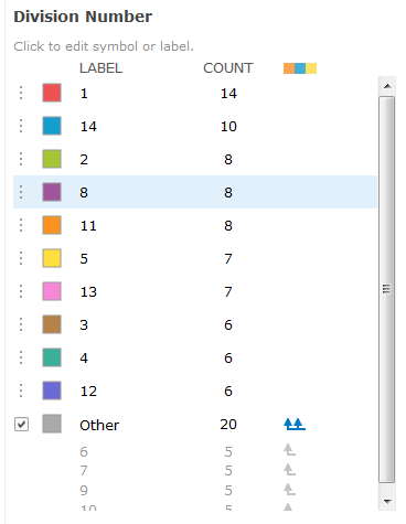
Here are the possible values all contained in the original data set.
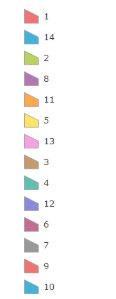
These are my choices when editing. Only 10 of the 14 options are available.
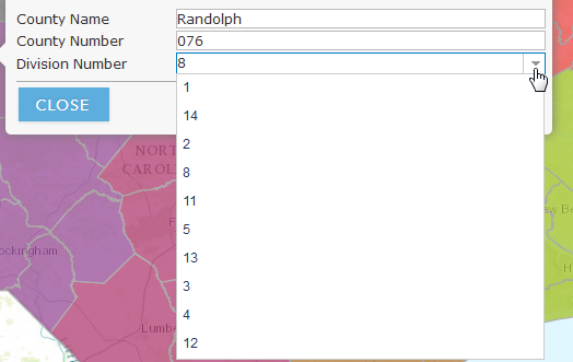
Here's the default style when I first select that style option.