- Home
- :
- All Communities
- :
- Products
- :
- ArcGIS Online
- :
- ArcGIS Online Ideas
- :
- Maintain Map Extent with Story Actions
- Subscribe to RSS Feed
- Mark as New
- Mark as Read
- Bookmark
- Follow this Idea
- Printer Friendly Page
- Mark as New
- Bookmark
- Subscribe
- Mute
- Subscribe to RSS Feed
- Permalink
Here are some persuasive details...
Summary
When configuring Story Actions we expect to be able to preserve the current user-defined map extent while turning layers on or off. We want the end user to be able to stay focused on the area they have zoomed to after clicking on a Story Action.
Technical Problem
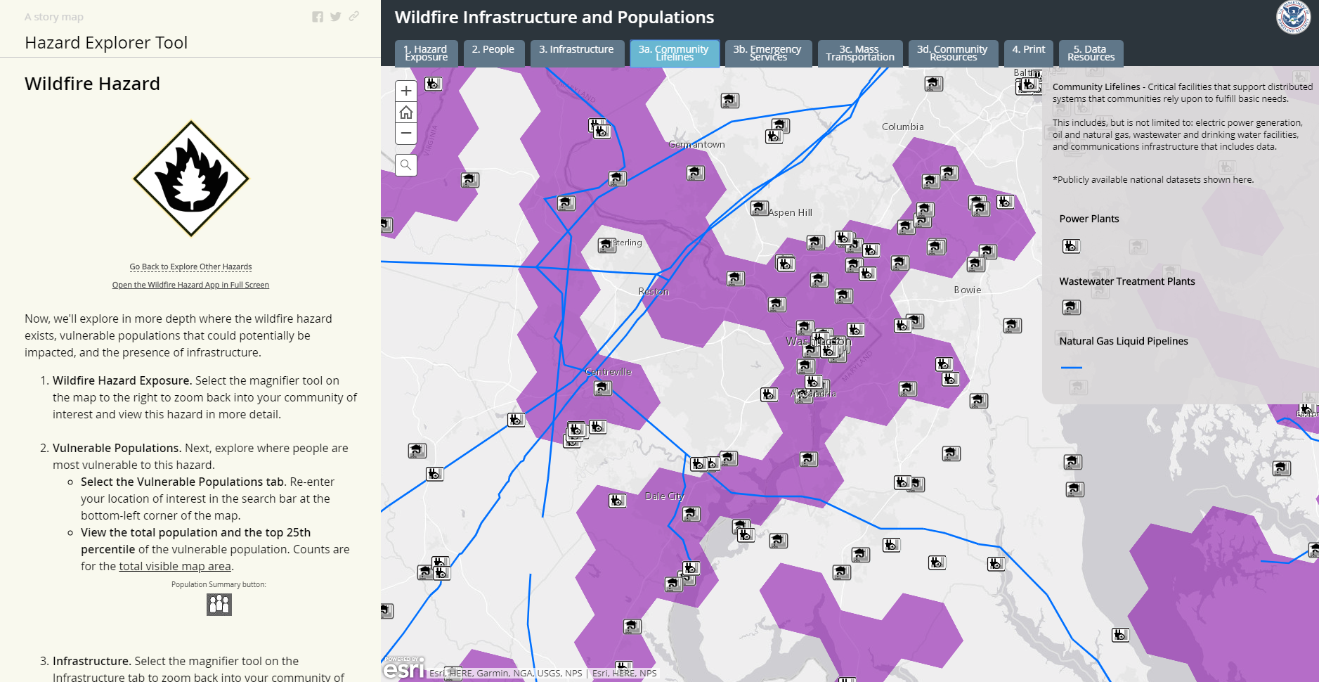
We would like to take advantage of the synchronization between tabs in the Story Map where each tab represents a hazard. So the end user can type in an address and/or zoom to an area of interest, if they flip through the tabs the hazards automatically change. This is awesome.
When we highlight the text and configure story actions action we are happy with the Content > Custom Configuration, this allows us to control the layers on the map. This is awesome.
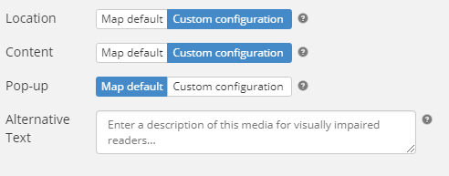
The challenge arises when we configure the Location > Custom Configuration, this results in the end user being taken back to the extent of the first tab. If we configure the Location > as Map default, this also takes us back to the extent of the first tab. This is heart-breaking....
Real-World Problem
Each time the end user clicks on the highlighted text, they lose their map extent. They get zoomed back out and have to start over. They are disappointed and stop using the Story Map altogether...
Proposed Solution
A "do nothing" button. A button that allows us to remove the change in location when they click on a story action.
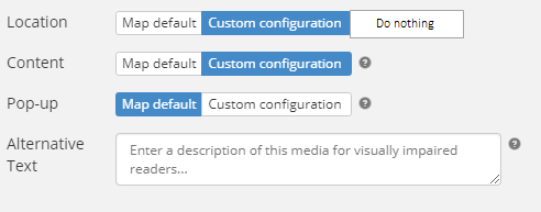
When the end user clicks on the highlighted text, only the Content / Layer changes. Nothing else. This elegant solution allows an intuitive way to explore an area without having to teach a non-GIS person how to turn layers on and off (a foreign concept to 95% of non-GIS Professionals).
We love simple Story Maps with just web maps embedded. They are easy to use, load quickly, and help focus the end user on the story you are trying to tell. This enhancement would help app designers configure better Story Maps and reduce the dreaded "appzilla" of apps embedded within apps.
Current Workaround: Our current workaround is Story Map Series embedded within a Story Map Journal. It is not optimal (potentially confusing, slow to load, and requires a lot of maintenance), but the only way we can deliver the stakeholder requirements at this point in time. It is confusing because as the end user navigates through hazards they get zoomed out to a default extent.
Thank you Story Map Team for considering this enhancement now or in the re-design of Story Maps. Story Maps
Software
Story Map Series, Story Map Journal
Real-World Use Case
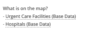
We are creating a Story Map that allows a user to explore their community by hazard exposure and would also like for them to be able to explore Community Lifelines / Infrastructure in the area.
Audience
Emergency Managers, Disaster Exercise Planners, Non-GISSers
You must be a registered user to add a comment. If you've already registered, sign in. Otherwise, register and sign in.