Turn on suggestions
Auto-suggest helps you quickly narrow down your search results by suggesting possible matches as you type.
Cancel
- Home
- :
- All Communities
- :
- Products
- :
- ArcGIS Online
- :
- ArcGIS Online Ideas
- :
- Add Ability to Offset Polygon Outline
Options
- Subscribe to RSS Feed
- Mark as New
- Mark as Read
- Bookmark
- Printer Friendly Page

- Mark as New
- Bookmark
- Subscribe to RSS Feed
- Permalink
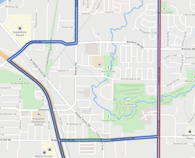
I think it would be nice to have the ability to offset (positively or negatively) a polygon outline within a web map. Having the ability to negatively offset a polygon boundary often helps visualize boundaries when they are symbolized differently, as shown in the screenshot below.
3 Comments

Totally agree. With the map viewer being so new and innovative according to Esri, a simple thing such as offset symbology for polygone outlines doesn't seem to look like that big of a deal, right?

Yes, please enable the offset function for points, lines, and polygons.

You must be a registered user to add a comment. If you've already registered, sign in. Otherwise, register and sign in.