Try the resources below to learn more about spatial data exploration and problem solving with ArcGIS Online.
Explore places
Find the best place for launching a travel service.
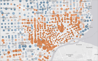
Reveal spatial patterns
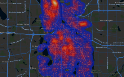
Create heat maps to make discoveries about your data.
Find locations
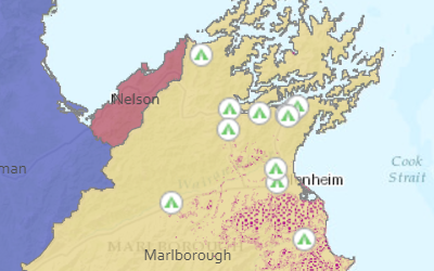
Identify campgrounds near invasive weeds.
Enrich your data
Add context to your data by making a demographic map.
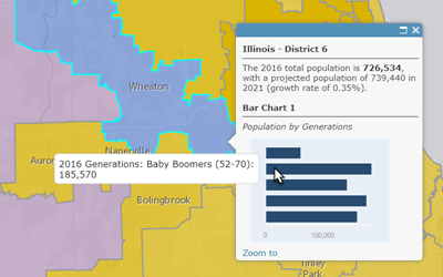
Analyze demographics
Locate children in poverty using smart mapping and demographic analysis.
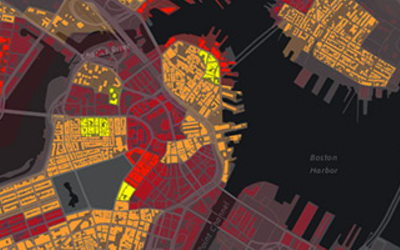
Track crime patterns

Help allocate resources to combat crime.
Model wildlife habitat

Find potential mountain lion corridors.