- Home
- :
- All Communities
- :
- Products
- :
- ArcGIS Network Analyst
- :
- ArcGIS Network Analyst Questions
- :
- Public Transit Network Dataset: Network Analyses (...
- Subscribe to RSS Feed
- Mark Topic as New
- Mark Topic as Read
- Float this Topic for Current User
- Bookmark
- Subscribe
- Mute
- Printer Friendly Page
Public Transit Network Dataset: Network Analyses (Service Area, Route, and OD Matrix) between three stops on new STC rail line not working
- Mark as New
- Bookmark
- Subscribe
- Mute
- Subscribe to RSS Feed
- Permalink
Good Morning.
I created a public transit network dataset incorporating a Metro Rail GTFS network with information on two future Metro lines, the Sepulveda Transit Corridor Alternative 4 (route id: 8104) and the East San Fernando Valley Transit Corridor (route id: 809) added in. The transit network dataset creation process ended up working out as planned, with only a few minor issues (a handful of empty stop connectors on local bus lines) shown following the "Build Network."
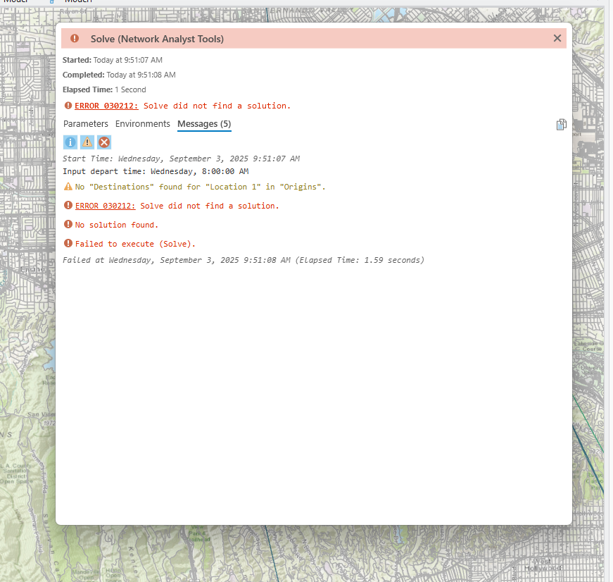
However, when I went to run an OD analysis evaluating access between the UCLA Gateway Plaza stop (stop id: 81044) and stations in the San Fernando valley (stop ids: 81045, 81046, 81047, and 81048), I get back an error message saying "Solve did not find a solution." I have also found that San Fernando Valley destinations do not feature in Service Area analyses performed with UCLA as a starting point, indicating that there's an issue with a link between the Gateway Plaza stop and points north. By contrast, Service Area analyses show increased accessibility to points south of UCLA (and the OD analysis also works for points south).
When I do routes between stop 81044 and 81045, I am able to get a route to appear but it follows the road network and shows a transit time of 3 hours...(see png)
I've checked and triple-checked the stops, trips, and stop times files for errors and can't find any issues so I'm wondering if you could take a look at this.
- Mark as New
- Bookmark
- Subscribe
- Mute
- Subscribe to RSS Feed
- Permalink
Unfortunately, while I can definitely help you with problems related to the GTFS To Public Transit Data Model tool and associated ArcGIS functionality, I can't really help you debug your GTFS data. I did take a quick look at it and spot-checked a few values for the two routes you mentioned, and everything looks okay as far as I can tell.
Here are a couple of things to check on the Network Analyst side to rule out a problem there:
- Make sure the date and time you're using for the analysis is a date and time when transit service is running for the new line.
- Make sure you don't have a connectivity problem. Use the Explore Network tool to click on the transit line and its associated StopConnectors features and make sure it's really connected to the streets.
- Are you using any of the Public Transit evaluator's supported attribute parameters to run scenarios for excluding lines? Have you inadvertently excluded the new transit lines? (See https://pro.arcgis.com/en/pro-app/latest/help/analysis/networks/public-transit-evaluator.htm#ESRI_SE.... If you have no idea what I'm talking about, you're probably not doing this.)
If none of those things bear any fruit, then the problem is likely related to your homemade GTFS files, and you'll need to check those carefully to find where it's falling apart.