- Home
- :
- All Communities
- :
- Products
- :
- ArcGIS Network Analyst
- :
- ArcGIS Network Analyst Questions
- :
- Problems with creating public transport network
- Subscribe to RSS Feed
- Mark Topic as New
- Mark Topic as Read
- Float this Topic for Current User
- Bookmark
- Subscribe
- Mute
- Printer Friendly Page
Problems with creating public transport network
- Mark as New
- Bookmark
- Subscribe
- Mute
- Subscribe to RSS Feed
- Permalink
Hi everyone!
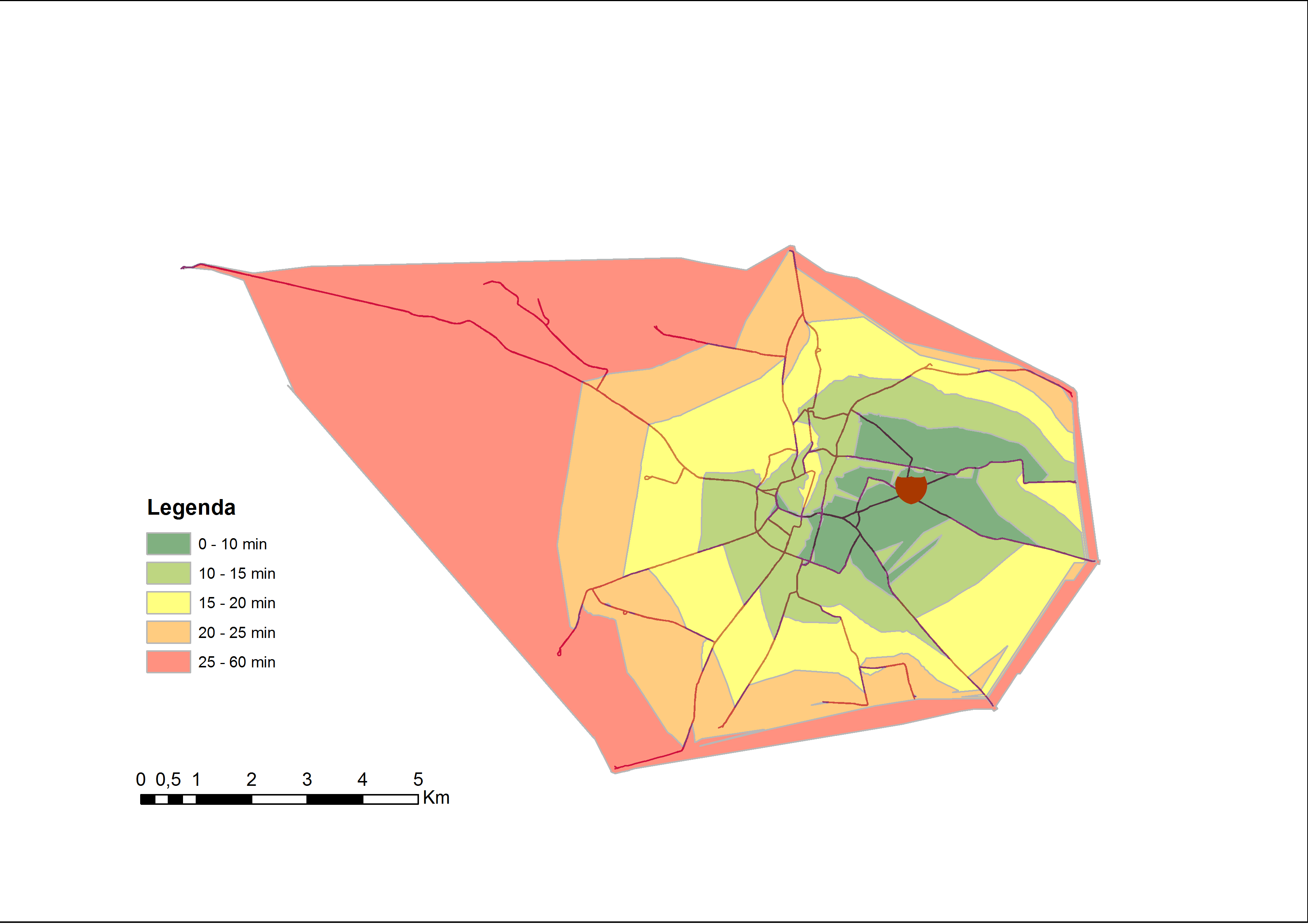
I'm trying to create a public transport network using Network Analyst to generate drive-time polygons. I already have segments (lines) of bus/tram lines and points that represent bus/trams stops. Each segment has DriveTime attribute. The problem is that my generated drive-time polygons have strange shapes and spikes. (attached a map) Do you know what am I doing wrong?
I'll be very gratefull for ANY help 
Greetings, Julita
- Mark as New
- Bookmark
- Subscribe
- Mute
- Subscribe to RSS Feed
- Permalink
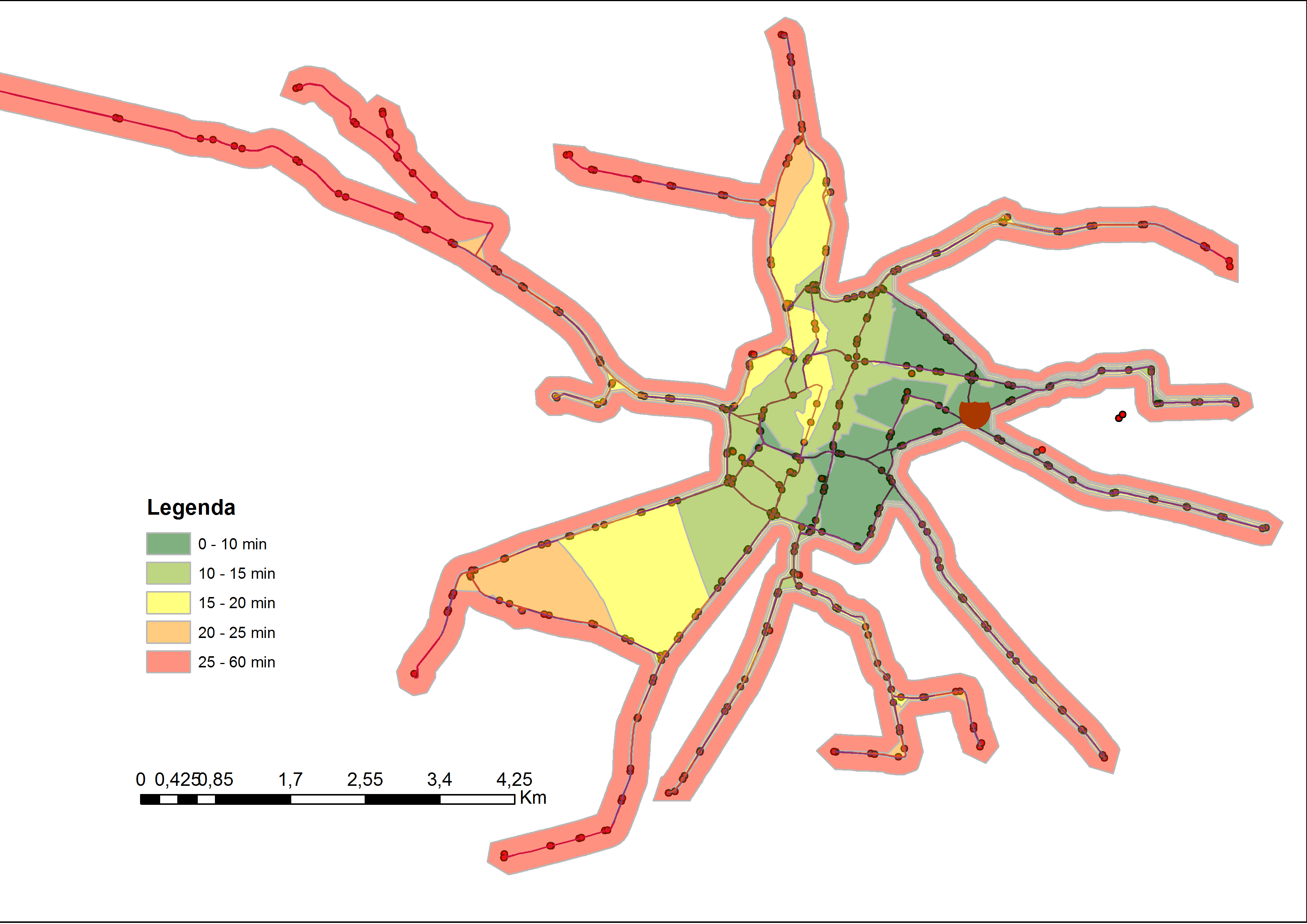
Are you using trim for your polygons? If not, try turning on trim (in the Service Area layer settings) and see if the spikes go away.
Are the lines shown in the picture the only lines you have in your network, or do you also have a streets feature class that isn't shown? If you have streets that aren't shown, perhaps the spikes are due to a connectivity problem with your streets.
~Melinda
- Mark as New
- Bookmark
- Subscribe
- Mute
- Subscribe to RSS Feed
- Permalink
I tried to trim polygons (attached a map). I'm concerned about irregurar shpes of polygons and that they are not symmetrical to both sides of a road.
Now in network I have lines shown on a map. I'm trying to model public transport (only tram and bus lines). There will also be bus lines, so there will be more values to interpolate polygons.
Julita
- Mark as New
- Bookmark
- Subscribe
- Mute
- Subscribe to RSS Feed
- Permalink
For your polygons to be meaningful, it seems like you would need to include some street data. Pedestrians can leave the bus and walk down a side street, for instance.
I really can't tell why your service areas look strange without looking at the data. Would you be able to post it somewhere?