- Home
- :
- All Communities
- :
- Products
- :
- ArcGIS Network Analyst
- :
- ArcGIS Network Analyst Questions
- :
- Network Analyst - Edit Navteq Network Dataset
- Subscribe to RSS Feed
- Mark Topic as New
- Mark Topic as Read
- Float this Topic for Current User
- Bookmark
- Subscribe
- Mute
- Printer Friendly Page
- Mark as New
- Bookmark
- Subscribe
- Mute
- Subscribe to RSS Feed
- Permalink
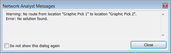
My company purchased/licensed the complete North American Navteq Streetmap for 2014. I am new to Network Analyst and would like to update the streets to include and route along newly added private roads. I read through the Network Dataset Help and completed several of the tutorials. To keep it simple and develop a workflow which I could apply to all of my new roads I started by adding only one road segment. I added the segment, insured it snapped to the existing roads, and ran the Build tool on the Network Dataset. Then I attempted to solve a route with the destination (Stop 2) being at the end of the new road segment. The result has been an error (screen shot attached) even after multiple attempts of assigning more attributes to my road segment and modifying restrictions. The error reads Warning: No route from location "Graphic Pick 1" to location "Graphic Pick 2".Error: No solution found. What am I missing? Is there a processing step/tool that I failed to run or some key attributes that are required which I failed to populate. I'm guessing it's a missing attribute but I can't easily find a list of key attributes for Navteq network datasets. Thanks in advance for any suggestions.
Solved! Go to Solution.
Accepted Solutions
- Mark as New
- Bookmark
- Subscribe
- Mute
- Subscribe to RSS Feed
- Permalink
Melinda Morang of ESRI had some good suggestions for dealing with Network Analyst issues in this recent thread:
Network Analyst Closest Facility Tool issues
Look particularly at the subheading she has called "Network dataset problems", as all but the first under this subheading are relevant to your issue (besides the original thread).
Chris Donohue, GISP
- Mark as New
- Bookmark
- Subscribe
- Mute
- Subscribe to RSS Feed
- Permalink
Another suggestion that others have mentioned as a way to quickly check a network dataset in problem areas where there does not seem to be a route found is to use the "Create a Service Area" function in Network Analyst. When doing so, intentionally put in a very large distance so it will try to create a Service Area for the whole dataset. Also, be sure to check "on" the option for "Generate Lines".
Then run it. After it is run, first check the overall Service Area to see if it matches the expectation. Disconnects of the data will result in a road network without a Service Area polygon. Then zoom in to these spots and use the Generated Lines to see where the "break" is. Note that the break may be due to either a disconnect and/or a Network-specific Attribute set wrong. For an example of the latter, "Oneway" set for a one-way street, but in the wrong direction, so the routing cannot happen.
Chris Donohue, GISP
- Mark as New
- Bookmark
- Subscribe
- Mute
- Subscribe to RSS Feed
- Permalink
Chris, thank you for both responses and the link to Melinda Morang's posting. I found all of the suggestions very helpful and I am in the process of reviewing my dataset to identify the problem(s). Though as of this morning I still haven't solved my problem, in fact one of the changes I applied resulted in a Build error. So, this could take some time but I will be sure to revisit this posting and acknowledge my error (once identified) and what the correct answer was. Thank you again
- Mark as New
- Bookmark
- Subscribe
- Mute
- Subscribe to RSS Feed
- Permalink
Chris, thanks again for you help and tips, especially the "Create a Service Area" with lines. This was a very important tool which allowed me to identifying errors in the geometric network.
In building and testing the network I separately built topology on the dataset which did not identify any geometric errors (snapping, intersections covered by points). But the Network Dataset on the same features would not route to all road segments. Creating the Service Areas with lines generated allowed me to see all of the disconnected segments. Thanks again Chris!
- Mark as New
- Bookmark
- Subscribe
- Mute
- Subscribe to RSS Feed
- Permalink
Chris, thanks again for the suggestions, I've finally had success. It turns out this is just a very tedious process but if you follow the guidelines then you can successfully edit a network dataset. I don't know the exact reason for my original error because I started again from scratch, moved very carefully, and didn't run into any errors. However, this was a very simple implementation on only a few new roads. Now I must apply this process to incorporate a large dataset of roads spanning several counties. I'm certain to run into new issues, please wish me luck and you will probably hear from me again. 
- Mark as New
- Bookmark
- Subscribe
- Mute
- Subscribe to RSS Feed
- Permalink
Glad to be of help.
One other tidbit about Network Analyst that may help understand it a bit - it was NOT originally developed by ESRI, but instead purchased from a software firm. This explains the odd wording seen in parts of it.
Chris Donohue, GISP