- Home
- :
- All Communities
- :
- Products
- :
- ArcGIS Network Analyst
- :
- ArcGIS Network Analyst Questions
- :
- Find a best route through crossroads without UTurn...
- Subscribe to RSS Feed
- Mark Topic as New
- Mark Topic as Read
- Float this Topic for Current User
- Bookmark
- Subscribe
- Mute
- Printer Friendly Page
Find a best route through crossroads without UTurns

- Mark as New
- Bookmark
- Subscribe
- Mute
- Subscribe to RSS Feed
- Permalink
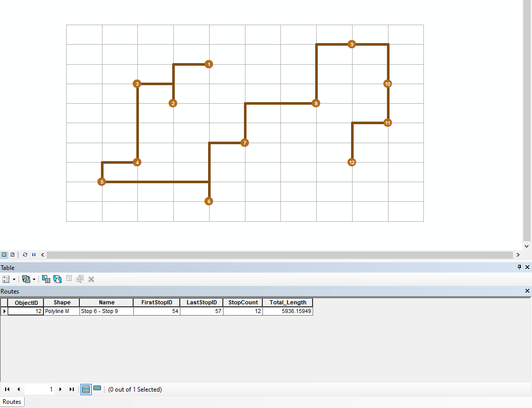
Here is a result with U-Turns in ArcMap. It's not the solution for the question.
- Mark as New
- Bookmark
- Subscribe
- Mute
- Subscribe to RSS Feed
- Permalink
1 2 3 4 6 7 5 9 11 8 10 12 11
There is an easy if not a little complex way. you can generate a near analysis on each point to find the point that is closest to it. start off by drawing lines between a point and its closest neighbor
9 would go to 11
12 to 11
10 to 12 and in this case 8 might go to 9
3 and 4 would partner up but instead go to 6
- Mark as New
- Bookmark
- Subscribe
- Mute
- Subscribe to RSS Feed
- Permalink
Hi Robert,
It could be work for regular network, however the nearest stop might not be the closet stop in a network.
And it not avoid U-Turn.
Thanks,
Leo
- Mark as New
- Bookmark
- Subscribe
- Mute
- Subscribe to RSS Feed
- Permalink
Then you would need to include roads in with your diagram and question.
- Mark as New
- Bookmark
- Subscribe
- Mute
- Subscribe to RSS Feed
- Permalink
I once did something similar for my mother in law when she wanted to visit all the assisted living facilities in my town.
however, I simply put the addresses into Google Maps and kept sliding stops up and down until I got the shortest route.