- Home
- :
- All Communities
- :
- Products
- :
- ArcGIS Network Analyst
- :
- ArcGIS Network Analyst Questions
- :
- Closest Facility - Incorrect Facilities, Wrong Rou...
- Subscribe to RSS Feed
- Mark Topic as New
- Mark Topic as Read
- Float this Topic for Current User
- Bookmark
- Subscribe
- Mute
- Printer Friendly Page
Closest Facility - Incorrect Facilities, Wrong Routes
- Mark as New
- Bookmark
- Subscribe
- Mute
- Subscribe to RSS Feed
- Permalink
Hi there,
I'm trying to find the three closest facilities, but I encounter two problems:
- It doesn't always select the closest facilities.
- Sometimes, the solved route is incorrect or cut off early.
There are two files I use - one Network Dataset layer (converted from lines), and one Points shapefile (which I load as facility locations). Both are incredibly simple layers with very little extra data.
This is an ideal scenario:
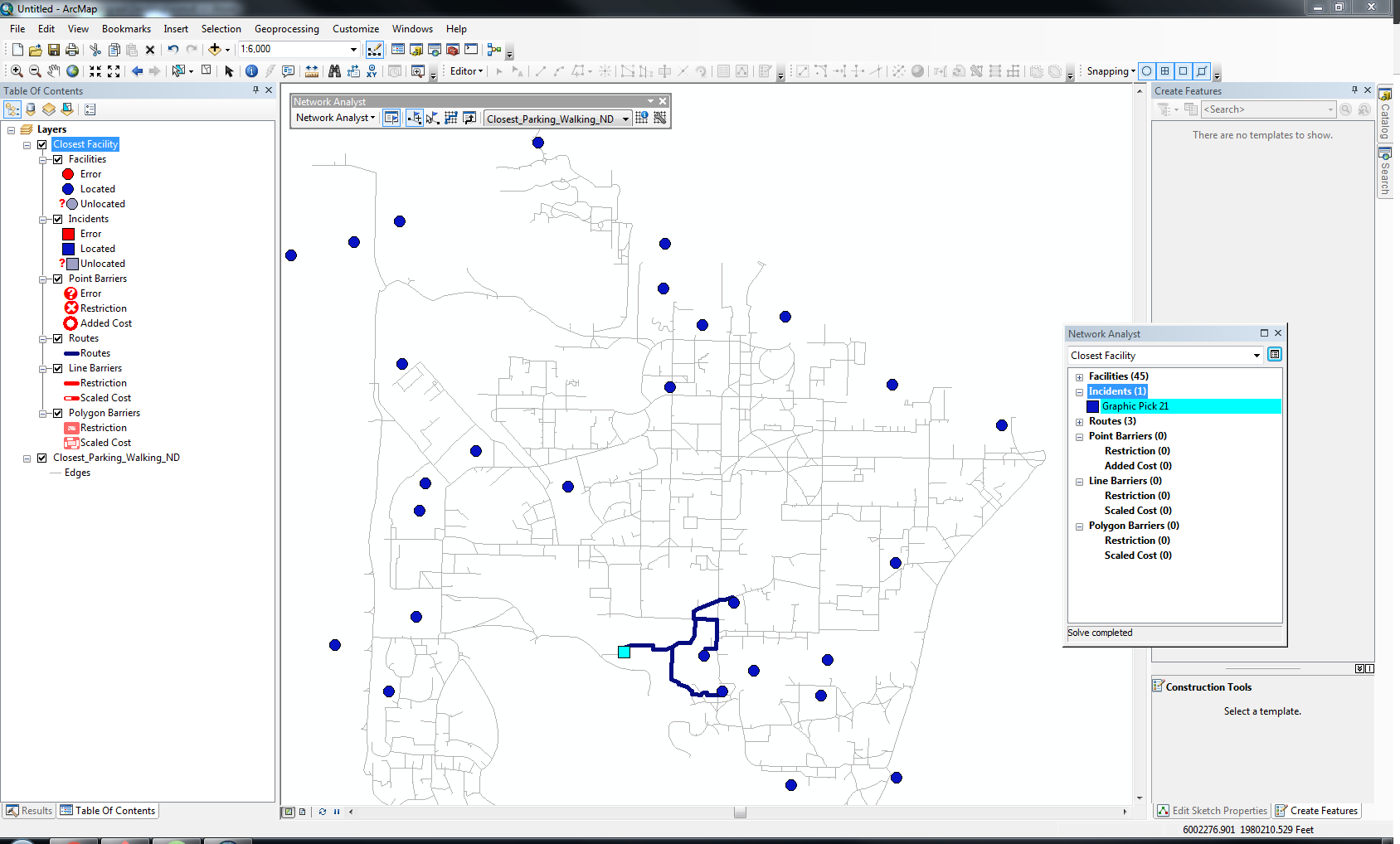
The three closest facilities are returned, with correctly-drawn routes.
This is a slightly less ideal scenario:
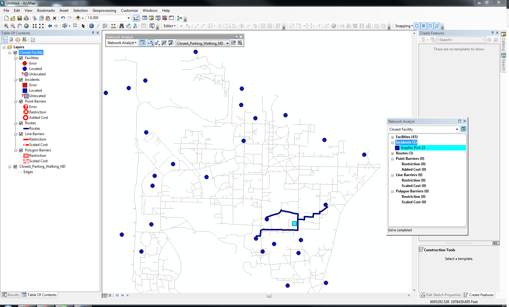
The routes are correctly-drawn, but you can tell that it did not select the three closest facilities.
This is the worst case scenario (most common):
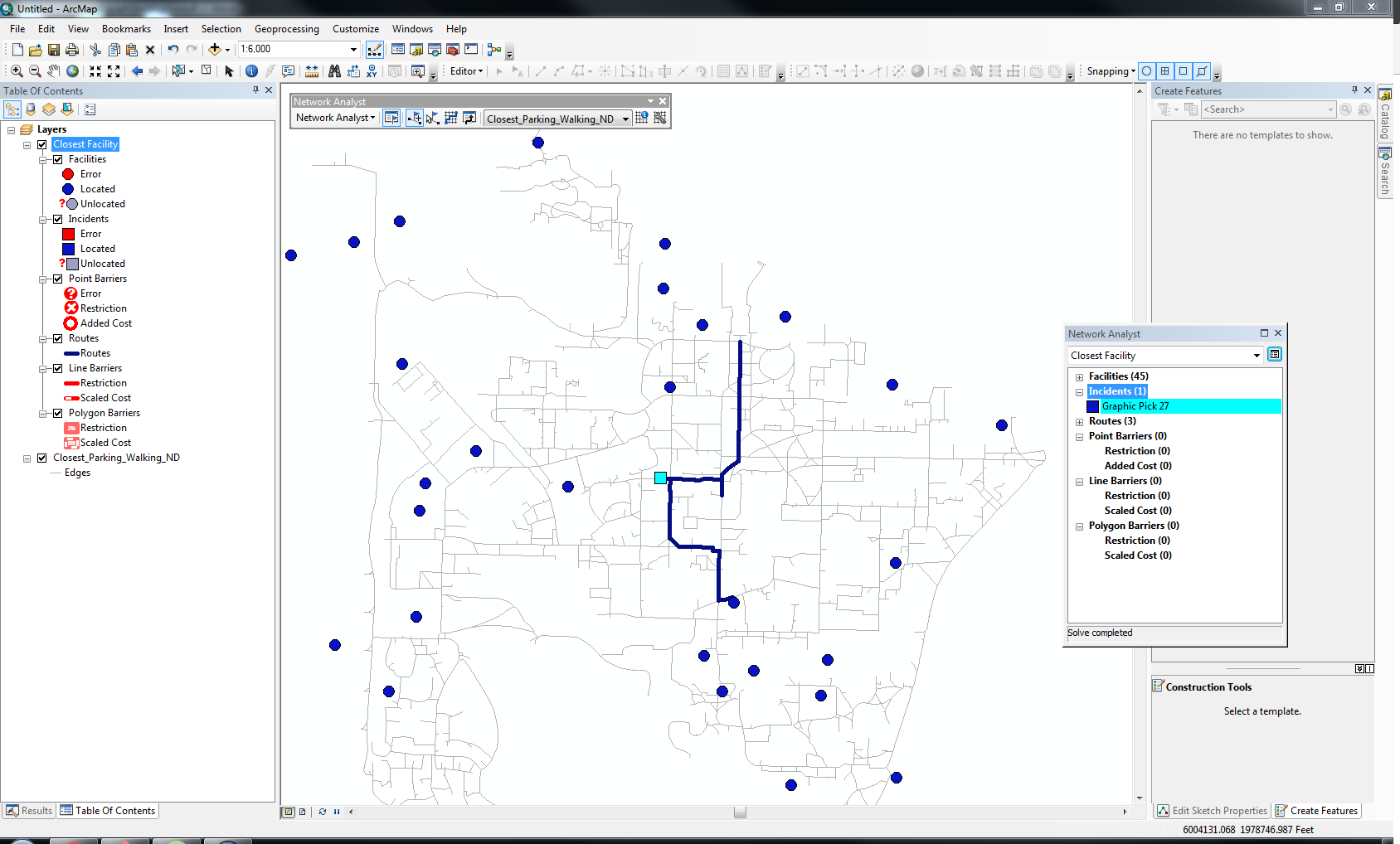
The facilities selected are not the closest, and the routes are cut off early (usually once it hits the facility's y-axis).
This is the same worst case scenario, with drawn with straight lines:
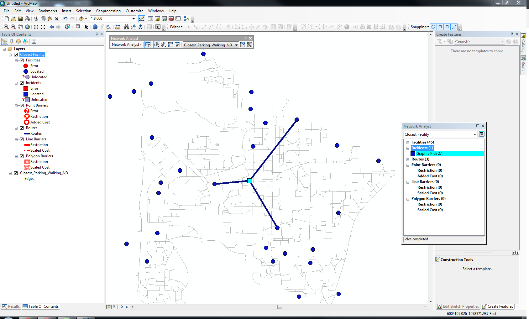
This is to show which facilities it was attempting to route to.
I apologize if this is an extremely simplistic question and/or it is asked very frequently.
I am a computer scientist who does not have a lot of experience with ArcGIS, so I would greatly appreciate any help there is to offer!
I have a couple points to note before anybody suggests anything:
- I am fairly certain the problem does not lie with my Network Dataset, as I have used the exact same layer to solve Routing problems and have not encountered any problems with it (the lines should be correctly joined).
- I used all default settings for Closest Facility, except for number of facilities to find (changed to 3).
- I am using ArcMap 10.3 on a Windows machine.
Thanks in advance.
Ben
- Mark as New
- Bookmark
- Subscribe
- Mute
- Subscribe to RSS Feed
- Permalink
The construction of the network may have included one-way limitations, speed limit differences, obstructions and a variety of other factors. The visual selection of the 'closest' can markedly vary from the actual given these constraints. So without knowing the details, you will have to revisit your solutions. I might add, that if the construction of the network didn't verify the connectivity of the edges, then even the smallest gap along what looks like a continuous road segment is in effect, a show stopper.