- Home
- :
- All Communities
- :
- Products
- :
- Mapping and Charting Solutions
- :
- Mapping and Charting Questions
- :
- Re: World Map
- Subscribe to RSS Feed
- Mark Topic as New
- Mark Topic as Read
- Float this Topic for Current User
- Bookmark
- Subscribe
- Mute
- Printer Friendly Page
- Mark as New
- Bookmark
- Subscribe
- Mute
- Subscribe to RSS Feed
- Permalink
Hi there, I've been using ArcMap for a few years but I'm trying now to do my first world map.
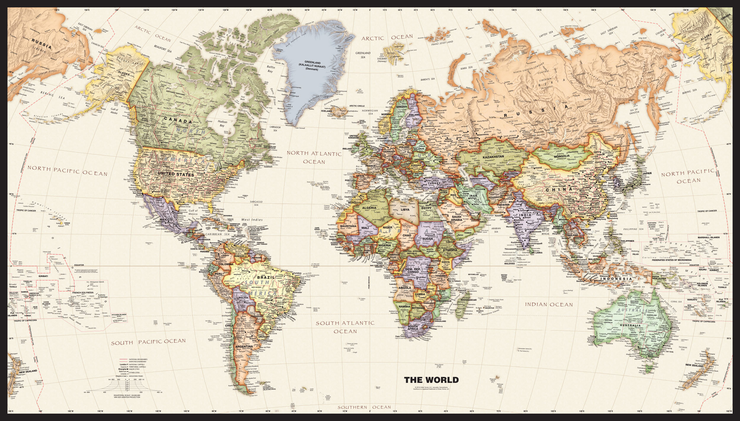
I really like the look of the Van Der Grinten projection but I want it to wrap around the international date line so that I end up with a more rectangular map if that makes any sense. I've attached a sample of the kind of map I want to emulate.
Does anyone know how I can achieve that wrapped effect?
Thanks very much in advance!
Solved! Go to Solution.
Accepted Solutions
- Mark as New
- Bookmark
- Subscribe
- Mute
- Subscribe to RSS Feed
- Permalink
There's been a few threads over on CartoTalk. One had no answers. The other mentioned ProMapper and Manifold.
I'm sure it's come up here or on the previous Esri forums, but ArcGIS is not set up to extend beyond 360 degrees.
Melita
- Mark as New
- Bookmark
- Subscribe
- Mute
- Subscribe to RSS Feed
- Permalink
have you set the projection of the data frame to what you want? perhaps you are just viewing the data in its unprojected form
Specifying a coordinate system—Help | ArcGIS for Desktop
or am I missing something?
- Mark as New
- Bookmark
- Subscribe
- Mute
- Subscribe to RSS Feed
- Permalink
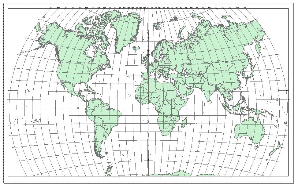
I could be doing something wrong, that's not out of the question at all. I've got the coordinate system set to Van Der Grinten and it's showing the world. I just want to know how to make it show more on each side like the map I attached in my post. The image below is what I have in ArcMap now.
- Mark as New
- Bookmark
- Subscribe
- Mute
- Subscribe to RSS Feed
- Permalink
ahhh the old change in the coordinate reference from -180 to 180 to 0 to 360
What happens to features at +/-180 (dateline)?—Help | ArcGIS for Desktop
now I just have to find it
List of supported map projections—Help | ArcGIS for Desktop
but perhaps you can modify the false easting/central meridian to -180 degrees longitude
Van der Grinten I—Help | ArcGIS for Desktop
I am not on an Arc* machine. I will flag Melita Kennedy she will probably know off the top of her head
- Mark as New
- Bookmark
- Subscribe
- Mute
- Subscribe to RSS Feed
- Permalink
Dan, look to Deanna Gibson picture look to Alaska it is in the right and in the left , she want to continue viewing in both sides.
- Mark as New
- Bookmark
- Subscribe
- Mute
- Subscribe to RSS Feed
- Permalink
I don't know if Arc Map can do this or not.
But it is good question and I am looking forward to know the answer.
- Mark as New
- Bookmark
- Subscribe
- Mute
- Subscribe to RSS Feed
- Permalink
No, ArcMap can't do that type of wrapped effect. You might be able to do something similar with separate data frames, but it would be difficult with van der Grinten because we usually don't allow data to go outside the projection's "horizon"--its valid area of use. Part of that includes not having the same point map/convert to two different places!
Melita
- Mark as New
- Bookmark
- Subscribe
- Mute
- Subscribe to RSS Feed
- Permalink
Thank you for getting back to me on this, Melita. Do you know of any software that might do this?
Thanks again!
Deanna
- Mark as New
- Bookmark
- Subscribe
- Mute
- Subscribe to RSS Feed
- Permalink
There's been a few threads over on CartoTalk. One had no answers. The other mentioned ProMapper and Manifold.
I'm sure it's come up here or on the previous Esri forums, but ArcGIS is not set up to extend beyond 360 degrees.
Melita
- Mark as New
- Bookmark
- Subscribe
- Mute
- Subscribe to RSS Feed
- Permalink
Thanks again, Melita.