- Home
- :
- All Communities
- :
- Products
- :
- Mapping and Charting Solutions
- :
- Mapping and Charting Questions
- :
- Re: Problem with ArcMap
- Subscribe to RSS Feed
- Mark Topic as New
- Mark Topic as Read
- Float this Topic for Current User
- Bookmark
- Subscribe
- Mute
- Printer Friendly Page
Problem with ArcMap
- Mark as New
- Bookmark
- Subscribe
- Mute
- Subscribe to RSS Feed
- Permalink
Hey everyone,
I am working on a project with ArcMap. I am trying to join a feature class with points that I have the coordinates of with a grid layer that has the temperature data for each single pixel in the grid. I want to join these two layers sothat I can get the temperature data of each point.
But when I select the layer with the points and then try to join something by location the grid with the temperature data does not appear in the list where you choose what you want to join with the layer you selected before. Why can't I select it? How can i fix this? Or is there another way to do it?
Hopefully someone can help me.
Thanks yet
Wayne
I
- Mark as New
- Bookmark
- Subscribe
- Mute
- Subscribe to RSS Feed
- Permalink
I believe you would like to extract the temperature information from the raster and assign to points in a feature class. Please try using "Extract values to points" tool. This tool will help to add the temperature information for each point in its attribute table.
- Mark as New
- Bookmark
- Subscribe
- Mute
- Subscribe to RSS Feed
- Permalink
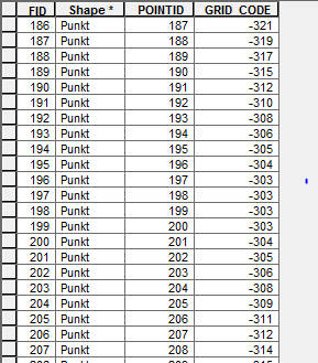
Hey, thanks for your quick reply. It might work. This is the attribute table that i now get. It is quite big and ArcMap crashes all the time when I try to join by loctaion it with my points .
I've heared that another possibility is to overlay the ponits(coordinates) as vectors adn then use "Feature to 3d"?
What do you think?
- Mark as New
- Bookmark
- Subscribe
- Mute
- Subscribe to RSS Feed
- Permalink
From Kishor Ghatage's solution, you should be able to get the temperature values of the grid on the points (new feature class). Why do you need to join by location, at all?
Think Location
- Mark as New
- Bookmark
- Subscribe
- Mute
- Subscribe to RSS Feed
- Permalink
The attribute table I've got after the conversion has about 9 million points but I only want the values of 1000 specific points (which I have the coordinates of). So I would have joined the values of the new feature class with the layer that includes the points. And in the end I should have a table with the coordinates of the point and the value of the temperature there.
Do you have a better idea?
Joining the two files by location takes VERRY LONG (2 hours)! and I need to do this with about 50 files...
- Mark as New
- Bookmark
- Subscribe
- Mute
- Subscribe to RSS Feed
- Permalink
You could create a point feature class out of the XY table of the 1000 points using Make XY Event layer and exporting it to shapefile/geodatabase feature class (while exporting, you could import the coordinate system of the GRID data, if different).
Use this feature class as Ïnput Point Feature" in Extract Values by points.
Think Location
- Mark as New
- Bookmark
- Subscribe
- Mute
- Subscribe to RSS Feed
- Permalink
Perfect solution!
Thank you so much for your quick and friendly help! It worked perfectly... I looked trhough all the tools yesterday but didn't see it! 
Wayne