- Home
- :
- All Communities
- :
- Products
- :
- Mapping and Charting Solutions
- :
- Mapping and Charting Questions
- :
- Need to create world map without dateline problem
- Subscribe to RSS Feed
- Mark Topic as New
- Mark Topic as Read
- Float this Topic for Current User
- Bookmark
- Subscribe
- Mute
- Printer Friendly Page
Need to create world map without dateline problem
- Mark as New
- Bookmark
- Subscribe
- Mute
- Subscribe to RSS Feed
- Permalink
Hi there,
I am creating a world map. Sounds simple, but I am having trouble with the international dateline. I want to show the world with North America on the left and Asia on the right. However, I would also like the Chukchi Peninsula to remain and appear on the far right rather than having a small chunk of it floating near Alaska.
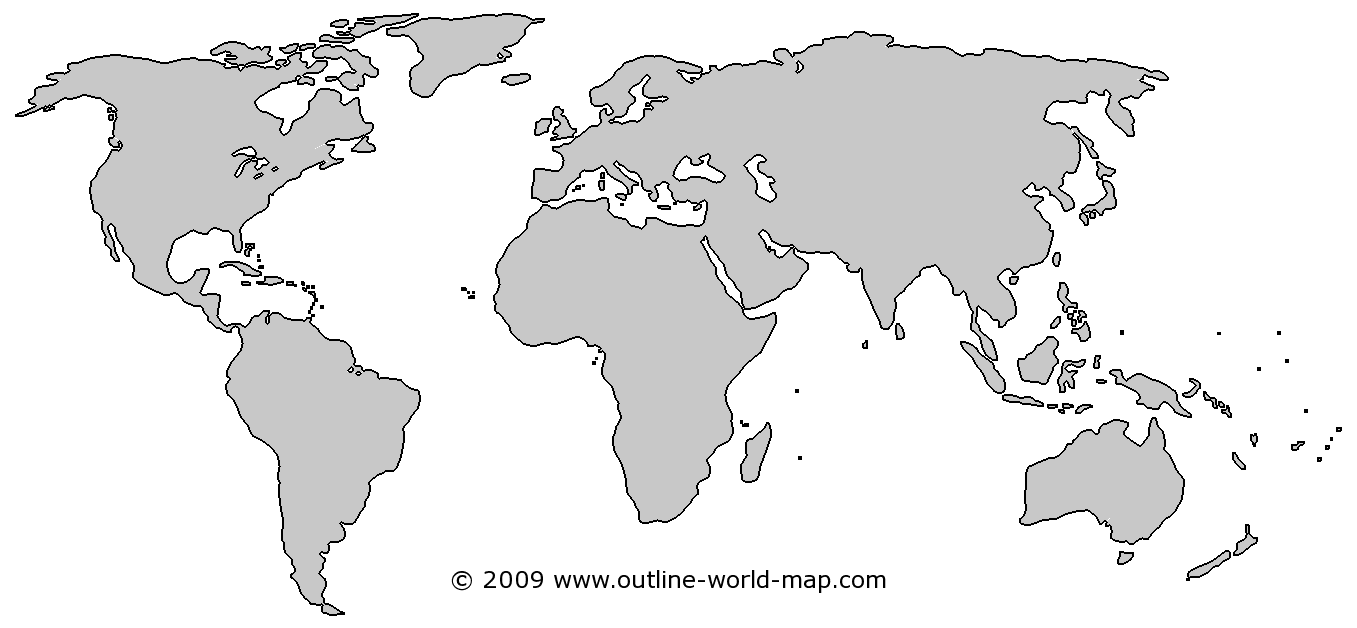
Something like this:
http://www.outline-world-map.com/map-images-original/outline-gray-white-blank-world-map-b9b.png
I understand that the Plate Carree projection is preferred. I am not looking for a pacific centered map.I have not had much luck. Any ideas?
Thank you,
Andrew
- Mark as New
- Bookmark
- Subscribe
- Mute
- Subscribe to RSS Feed
- Permalink
The central meridian on that picture looks like it's around 10E which does allow the Chukchi peninsula to stay connected to the rest of Asia.
What do you want to do with the map? Plate Carree is simple and rectangular, but it doesn't preserve any properties. You might look at Goode's Homolosine (land-based option still preserve Chuckchi too) or Mollweide, or Robinson.
Melita
- Mark as New
- Bookmark
- Subscribe
- Mute
- Subscribe to RSS Feed
- Permalink
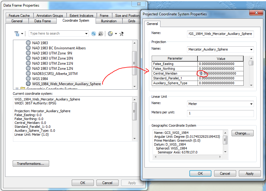
Just to expand on Melita Kennedy's comment, you can shift the CRS over by changing the central meridian parameter and saving as a custom projection, in the Data Frame Properties.
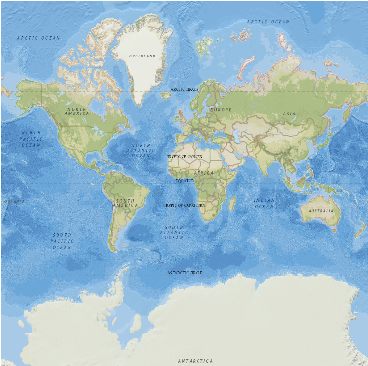
Original (using Web Mercator, but you can change any CRS):
Change CRS in Data Frame Properties:
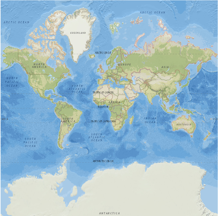
Final:
- Mark as New
- Bookmark
- Subscribe
- Mute
- Subscribe to RSS Feed
- Permalink
This is what I was going to reply with, but I tried it in just WGS84 and it didn't change like I expected. I guess it has to be projected.
- Mark as New
- Bookmark
- Subscribe
- Mute
- Subscribe to RSS Feed
- Permalink
If you want to do it in WGS84 aka with the data frame set to a geographic coordinate system, you have two choices:
- Use a projected coordinate system based upon Plate Carree. If you leave the standard parallel to 0, it will look the same as lat/lon values do when displayed in ArcMap.
- Modify the prime meridian's value and change the GCS name. You then have to create a custom geographic/datum transformation. Use the Longitude Rotation method (there are no parameters).
Melita
- Mark as New
- Bookmark
- Subscribe
- Mute
- Subscribe to RSS Feed
- Permalink
Thank you all! Changing the central meridian was all I needed to do. The map is only for a quick illustration to show global office locations. Nothing fancy. Cheers.