- Home
- :
- All Communities
- :
- Products
- :
- Mapping and Charting Solutions
- :
- Mapping and Charting Questions
- :
- Editing vertices shortcut
- Subscribe to RSS Feed
- Mark Topic as New
- Mark Topic as Read
- Float this Topic for Current User
- Bookmark
- Subscribe
- Mute
- Printer Friendly Page
Editing vertices shortcut
- Mark as New
- Bookmark
- Subscribe
- Mute
- Subscribe to RSS Feed
- Permalink
Hello, I am currently mapping a large orchard from an aerial image, with the aim to have a polygon for every individual row (>16,000). To do this, I have created boundaries for each planted area (excluding headlands and roads between), created a fishnet grid over the top of that, aligned by hand and clipped the fishnet to the boundary polygon. I am currently going through and manually moving each vertex of the original boundary to ensure it is snapped to the fishnet grid, to get an even shape. this is where I am starting to struggle, as I have to zoom all the way in to move the vertex accurately, but for one polygon i'm zooming in and out using the mouse hundreds of times.
Question: Is there a way, once zoomed in, to skip to the next point in the polygon using a keyboard shortcut or something similarly simple?
Thanks for reading.
Cheers
- Mark as New
- Bookmark
- Subscribe
- Mute
- Subscribe to RSS Feed
- Permalink
Maybe this will work for you:
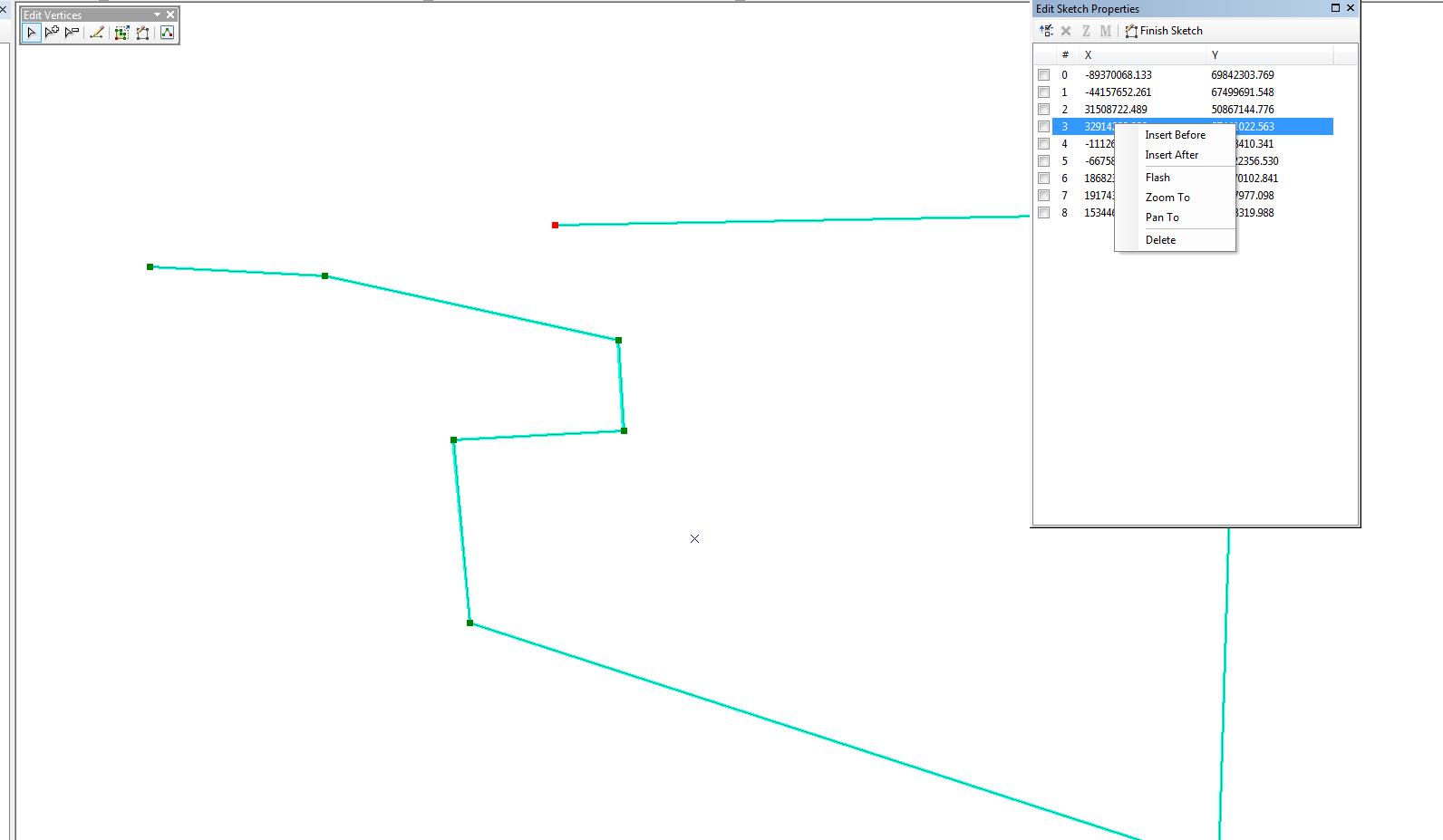
In Arcmap, select your polyon and bring up the Edit Vertices toolbar. Click the Edit Sketch Properties button (far right button on the Edit Vertices toolbar in my screenshot). This will bring up a dialog with a sequential list of vertices for the selected feature. You can right-click on a vertex and there is a Pan To function.

Steve
- Mark as New
- Bookmark
- Subscribe
- Mute
- Subscribe to RSS Feed
- Permalink
Hi Steve,
Thankyou for the suggestion. I've given it a go over the last 2 days on and off, but because I use the mouse to edit each point, it ended up being the same thing but a different movement (zoom in/out or move the mouse to RC in the table). I really would have thought there'd be more resources for editing online, almost everything I've read simply goes through the basics only.
- Mark as New
- Bookmark
- Subscribe
- Mute
- Subscribe to RSS Feed
- Permalink
You might create a viewer window and then use that to shift from point to point. It's not as simple as hitting a key but better than zooming in and out. You could convert your vertices to points, edit the points (which would allow you to open the table and move to points through it) and then convert them back to lines but that seems like a lot of work too. You couldn't automate a lot of this with the Snap tool?