- Home
- :
- All Communities
- :
- Products
- :
- Mapping and Charting Solutions
- :
- Mapping and Charting Questions
- :
- Create points with Z, intersecting one 2D line and...
- Subscribe to RSS Feed
- Mark Topic as New
- Mark Topic as Read
- Float this Topic for Current User
- Bookmark
- Subscribe
- Mute
- Printer Friendly Page
Create points with Z, intersecting one 2D line and one 3D line
- Mark as New
- Bookmark
- Subscribe
- Mute
- Subscribe to RSS Feed
- Permalink
Hi everybody
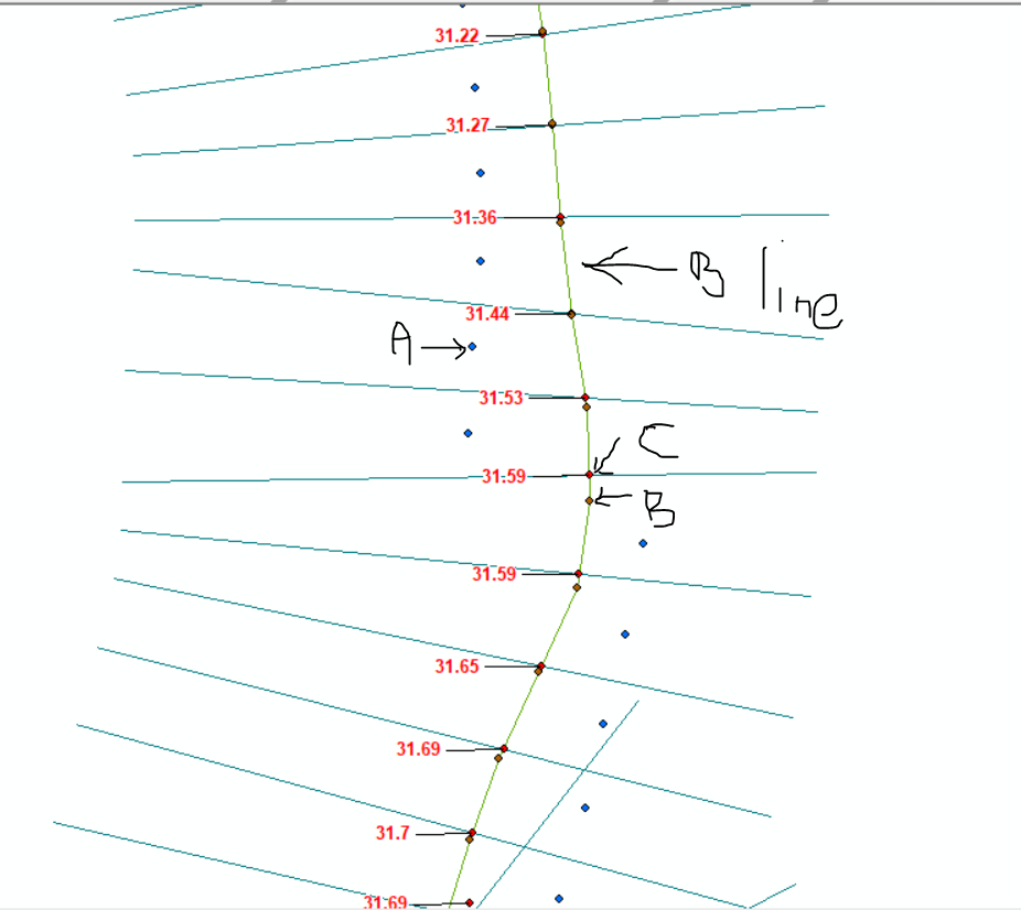
I have two layers of points (in a shape of a line) more or less parallel and more or less each 5m, Those points have a Z field,
I would like to create ortholines exactly between two points of the layer A. those ortholines will intersect a line created thanks to the point of the layer B, that means a Zline.
What I would like is to create automatically points with Z by intersecting this Z line and the ortholines. I have arround 9000 pts to create with this.

the B should be create with the B points, and I would like to create the C points with elevation by intersecting the ortholines in the midlle of the A points
- Mark as New
- Bookmark
- Subscribe
- Mute
- Subscribe to RSS Feed
- Permalink
I suppose that this will require some scripting , so I will tag the Python space to give it more visibility. You could move it there, since the GeoNet Help space is only for questions on how to use GeoNet.
If possible, I would recommend you to include some sample data that corresponds to the image you included to make it easier to understand and provide a solution.
- Mark as New
- Bookmark
- Subscribe
- Mute
- Subscribe to RSS Feed
- Permalink
i see that this question was marked as "assumed answered", but I'm pretty sure it isn't.
- Mark as New
- Bookmark
- Subscribe
- Mute
- Subscribe to RSS Feed
- Permalink
Yes, my mistake, 'm quite New on the forum 😕
- Mark as New
- Bookmark
- Subscribe
- Mute
- Subscribe to RSS Feed
- Permalink
So, any chance on sharing some sample data?