Hi,
I see that you can display a layer and field selector in the configuration panel. I was wondering how can you display tables that are added to the webmap as a list that users can choose from?
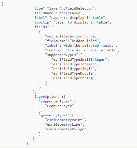
If you look at the graphic below, it has an example of supportedTypes: FeatureLayer, in LayerOptions
I got this snap from Add configurable parameters to templates—ArcGIS Online Help | ArcGIS
What's the key to use a table? What are the other supported types? Is there a list of supportedTypes values available somewhere?
regards
Anand