- Home
- :
- All Communities
- :
- Products
- :
- ArcGIS Image Analyst
- :
- ArcGIS Image Analyst Questions
- :
- Importing Pix4D Multispectral Reflectance Maps
- Subscribe to RSS Feed
- Mark Topic as New
- Mark Topic as Read
- Float this Topic for Current User
- Bookmark
- Subscribe
- Mute
- Printer Friendly Page
Importing Pix4D Multispectral Reflectance Maps
- Mark as New
- Bookmark
- Subscribe
- Mute
- Subscribe to RSS Feed
- Permalink
- Report Inappropriate Content
I was wondering if anyone has experience with importing multispectral reflectance maps from Pix4D into ArcMap 10.5. I seem to be having an issue with the individual bands once the reflectance maps are in ArcMap. When I import the individual reflectance maps (Blue, Green, Red, NIR, RE) it shows each of the .tif files having 2 bands associated with them. When I composite all five bands, the result is very bright colors and not the usual RGB or NIR look. When I look at the bands within the composite file there are multiple bands shown as only 1 & 2. My goal is to export the individual reflectance maps from Pix4D and make my own composite in ArcMap instead of having Micasense Atlas make the composite. I have seen a few videos of people performing this task and it seems to work fine and all appropriate bands are associated with the respected reflectance maps once imported into ArcMap or QGIS. Any help would be great, I have attached some images for reference.
- Mark as New
- Bookmark
- Subscribe
- Mute
- Subscribe to RSS Feed
- Permalink
- Report Inappropriate Content
They're using an open source image software library that adds an extra band to each image, usually with a NoData mask with each pixel written as 0 or 255. Notice band 6 in your first screenshot - that's the extra band. In what should be single band images you get 2 bands. just ignore band 2 in all of the single band reflectance images.
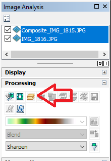
You can use the image analysis window and "Composite Bands" function to combine 5 single band images into a 5 band output. Make sure your 5 input bands are in the correct order in the table of contents.
