- Home
- :
- All Communities
- :
- Products
- :
- ArcGIS Hub
- :
- ArcGIS Hub Questions
- :
- Re: Improvements people would like for Open Data
- Subscribe to RSS Feed
- Mark Topic as New
- Mark Topic as Read
- Float this Topic for Current User
- Bookmark
- Subscribe
- Mute
- Printer Friendly Page
Improvements people would like for Open Data
- Mark as New
- Bookmark
- Subscribe
- Mute
- Subscribe to RSS Feed
- Permalink
I thought I'd start a discussion about the improvements people would like for Open Data.
Two of my bigger issues were ticked off recently with the introduction of domain support and local projection for shapefile downloads, so thanks for that!
Here are two other things I'd quite like to see happen
1. Instead of filtering by the map view, I think it would be easier for users to draw an extent on the map of an area they are interested in. Could be a simple as a rectangle extent. For a good example of this, see here
2. I would like the "Updated" date to change when the underlying data is changed, not when the ArcGIS Online settings for that layer are updated. For example, the data in this layer is updated weekly, yet the "Updated" date says 3 months ago. This can be very misleading for users.
If anyone else has ideas for improvement, feel free to add them.
- Mark as New
- Bookmark
- Subscribe
- Mute
- Subscribe to RSS Feed
- Permalink
I presented my agency's Open Data site (geodata.myfwc.com) to all of the State of Florida Agency GIS Heads and one of their main requests was the select vector data by user drawn polygon. In particular, many of Florida's agency's have to query permit locations, water sampling wells, emergency facilities, etc. within a certain proximity of an event.
- Mark as New
- Bookmark
- Subscribe
- Mute
- Subscribe to RSS Feed
- Permalink
Thanks for the feedback, Christopher. We have this task on our backlog - good to know people are actively asking for it!
- Mark as New
- Bookmark
- Subscribe
- Mute
- Subscribe to RSS Feed
- Permalink
I'd like to see improvement in ArcGIS Online and Open Data providing full support for and integration with the geodatabase structure. That would be sweet  .
.
There are a lot of variations at present on which geodatabase data types can be ingested into ArcGIS Online, then fully used by ArcGIS Online apps, app templates, app builders, app studios, and Open Data capabilities.
Deficiencies I have experienced and investigated recently are:
- Subtypes and domains
- Many-to-many relationship classes
- Metadata
My story:
As a data manager for an organization with open data sharing obligations, I need to upload our geodatabase structure to ArcGIS Online and share it via Open Data in a way that respects and fully utilizes the on-premise source geodatabase structure so that I can meet our obligation to share our data with a minimum of effort, thus allowing me to focus more time and effort on core business activities.
Two recent experiences, not going into detail or completeness here:
- upload fGDB to AGO, specify to publish a feature service. The feature service is published, but an awful lot of fGDB parts are stripped out. Download the the fGDB and discover that the parts really are gone. It's not just that the service ignored the parts. It appears that the parts aren't there.
- publish geodatabase-sourced layer from ArcMap or ArcGIS Pro 1.1 to AGO, specify feature service. ArcMap 10.3.1 is the only version that gets subtypes and domains right in the resulting service. cool. However, now the default map viewer table tool and Open Data don't understand the subtypes and domains. Interestingly, the default map viewer popup gets it and presents results properly.
- I've noticed some mis-representation around values stored in date fields when using hosted feature services as a source. I have not investigated, but my immediate suspicions point toward the possibility that some SQL Server queries might be experiencing the time data rounding issue.
- Mark as New
- Bookmark
- Subscribe
- Mute
- Subscribe to RSS Feed
- Permalink
I like the ability in the Site Manager to create many sites. It's useful for working out different configuration options. But, when I get a baseline configuration I want to expand on, there seems to be no way to make copy of it or import it when creating a new site, so I am recommending the ability to copy and/or import sites.
- Mark as New
- Bookmark
- Subscribe
- Mute
- Subscribe to RSS Feed
- Permalink
Hi this is Rami from WHO,
I also have some points to add concerning theOpen Data Site, and they are as the follow:
1 Requesting
ability be considered to allow the scroll button on the mouse to additionally
control zooming.
2 Requesting
ability be considered to allow for the definition of custom zoom levels.
3 Requesting
ability be considered to allow for transparency to be set when multiple datasets
are available in one vicinity to make the outlines easier to view.
- Mark as New
- Bookmark
- Subscribe
- Mute
- Subscribe to RSS Feed
- Permalink
We are planning on using our local ArcGIS Server services on the OpenData site. I have a few test services working. However, when we do maintenance or shutdown a service, the Tables and Chart tabs show an error.
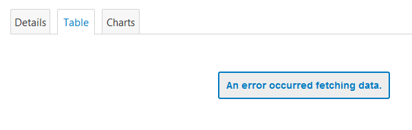
Not very informative to a user. It would be nice is OpenData could recognize when a service/URL is not available, and place text "currently not available" or some kind of symbol like a
![]() symbol over the item on the gallery page....or at least have the error message say "Service is currently offline".
symbol over the item on the gallery page....or at least have the error message say "Service is currently offline".
Is this something that can be considered in the future? Is there anyway to at leat customize the error message for items that are from services?
- Mark as New
- Bookmark
- Subscribe
- Mute
- Subscribe to RSS Feed
- Permalink
Something I have been thinking about lately that would be handy would be the ability to set custom URLs for datasets.
So instead of a link like this
http://data.marlborough.opendata.arcgis.com/datasets/05f33314475b495fa2eba9555baf317b_4
It would be cool if I could manually set it to something like this in the admin.
http://data.marlborough.opendata.arcgis.com/datasets/busroutes
This would make URLs more meaningful if sent as a link and embedded links from other webpages easier to maintain.
- Mark as New
- Bookmark
- Subscribe
- Mute
- Subscribe to RSS Feed
- Permalink
Can we talk about the charting features? They are really elementary. I'd like to be able to at least chart multiple variables from the attribute table - and be able to say which goes on which access. I admit I'm still learning my way around the features, so someone tell me if this option exists. But really all I see is you select only one attribute and the charting tool will create its own axis and chart just that one feature.
more control over what to chart would be huge for my users.
- Mark as New
- Bookmark
- Subscribe
- Mute
- Subscribe to RSS Feed
- Permalink
I'd like to echo a couple of the requests made initially:
1. The ability to export via a user defined polygon
2. Ability to download a FGDB
Functionality that I don't believe exists yet, but would be very helpful would be the ability to send URL parameters to our open data site to specify certain things like:
1. The layer by name
2. The extent to filter from
3. Queries for filtering
4. File format to download
5. etc.
This would be helpful for some organizations that use ArcGIS Online or any other web platform for mapping, the ability to provide a link to the end user to download a particular layer they may be interacting with in another application. For instance, they may be mapping parcels in a particular town. If a user identifies, or queries this in another application, it would be nice to provide the user with a link to our open data site that would select parcels, zoom to the same extent, and start downloading the data in a new window.
This could also simply function as a service to extract this information from an endpoint the Open Data publishes when your site is created/managed.
- Mark as New
- Bookmark
- Subscribe
- Mute
- Subscribe to RSS Feed
- Permalink
Can we revive this discussion? there are still some things in here that would greatly improve Open Data that haven't been done yet. My top few:
1. ability to filter a dataset using a polygon rather than that wide basemap
2. ability to copy an existing Open data site (I would like to be able to do my edits in the non-production site)
3. ability to enable File geodb download without hosting the feature service on AGOL
4. ability to zoom in on the basemap using the mouse scroll button (not just +- buttons)
5 ability to have the exports use the field alias rather that the field name (to help mitigate the shapefile field truncation issue)
- « Previous
-
- 1
- 2
- Next »
- « Previous
-
- 1
- 2
- Next »