- Home
- :
- All Communities
- :
- Products
- :
- ArcGIS GeoStatistical Analyst
- :
- ArcGIS GeoStatistical Analyst Questions
- :
- Re: Query regarding the trend analysis tool in geo...
- Subscribe to RSS Feed
- Mark Topic as New
- Mark Topic as Read
- Float this Topic for Current User
- Bookmark
- Subscribe
- Mute
- Printer Friendly Page
Query regarding the trend analysis tool in geostatistical analyst
- Mark as New
- Bookmark
- Subscribe
- Mute
- Subscribe to RSS Feed
- Permalink
The trend analysis tool automatically projects the data along the East-West and North-South direction simultaneously showing their trends in the respective directions. Is there any way to project the data on a plane of a different orientation, eg NW to SE?
- Mark as New
- Bookmark
- Subscribe
- Mute
- Subscribe to RSS Feed
- Permalink
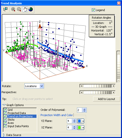
can you demonstrate your question with snapshot?
For example, what do you want to change from the following pic?
- Mark as New
- Bookmark
- Subscribe
- Mute
- Subscribe to RSS Feed
- Permalink
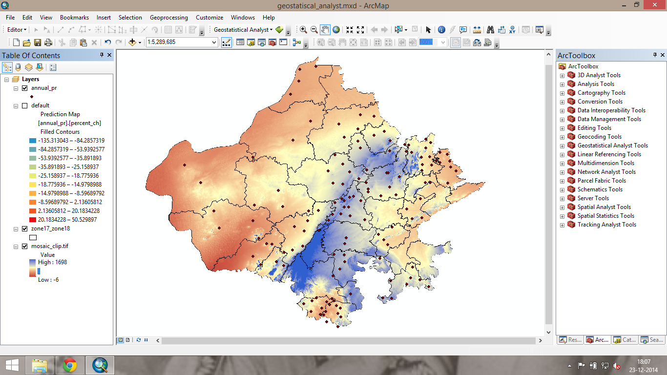
in the above image (the displayed raster is DEM) it can be seen that the DEM has has high value along the center,in a SW to NE direction
the points represent the rainfall stations for the area
I want to project a certain attribute of the rainfall data along an axis perpendicular to the direction to the hills to see the effect of the elevation on this particular attribute
- Mark as New
- Bookmark
- Subscribe
- Mute
- Subscribe to RSS Feed
- Permalink
It makes scenes to me, titas!
Pls try to use ArcScene or ArcGlobe, with your analysis data, and see if it will meet your demands...
- Mark as New
- Bookmark
- Subscribe
- Mute
- Subscribe to RSS Feed
- Permalink
Larry thanks for responding