- Home
- :
- All Communities
- :
- Products
- :
- ArcGIS GeoPlanner
- :
- ArcGIS GeoPlanner Questions
- :
- Re: Own data in landscape modeler
- Subscribe to RSS Feed
- Mark Topic as New
- Mark Topic as Read
- Float this Topic for Current User
- Bookmark
- Subscribe
- Mute
- Printer Friendly Page
Own data in landscape modeler
- Mark as New
- Bookmark
- Subscribe
- Mute
- Subscribe to RSS Feed
- Permalink
Hi everyone!
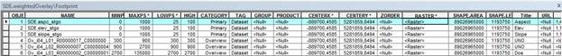
I'm trying to load my own services following the steps of http://resources.arcgis.com/en/help/landscape-modeler/prepare-data/#/Creating_the_mosaic_dataset_for...
But i'm sticking here
I dont know where is the problem.
I'm trying different ways but...the same issue appears
I cant get the same configuration in the function chain.
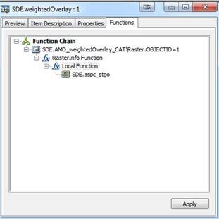
Perhaps my mosaic dataset is wrong...
I'm dont know what else can i do.
Thank you for your time.
- Mark as New
- Bookmark
- Subscribe
- Mute
- Subscribe to RSS Feed
- Permalink
Hi Victor,
Try this (working backwards from the app):
- Open the config.js file for the landscape modeler web app.
- Verify that the variable weightedOverlayServiceUrl points to your hosted mosaic image layer - Browse to the URL referenced by the variable. The URL should be something like this - http://your-arcgis-server/arcgis/rest/services/your-mosaic/ImageServer
- In the REST items details, check for RasterFunction Infos - there should be two listed: (1) WeightedOverlay_7_0_9_histogram; (2) WeightedOverlay_7_1_9_colormap.
- In addition to all the fields in the mosaic, verify that you have all of these:
- Title ( type: esriFieldTypeString , alias: Title , length: 50 )
- Url ( type: esriFieldTypeString , alias: URL , length: 1024 )
- InputRanges ( type: esriFieldTypeString , alias: Input Ranges , length: 256 )
- OutputValues ( type: esriFieldTypeString , alias: Output Values , length: 256 )
- NoDataRanges ( type: esriFieldTypeString , alias: NoData Ranges , length: 256 )
- RangeLabels ( type: esriFieldTypeString , alias: Range Labels , length: 1024 )
- NoDataRangeLabels ( type: esriFieldTypeString , alias: NoData Range Labels , length: 1024
- The field names, aliases, types, and lengths should match exactly. Double check against the doc here.
- Remove the overview images from the mosaic - Either create a new mosaic (and don't create overviews), or delete them. Alternatively, in config.js, you can set the queryParameters object where statement to remove the overviews from processing.
- Since your mosaic is stored in an eGdb, verify that ArcGIS Server can actually access it - just try to view it.
- Make sure you have the ArcGIS Server image extension installed (you probably do).
- Regarding the function chains - they are used to handle no data values in the weighted overlay process. First get your widget to display the correct layer names (from the title field in the mosaic). Then verify that the Range Labels display in the widget (from the RangeLabels field). Once you can do this, then handle no data by either: (1) using the function chains OR; (2) using the Raster Calculator to calc the no data values to another value. If you read the comments in config.js, note the comments around dummyRasterId:
- This should be the OBJECT ID of a raster that is continuous for the entire extent of the service (ie does not have any NoData cells)
- Mark as New
- Bookmark
- Subscribe
- Mute
- Subscribe to RSS Feed
- Permalink
Hi!
Thank you very much for your answer.
I will try this.
- Mark as New
- Bookmark
- Subscribe
- Mute
- Subscribe to RSS Feed
- Permalink
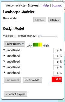
I have new issues...
I get the names of the service
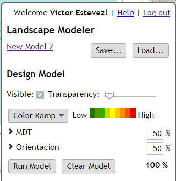
But, if i run the model it doesn't show anything and in the developer mode i get this
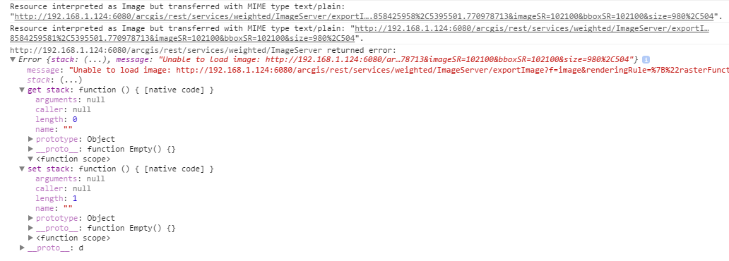
My data has the correct coordinate system and i can load the service in arcgis online
Again, Thank you for your time.
- Mark as New
- Bookmark
- Subscribe
- Mute
- Subscribe to RSS Feed
- Permalink
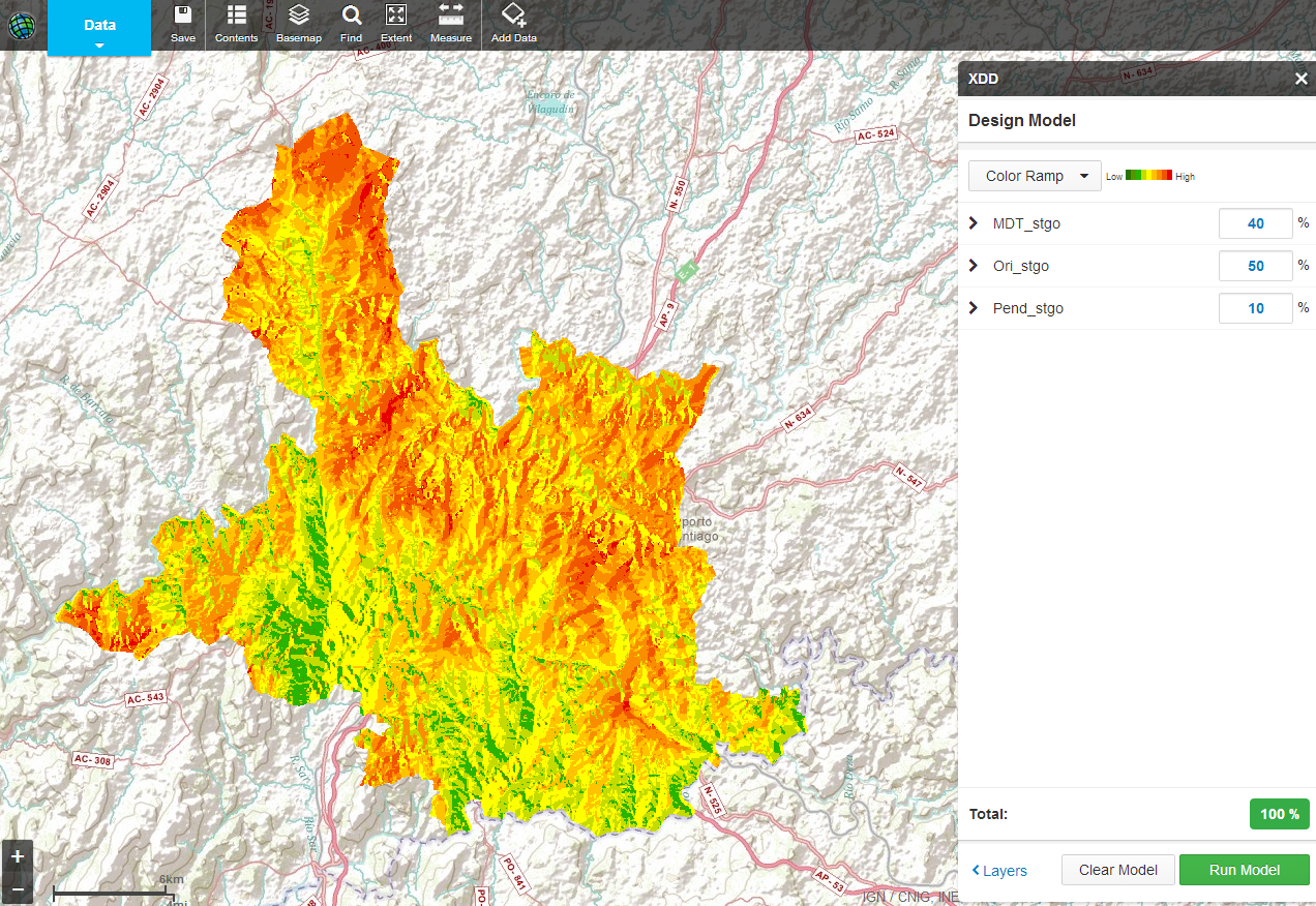
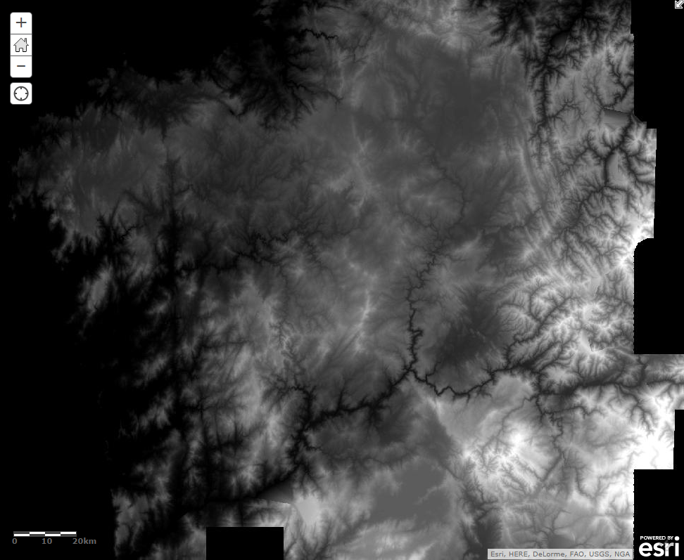
Hi!!
Once Again thank you for your help!
This is the final result