- Home
- :
- All Communities
- :
- Products
- :
- ArcGIS Explorer Online
- :
- ArcGIS Explorer Online Questions
- :
- Re: Shape Files are not displaying properly when u...
- Subscribe to RSS Feed
- Mark Topic as New
- Mark Topic as Read
- Float this Topic for Current User
- Bookmark
- Subscribe
- Mute
- Printer Friendly Page
Shape Files are not displaying properly when uploaded to ArcGIS Online
- Mark as New
- Bookmark
- Subscribe
- Mute
- Subscribe to RSS Feed
- Permalink
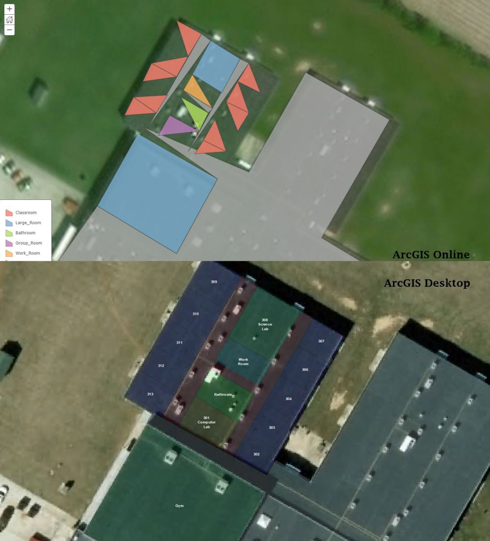
I'm working with a polygon shape file that I'm editing in ArcGIS Desktop. I have one large polygon that is used as a footprint for a building and I'm cutting the polygon trying to separate it to categorize rooms like a blue print. In desktop is shows up fine but when I upload it to ArcGIS Explorer Online it displays my rooms as cut up looking triangle. Does anyone know why it would be doing this? I attached a picture.
Thanks!

Solved! Go to Solution.
Accepted Solutions
- Mark as New
- Bookmark
- Subscribe
- Mute
- Subscribe to RSS Feed
- Permalink
I seemed to have figured out the solution.
I was trying to add a layer to my ArcGIS Explorer Online map of blueprints for schools. Each room in the school was its own polygon with attribute data. When I uploaded the shape file to ArcGIS Explorer online the square polygons were showing up as half squares (triangles) and what I ended up doing was, instead of generalizing the shape file I told it to stay the keep the original features and it displayed correctly.
Hope this helps someone in the future.
Thanks!