- Home
- :
- All Communities
- :
- Products
- :
- ArcGIS Explorer Desktop (Retired)
- :
- ArcGIS Explorer Desktop Questions
- :
- Re: saving details of a grid to apply to other fil...
- Subscribe to RSS Feed
- Mark Topic as New
- Mark Topic as Read
- Float this Topic for Current User
- Bookmark
- Subscribe
- Mute
- Printer Friendly Page
saving details of a grid to apply to other files
- Mark as New
- Bookmark
- Subscribe
- Mute
- Subscribe to RSS Feed
- Permalink
My apologies if this is a super easy question or has been asked before but I cant seem to find it because my ArcMap expertise is severely limited.When we produce maps as figures for publication we set a grid using View->Data Frame Properties->New Grid and chose out of the 3 options - usually "Graticule divides map by Meridians and Parallels as it suits our oceanographic setup. Then we go through all the details like font, line style etc all of which can get tedious if you have many figures and have to repeat this again and again. How can we save a template like file of our setup and apply it to all our other figures in the future? That would save us a ton of time! Thanks a lot!
Helga
Solved! Go to Solution.
- Mark as New
- Bookmark
- Subscribe
- Mute
- Subscribe to RSS Feed
- Permalink
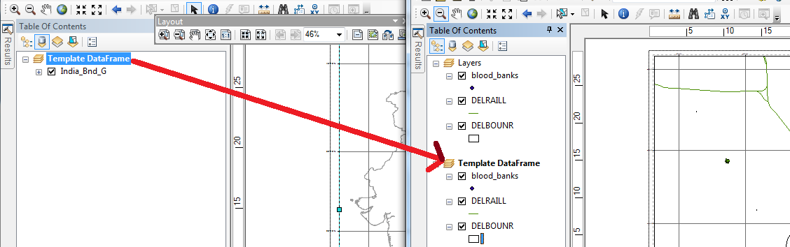
You can Drag-and-Drop the Data Frame from the saved template MXD to your current MXD. If there are existing layers in your current MXD, you can copy-paste the layers from one data frame to other. Then delete the older data-frame from your current MXD.
Think Location
- Mark as New
- Bookmark
- Subscribe
- Mute
- Subscribe to RSS Feed
- Permalink
I hate to be bothering you Jayanta but although i understood what you are doing i cant seem to reproduce it with my data.
I took the MXD file with the grid that I want and as removed all the layers. Then I saved it as MyTemplate in the Templates folder. The grid still remained but unlike what you have shown in the image above I cant see a DataFrame Layer like you have shown in the image. Is it a name you gave? In other words can i see the Data Frame Layer in my MXD file because right now I cannot see any such layer. Thanks a million!
- Mark as New
- Bookmark
- Subscribe
- Mute
- Subscribe to RSS Feed
- Permalink
It would have been more helpful if you could have attached screenshots of your MXDs/ Table of Content.
Every MXD will have at-least 1 Data Frame. By default, the name of the Data Frame is "Layers". I had just renamed my Data Frame to "Template Data Frame".
Using data frames—Help | ArcGIS for Desktop
Think Location
- Mark as New
- Bookmark
- Subscribe
- Mute
- Subscribe to RSS Feed
- Permalink
Hi Jayanta,
Thanks a lot for all your help! I actually worked very well!
Helga
- Mark as New
- Bookmark
- Subscribe
- Mute
- Subscribe to RSS Feed
- Permalink
Glad I could help!!!
Think Location
- Mark as New
- Bookmark
- Subscribe
- Mute
- Subscribe to RSS Feed
- Permalink
Hi Jayanta,
I went to back to this problem which i thought I had solved but the template that I made which I made does not have any geolocation. Its just a frame that sits on my new mxd figures no matter where the actual latitude or longitude is. Is there any way that I can save the geolocation? Thanks a lot.
Helga
- Mark as New
- Bookmark
- Subscribe
- Mute
- Subscribe to RSS Feed
- Permalink
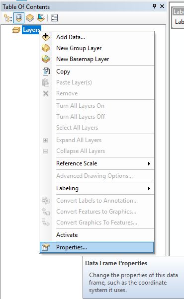
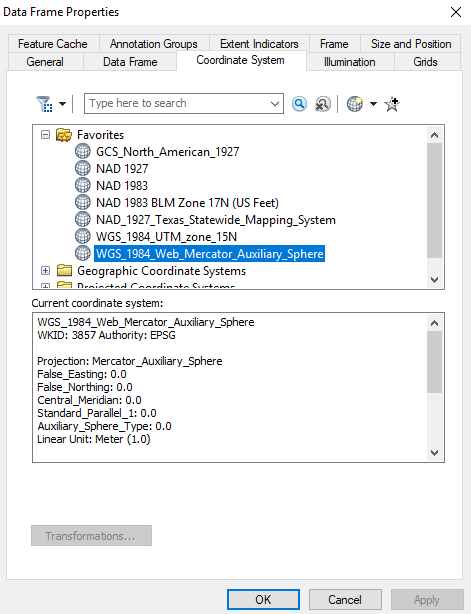
Ensure that your Data-frame has a coordinate system (Data-frame Properties > Coordinate System). Then save the template as suggested above.
If you are referring to the grids and graticules that you are not able to see, then click on layout view to see the grids. Grids will be visible only in layout view.
Displaying maps in data view and layout view—Help | ArcGIS for Desktop
Think Location
- Mark as New
- Bookmark
- Subscribe
- Mute
- Subscribe to RSS Feed
- Permalink
Hi Jayanta,
Thank you very much for your response. My template now has a geo reference but it still doesnt fall into place when i overlay it on other mxd files. I made a grid on my mxd file and then dragged and dropped the template on it like you suggested. Attached is a figure of how it
is mismatched. I wonder where i am going wrong. 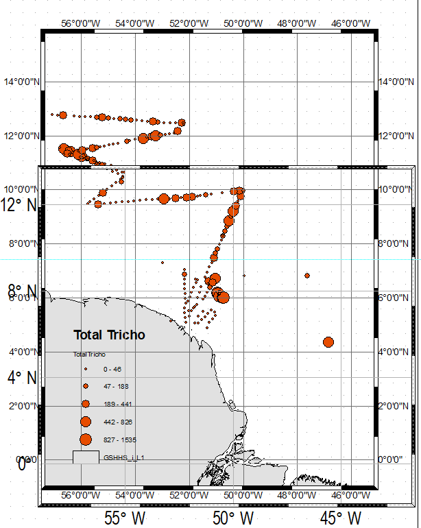
- Mark as New
- Bookmark
- Subscribe
- Mute
- Subscribe to RSS Feed
- Permalink
Each data-frame (DF) is independent of other data-frames. Do not overlay one DF over another DF. If you want to sync multiple DFs, then use Extent Indicators (DF Properties > Extent Indicators).
See this blog for a few more methods Creating multiple dataframes in map view to do equally attached extent rectangles in layout view. | ...
Think Location
- « Previous
-
- 1
- 2
- Next »
- « Previous
-
- 1
- 2
- Next »