- Home
- :
- All Communities
- :
- Products
- :
- ArcGIS Enterprise
- :
- ArcGIS Enterprise Questions
- :
- Re: Offset between highlighted parcel and parcel p...
- Subscribe to RSS Feed
- Mark Topic as New
- Mark Topic as Read
- Float this Topic for Current User
- Bookmark
- Subscribe
- Mute
- Printer Friendly Page
Offset between highlighted parcel and parcel polygon
- Mark as New
- Bookmark
- Subscribe
- Mute
- Subscribe to RSS Feed
- Permalink
When using AGS map service with our system, in some cases the highlighted parcel boundary is misaligned with the underlying parcel boundary even when the presented map service and the queried map service are generated from the same source. The coordinate reference is Web Mercator and AGS is 10.22 although we are not sure it is exclusive to 10.22. We reproduced the same offset in ArcGIS.com so it seems like not related with the application's code. Any idea?
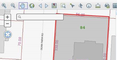
Example from our application:
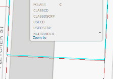
Example from ArcGIS Online:
Solved! Go to Solution.
Accepted Solutions
- Mark as New
- Bookmark
- Subscribe
- Mute
- Subscribe to RSS Feed
- Permalink
Hi Einat,
Is the data projected to WGS Web Mercator, or is the data frame of the MXD projected to WGS Web Mercator? If the data frame and data are different coordinate systems, make sure you are applying the correct geographic transformation.
- Mark as New
- Bookmark
- Subscribe
- Mute
- Subscribe to RSS Feed
- Permalink
Jake and Einat,
I see the same behavior with ArcGIS Server 10.3. Whether the Map Service mxd data frame is set to WGS Web Mercator or to the Feature Class's Coordinate System, either way the error exists. Can reproduce with points, lines, polys. ArcGIs Server 10.3. The only workaround so far seems to be to add only one layer from the Map Service instead of the "parent" Map Service url. Did you ever figure this out? Is this a bug in the Javascript API?
Thanks,
Tobias
- Mark as New
- Bookmark
- Subscribe
- Mute
- Subscribe to RSS Feed
- Permalink
The mis-alignment was resolved only when the data was transformed to GCS_WGS_1984, and the data frame
was WGS84 web Mercator auxiliary (102100).
- Mark as New
- Bookmark
- Subscribe
- Mute
- Subscribe to RSS Feed
- Permalink
Hi Einat. Thanks for the response. Do you know whether this an officially logged bug?
- Mark as New
- Bookmark
- Subscribe
- Mute
- Subscribe to RSS Feed
- Permalink
As far as I know, it is not logged as a bug.