- Home
- :
- All Communities
- :
- Products
- :
- ArcGIS Enterprise
- :
- ArcGIS Enterprise Questions
- :
- Re: Labels conflict in ArcGIS server
- Subscribe to RSS Feed
- Mark Topic as New
- Mark Topic as Read
- Float this Topic for Current User
- Bookmark
- Subscribe
- Mute
- Printer Friendly Page
- Mark as New
- Bookmark
- Subscribe
- Mute
- Subscribe to RSS Feed
- Permalink
Hello,
I couldn’t figure out how to remove the label conflict between the different published map services, I have several map services and I want to show them at the same time, but the issue here is that the labels of these service conflict and overlay on each other!! Is there any suggestions to avoid this?
Using ArcGIS Desktop/Server 10.3.1
Regards,
Ahmad Saleh
Solved! Go to Solution.
Accepted Solutions
- Mark as New
- Bookmark
- Subscribe
- Mute
- Subscribe to RSS Feed
- Permalink
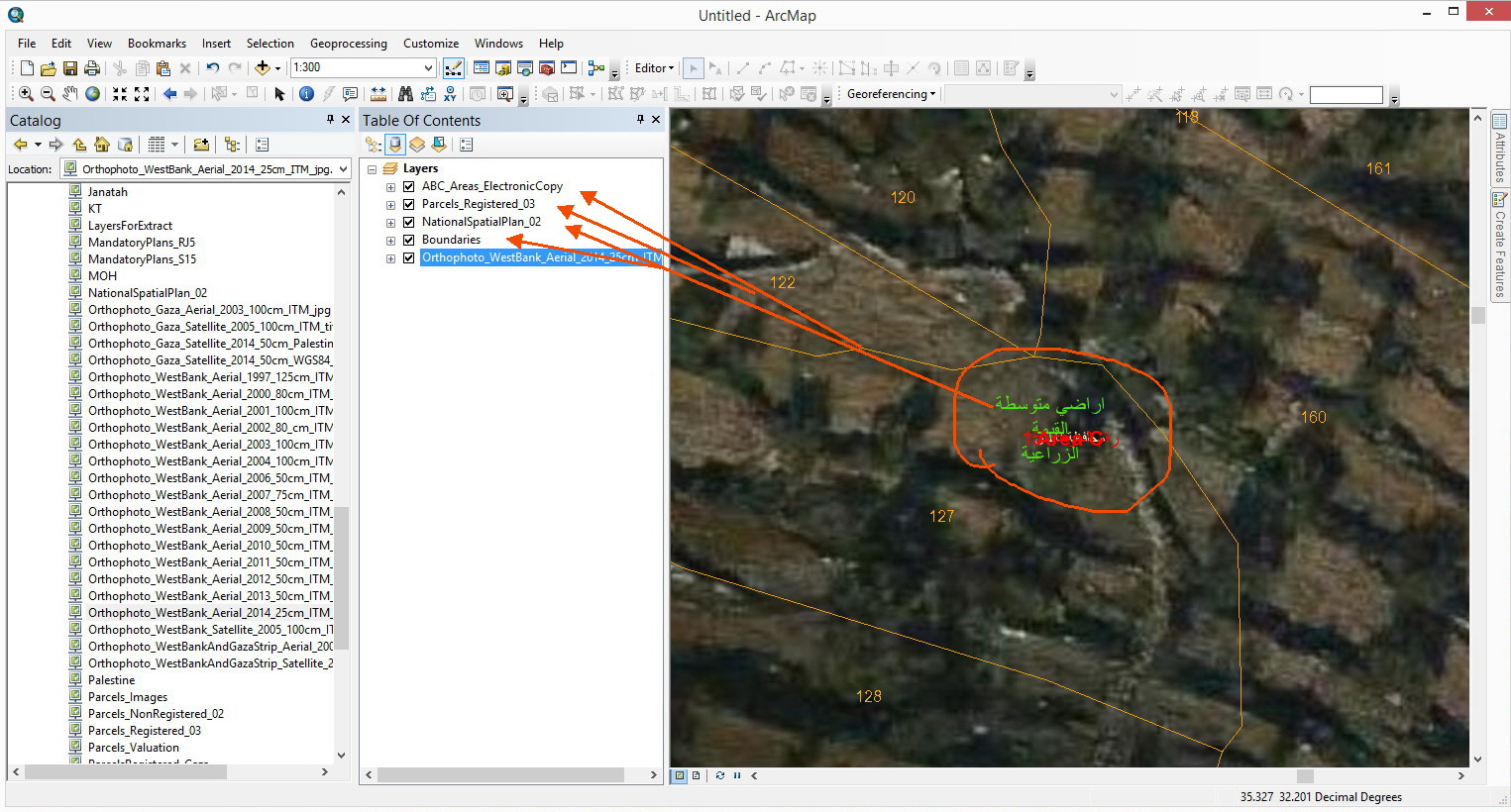
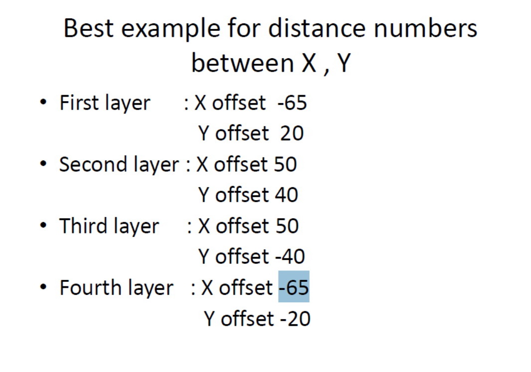
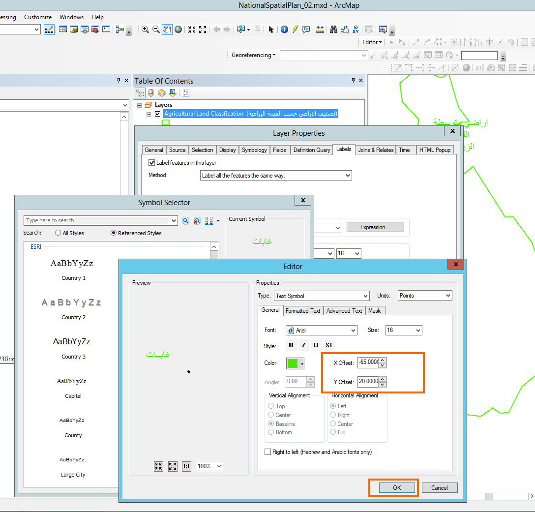
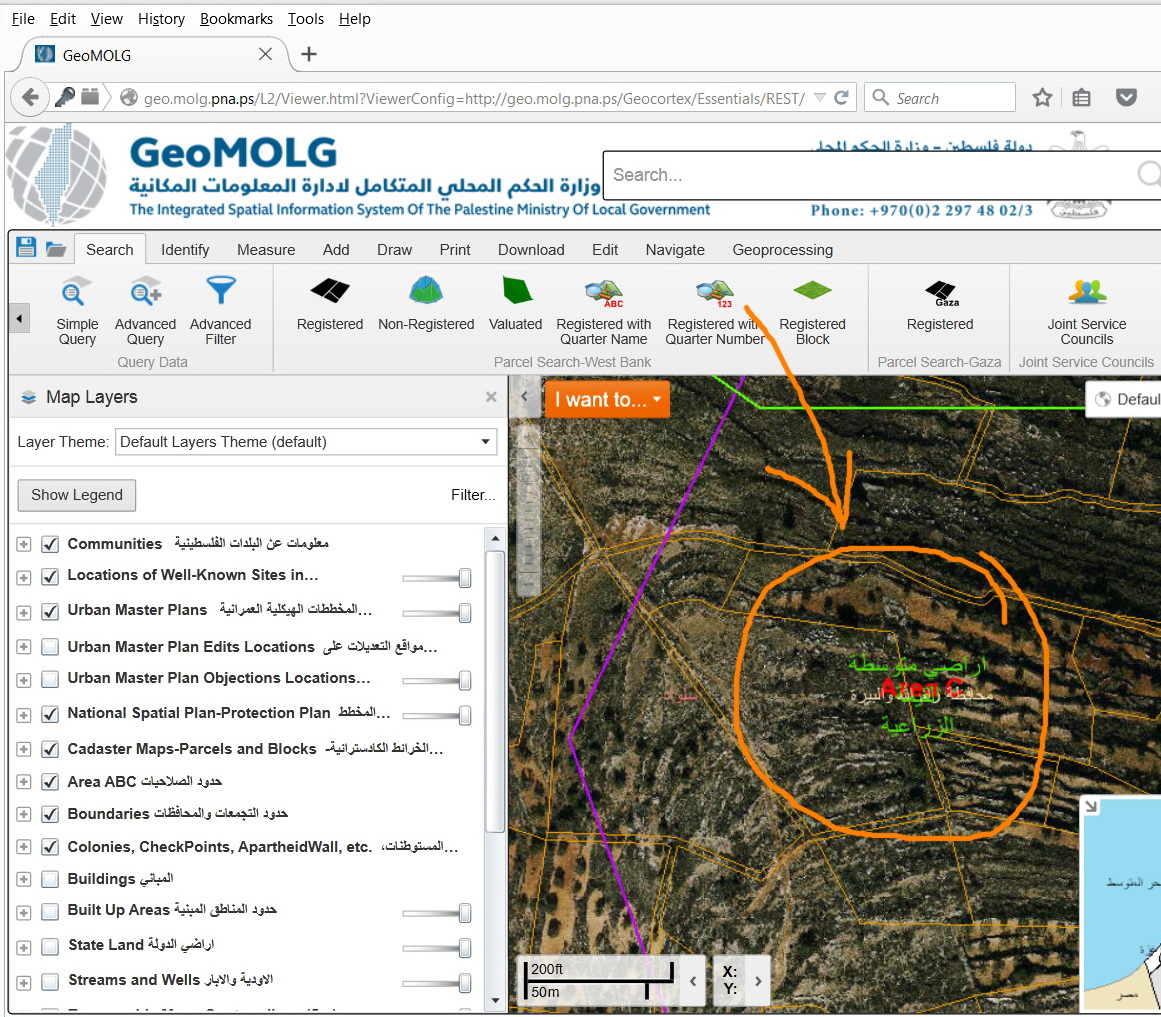
I was able to resolve this issue by applying x and y offset for the labels of each layer:
.png)
- Mark as New
- Bookmark
- Subscribe
- Mute
- Subscribe to RSS Feed
- Permalink
Hi Ahmad,
You won't have the ability to control the labels of map services. One option you can do is download the data from these services using the following tool:
Download ArcGIS Online Feature Service or ArcGIS Server Feature/Map Service
You will have the data as feature classes, and then you can set up the labels at your discretion.
- Mark as New
- Bookmark
- Subscribe
- Mute
- Subscribe to RSS Feed
- Permalink
Dear Jake,
Its really a very helpful tool, but I am not searching about downloading the data rather than viewing it online, I have a web mapping application that reads these services directly on top of each other and the users suffering from this issue and after investigating it I found that the source of this issue is the ArcGIS server. So I am searching for a solution for it.
Many thanks and very much appreciated.
Ahmad
- Mark as New
- Bookmark
- Subscribe
- Mute
- Subscribe to RSS Feed
- Permalink
When accessing a service, a rendered image of the data is returned. Unfortunately, there won't be a way for these rendered images to perform label detection/conflicts.
- Mark as New
- Bookmark
- Subscribe
- Mute
- Subscribe to RSS Feed
- Permalink
Hi Ahmad,
If these are all your services that you are using - can you create the map services without labels, and then have a separate service that contains only the labels?
- Mark as New
- Bookmark
- Subscribe
- Mute
- Subscribe to RSS Feed
- Permalink
We got around this with our own data by putting all the feature classes into a single MXD / Map Service. That way it's a single map service with the labels rendered on ArcGIS Server.
- Mark as New
- Bookmark
- Subscribe
- Mute
- Subscribe to RSS Feed
- Permalink
Dear Jennifer and Randy,
Thanks for the tips and ideas that you provided, but unfortunately it will not work in my case since some of the layers are hosted only in my web mapping application and related to other organizations and some layers are very heavy (more than 250,000 feature) and it would be heavier if I added more features to it.
Thanks guys for the keen help.
Ahmad
- Mark as New
- Bookmark
- Subscribe
- Mute
- Subscribe to RSS Feed
- Permalink
Ahmad,
It appears that you control some of these layers (map services) and others you simply consume? That fact may make my suggestion a non-starter but...
Might you be able to convert the labels of the layers you DO control into feature-linked annotation and edit that anno to conflict less with the layers you don't control? You mention layers with 250K features, so what I suggest isn't something that can be solved with a simple click of the button, but that might be one of your very limited options.
Your experience is the downside of serving up a multitude of data in separate map services. Sometimes the combination doesn't work very well. I run into the same issue with various combinations of map services I provide my users. With so many possible combinations of map services that can be viewed at once, there is bound to be conflict that cannot be easily resolved.
- Mark as New
- Bookmark
- Subscribe
- Mute
- Subscribe to RSS Feed
- Permalink
I was able to resolve this issue by applying x and y offset for the labels of each layer: