Hello ImageServer experts,
I am running into an issue and I am wondering whether it is a bug or if I missed anything.
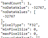
We have a mosaic dataset published and raster has no data value configured:
 NicolasGIS_0-1658329819348.png
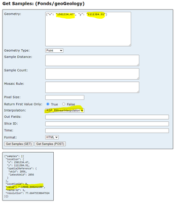
But when I query the ImageServer using "getSamples" operation, to get pixel information nearby an aera surrounded with no data value, I get a very weird result as if the no_data pixel value, was taken into account in the interpolation:
 NicolasGIS_3-1658330864929.png
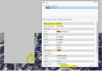
If I do the same query operation in ArcGIS pro at the very same coordinate, I get a correct value:
 NicolasGIS_5-1658331053768.png
Question: does ArcGIS Image Server getSamples operation take into account pixels value defined as no_data while doing interpolation ? If yes, do you consider legitimate ? To me, it's strange.
Many thanks for help !