- Home
- :
- All Communities
- :
- Products
- :
- ArcGIS Enterprise
- :
- ArcGIS Enterprise Portal Questions
- :
- Dynamic rendering of image service from mosaic dat...
- Subscribe to RSS Feed
- Mark Topic as New
- Mark Topic as Read
- Float this Topic for Current User
- Bookmark
- Subscribe
- Mute
- Printer Friendly Page
Dynamic rendering of image service from mosaic dataset issues
- Mark as New
- Bookmark
- Subscribe
- Mute
- Subscribe to RSS Feed
- Permalink
Hello,
I have a large collection of GeoTiff files representing LiDAR DEM data. 6000-7000 raster tiles in total. My aim is to load these data into a mosaic dataset, add raster functions (hillshade, shaded relief and slope) and serve the data up as an image service for dynamic rendered basemap information.
I have the GeoTiff files organised in separate folder paths based on region and LiDAR flight year, which are all registered with our GIS Portal. I have created a mosaic dataset, added all of the GeoTiff DEM files and built overviews. I have exported the raster functions for hillshade, shaded relief and slope to create rft.xml files that I can edit for my specific requirements like setting the hillshade to multi-directional and adding a color ramp to the slope function.
In ArcGIS Pro Catalog view I open the Share Raster Data As a Web Layer tool using the following options...
General Options
Data - Reference registered data
Layer Type - Imagery
Server - image
Configuration
Operations - Default values
Raster Functions - Allow client specified rendering rules ticked and Processing template files added
Hitting Analyze gives 2 warnings

Unfortunately, ArcGIS Pro will not allow me to run the Analyze Mosaic Dataset tool (Failed to analyze error) and setting the Maximum Number of Rasters per Mosaic also fails. I have rebuilt the Mosaic several times and these warnings remain. So I'm using the Mosaic as it is.
I hit publish and the image service is published successfully.
We have ArcGIS Portal version 10.5 and the resulting image service loads in the Map View, but I have noticed the following issues:
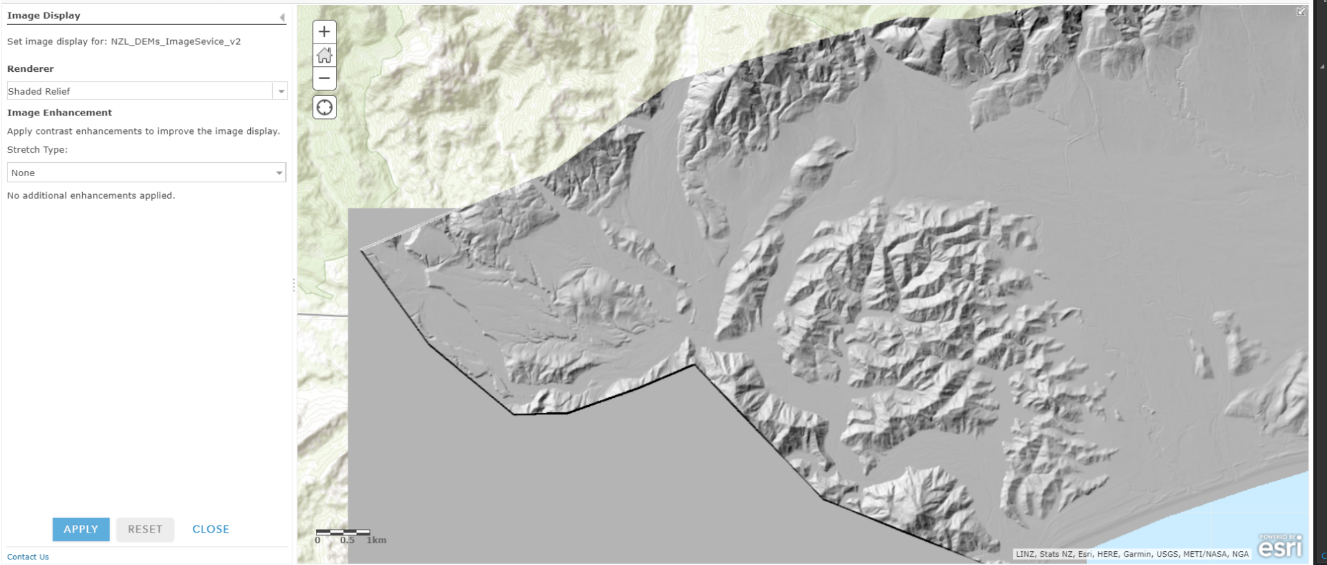
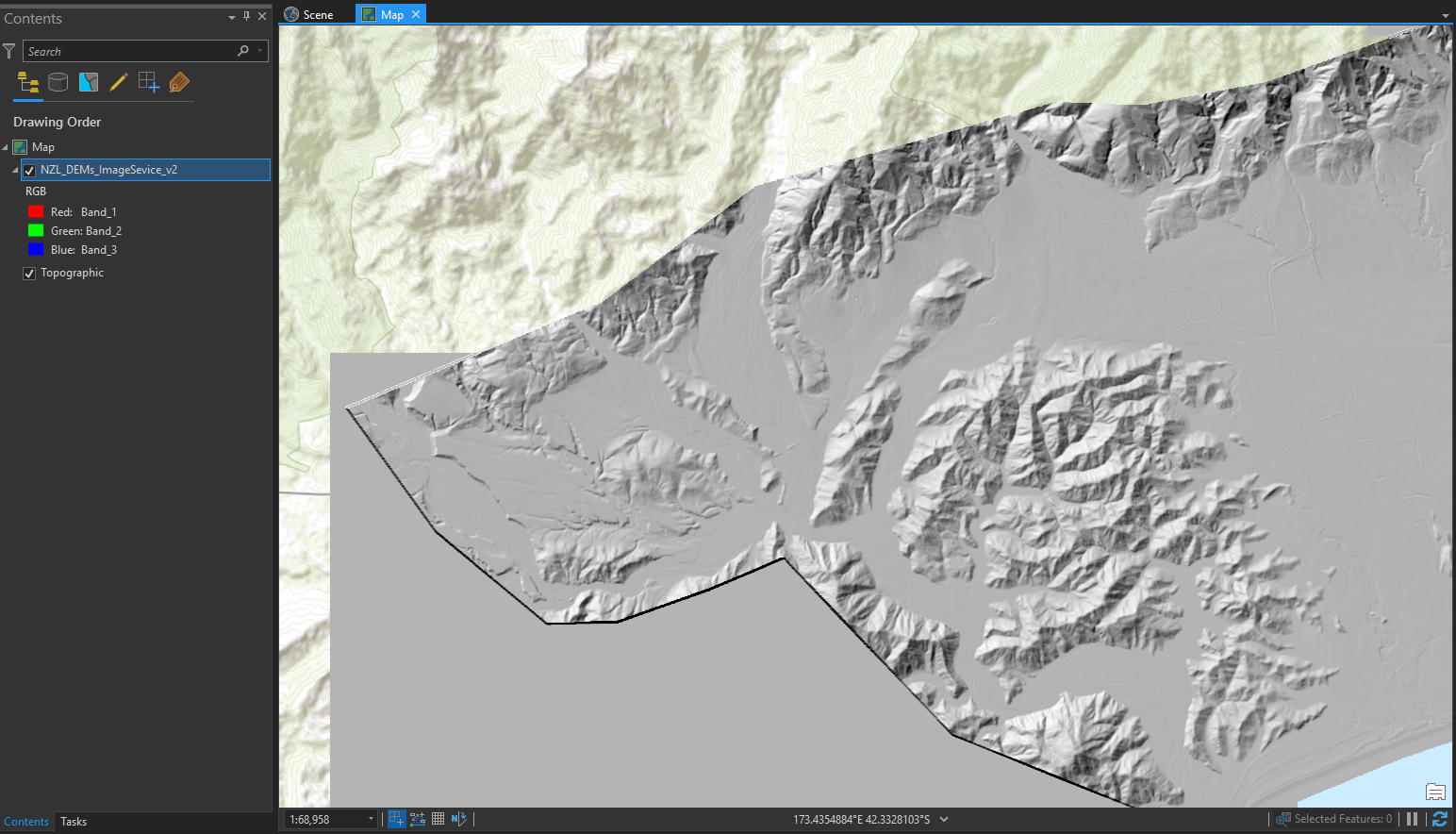
- Areas of no-data seem to be rendered as grey when they should be 100% transparent. Red circled area in screen shot below should be no-data.
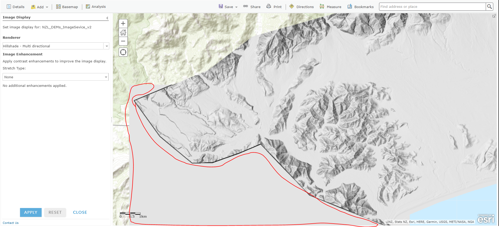
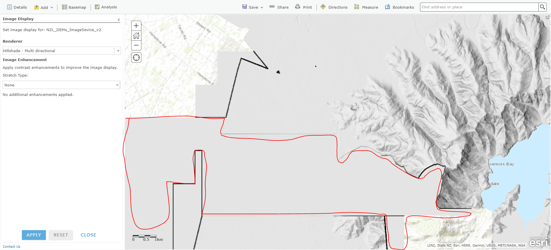
This becomes an issue where 2 overlapping areas of terrain data meet. Circled area shown below should be transparent showing terrain detail from other DEM rasters.
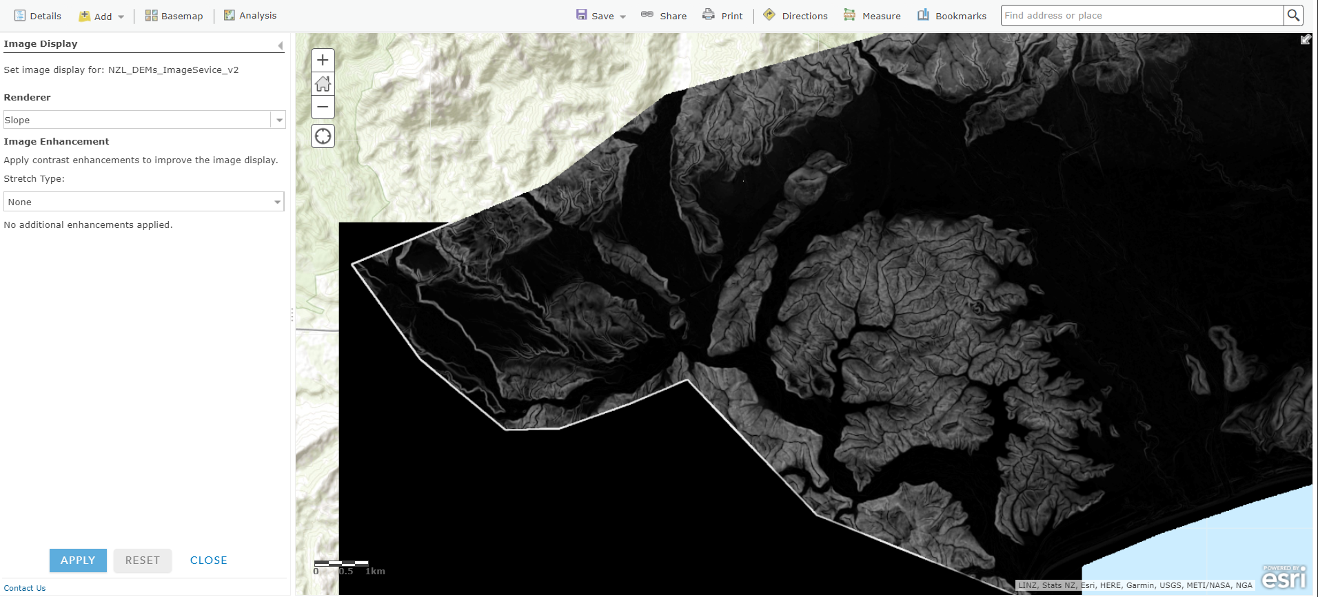
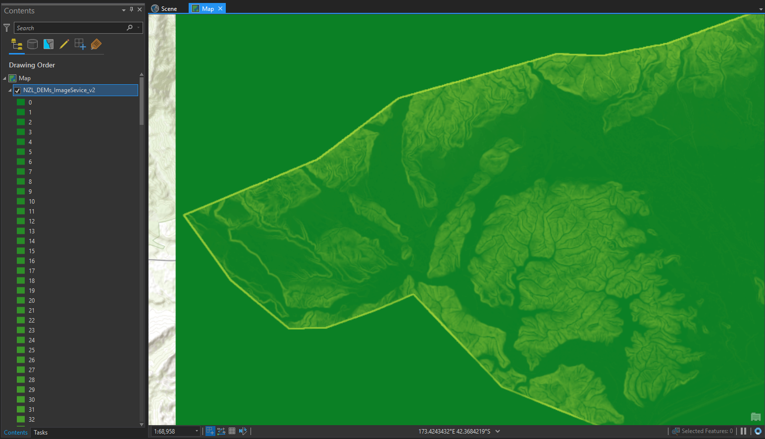
- I set the Slope raster function to have a green to red color ramp, but in the map viewer it has a grey scale color ramp (ArcGIS Portal 10.5). In ArcGIS Pro the green to red color ramp is shown as expected. Note the black and green areas that should be transparent no-data.
- The Shaded Relief raster function should show a color ramp over a hillshade, but in both the web viewer and ArcGIS Pro I see the hillshade with no color ramp. I briefly had the color ramp draped over a hillshade working in ArcGIS Pro, but that's not working for me now.
- I have tried adding additional GeoTiff files to the mosaic dataset after the image services were published as in the future I hope to add more DEMs as they become available, but this seemed to break all raster function rendering showing a strange grey and black regular grid everywhere.
- I'd also like to have the option of choosing a color ramp for the Slope function within the web map view, but I haven't had any luck. Making parameters public in the raster function made no difference.
I'm very new to raster functions and I'm really hopeful that we can make use of this functionality via image services as having multiple rendering options from a single elevation data source seems like a good alternative to making and managing separate datasets for slope, hillshade, aspect, etc... Unfortunately, it's not quite panning out as I had hoped.
In addition to all of the above I'd like to publish an elevation service from the same mosaic dataset, which I have done, but no elevation appears in the web scene viewer. That's perhaps an issue for a separate query.
Any help would be much appreciated.